Click Here. Double your traffic. Get Vendio Gallery - Now FREE!
Rare Map Collection
This DVD is part of our Historic Map and
Atlas Collection.
We have dozens of Atlas maps on DVD and CD ranging from the 1500s
to the 1900s covering many areas and topics.
Please Check our Ebay Store for what's available. |
FOR MANY MORE EDUCATIONAL CD
TITLES
ON THIS AND MANY OTHER
SUBJECTS
PLEASE VISIT OUR EBAY STORE |
VERY LARGE HIGH RESOLUTION
MAP COLLECTION
ON DVD!!
(please see full table of contents and sample
illustrations below) |
|
This DVD Contains
104 Maps
of
Kansas
Including 10 PANORAMIC MAPS of various
Kansas Cities
These are scans of the ORIGINAL maps
by various Cartographers.
on DVD
System requirements
PC or Mac compatible.
Files are simple PDF files with a basic HTML
interface (just like viewing a webpage)
Works with ALL versions of Windows.
|
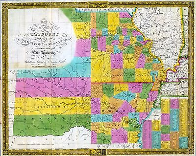
Early Maps of
Kansas

0041026
|
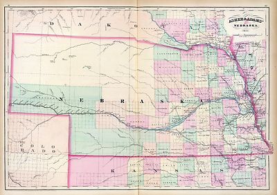
Kansas
Asher & Adams
1874 |

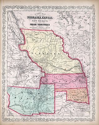
0041027
|
Nebraska.and Kansas
Asher & Adams
1874 |
|
|

3565134
|
Kansas.
Rand McNally and Company
1897 |

3933001
|
Kansas And The Gold Mines.The map is of eastern Kansas west to the 98th
meridian, with an inset of the "Routes from the Missouri River to the Kansas
Gold Mines." This inset does not show Colorado, even though it was formed
in 1860. There is a list of the Population of Kansas Counties, and a vignette
of an Indian.
Gunn, O.B. ; Mitchell, D.T.
1862 |

4520041
|
Kansas.
Rand McNally and Company
1879 |

5370017
|
Kansas.
Cram Atlas Company
1875 |

ct000891
|
J.H. Colton & Co.
Colton’s Kansas and Nebraska.
New York, 1855
|

ct001342
|
Hartley French Dickson & Co.
Map of the recently discovered gold regions in Western Kansas & Nebraska
/ from actual surveys notes & observations by Hartley French Dickson
& Co.
1859? |

ct001346
|
Mitchell, D. T. (David T.)
Mitchell’s sectional map of Kansas / compiled from the field notes in
the Surveyor General’s office by David T. Mitchell, U.S. surveyor and
land agent, Lecompton, Kansas ; showing the U.S. survey up to 1859.
Lecompton, Kansas : David T. Mitchell , 1859
|

cwh00204
|
[Base map of Kansas].
[1893]
|

pm002260
|
Ruger, A.
Bird’s eye view of the city of Atchison, Atchison Co., Kansas 186[9]
Drawn by A. Ruger.
Chicago, Merchants Lithographing Co. [1869]
|

pm002263
|
Stoner, J. J.
Bird’s eye view of Great Bend, Kans. : c.s. of Barton County, 1882.
Madison, Wis. : J.J. Stoner, 1882 (Milwaukee, Wis. : Beck & Pauli,
lithographers) |

pm002290
|
Ruger, A.
Bird’s eye view of the city of Lawrence, Kansas 1869.
[n.p., 1869]
|

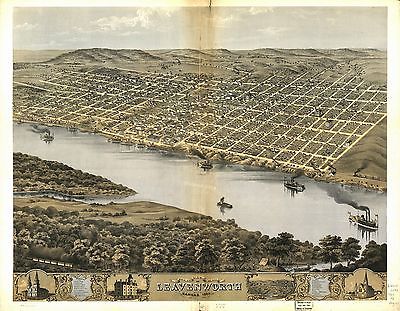
pm002300
|
Ruger, A.
Bird’s eye view of the city of Leavenworth, Kansas 1869. Drawn by A.
Ruger.
[Chicago] Chicago Lithographing Co. [1869]
|

pm002302
|
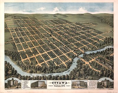
Glover, E. S.
Bird’s-eye view of Ottawa, the largest city of its age in Kansas, 1872
: looking south-west / drawn by E.S. Glover.
Cin[cinnati] : Strobridge & Co. Lith., [1872]
|

pm002310
|
Ruger, A.
Bird’s eye view of the city of Topeka, the capital of Kansas 1869. Drawn
by A. Ruger.
[Chicago] Chicago Lithographing Co. [1869]
|

pm002320
|
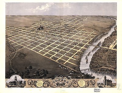
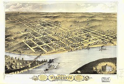
Ruger, A.
Bird’s eye view of Wyandotte, Wyandotte Co., Kansas 1869. Drawn by A.
Ruger. C. Hafften fec.
Chicago, Merchants Lith. Co. [1869]
|

pm004280
|
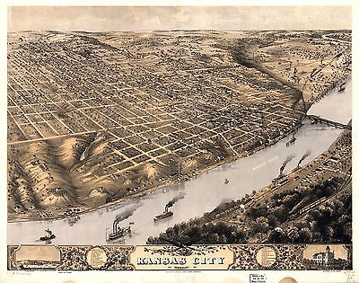
Ruger, A.
Bird’s eye view of Kansas City, Missouri. Jan’y. 1869. Drawn by
A. Ruger. Merchants Lith. Co.
Madison, Wis., Ruger & Stoner [1869]
|

pm004290
|
Koch, Augustus, b. 1840.
Panoramic view of the west bottoms, Kansas City, Missouri & Kansas showing
stock yards, packing & wholesale houses.
[n.p.] c1895
|

pm004391
|
Lord, C. K.
Birds eye view of St. Louis : showing the new line of the St. Louis, Kansas
City & Northern Ry. running into the Union Depot.
[St. Louis : Woodward, Tiernan, and Hale], 1876.
|

rr002210
|
Du Bois, Charles.
A new sectional map of the state of Kansas showing the route of the Union
Pacific Railway--E. D. to Denver City. Col. and complete system of projected
rail roads. Information compiled & collected from departments of the
government at Washington, D.C. and other authentic sources by W. J. Keeler,
C. E. 1867.
Washington, D.C., 1867.
|

rr002220
|
United States. General Land Office.
State of Kansas, 1884; compiled from the official records of the General
Land Office and other sources under supervision of G.P. Strum, Principal
Draughtsman, photo lith & print by Julius Bien & Co. N.Y. 1884.
[Washington, 1884]
|

rr002230
|
Galbraith, Frank H.
Galbraith’s railway mail service maps, Kansas.
Chicago, 1897, c1898.
|

rr003240
|
G.W. & C.B. Colton & Co.
Map showing the Atchison, Topeka & Santa Fe´ Rail Road and its auxiliary
roads in the state of Kansas.
New York, 1886
|

rr005890
|
Gillis, J. R.
Map and profile of first 40 miles of Union Pacific Rail Road Eastern Division
extending west from boundary between states of Missouri and Kansas, accompanying
report of commissioners submitted to Hon. James Harlan, Secretary of the
Interior, October 26th, 1865; compiled from map, submitted by U.P.R.R. Co.
E.D., and records in Gen. Land Office.
[Washington, D.C., 1865]
|

6727041
|

0149055
|

0151058
|

0152063
|

0352039
|

0358044
|

0425045
|

0535037
|

0535039
|

0579040
|

0586041
|

0592043
|

0594041
|

0693033
|

0693034
|

0693035
|

1012076
|

1070015
|

1071013
|

1550058
|

1690120
|

1780066
|

1780119
|

1780163
|

1780164
|

2054048
|

2094046
|

2134085
|

2212253
|

2307020
|

2320001
|

2370002
|

2453002
|

2453003
|

2464000
|

2483036
|

2585076
|

2809028
|

2844065
|

2861009
|

2863007
|

2871011
|

2905026
|

2905028
|

3060002
|

3069001
|

3283002
|

3383003
|

3471005
|

3565129
|

3786003
|

3825013
|

3888046
|

6921126
|

3934000
|

3989002
|

4094002
|

4095002
|

4096002
|

4102001
|

4110002
|

4117001
|

4117A
|

4117B
|

4325001
|

4552001
|

4557037
|

4574034
|

4727027
|

4825056
|

4872004
|

4872005
|

4933002
|

4977052
|

5028104
|

5028108
|

5041038
|

5479097
|

5755026
|

5784041
|

6727040
|
|
Features of this DVD
This auction is for a DVD of the maps listed
in electronic form,
NOT
the maps
themselves.
These maps are VERY high resolution and
can be printed at FULL SCALE or LARGER for framing and display. The results
are very high quality and convincing. |
|
Ad and disk copyright 2013
Euriskodata
All Rights Reserved |
The free listing tool. List your items fast and easy and manage your active items.
|