Click Here. Double your traffic. Get Vendio Gallery - Now FREE!
Rare Map Collection
This DVD is part of our Historic Map and
Atlas Collection.
We have dozens of Atlas maps on DVD and CD ranging from the 1500s
to the 1900s covering many areas and topics.
Please Check our Ebay Store for what's available. |
FOR MANY MORE EDUCATIONAL CD
TITLES
ON THIS AND MANY OTHER
SUBJECTS
PLEASE VISIT OUR EBAY STORE |
VERY LARGE HIGH RESOLUTION
MAP COLLECTION
ON DVD!!
(please see full table of contents and sample
illustrations below) |
|
This DVD Contains
114 Maps
of
Wyoming
Including 3 PANORAMIC MAPS of various
Wyoming Cities
These are scans of the ORIGINAL maps
by various Cartographers.
on DVD
System requirements
PC or Mac compatible.
Files are simple PDF files with a basic HTML
interface (just like viewing a webpage)
Works with ALL versions of Windows.
|
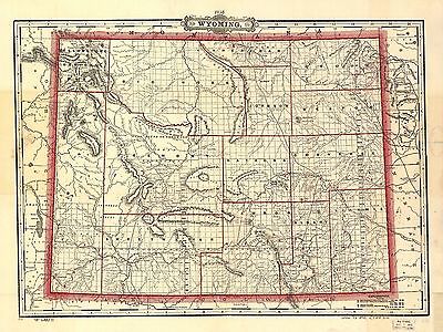
Maps of
Wyoming

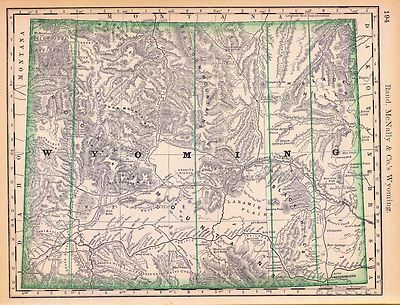
0041035
|
Asher & Adams
1874
Wyoming.
|

0408002
|
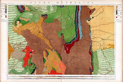
King, Clarence
1876
Rocky Mountains. (Geological)
|

0408009
|
King, Clarence
1876
Rocky Mountains. (Topographical)
|

0586042
|
(Mitchell, Samuel Augustus)
1880
Wyoming.
|

3565141
|
Rand McNally and Company
1897
Wyoming.
|

4069001
|
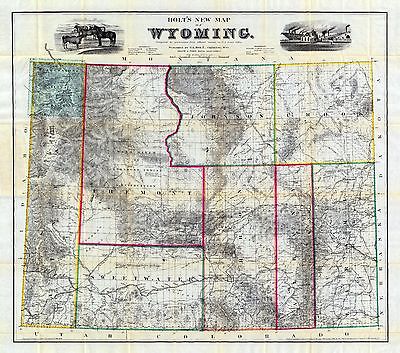
Holt, George L.
1885
Holt's New Map Of Wyoming.
|

4118001
|
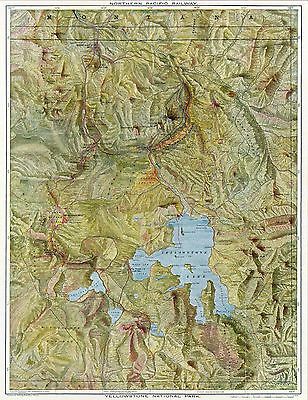
Northern Pacific Railway Company
1898
Yellowstone National Park.
|

4118B
|
Northern Pacific Railway Company
1898
Cover: Yellowstone National Park.
|

4520040
|
Rand McNally and Company
1879
Wyoming.
|

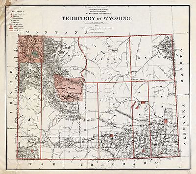
4618000
|
U.S. General Land Office
1879
Territory Of Wyoming.
|

5370031
|
Cram Atlas Company
1875
Wyoming.
|

ct001176
|
Drewyer, George.
Sketch given by George Drewyer, 5th August 1808 : [Bighorn River, Wyoming
and Montana].
[1808?]
|

ct001852
|
Bond, Frank, 1856-1940.
Holt’s new map of Wyoming : compiled by permission from official records
in U.S. Land Office / Frank & Fred. Bond, draftsmen.
Cheyenne, Wyo. : G.L. Holt, c1883 (New York : G.W. & C.B. Colton &
Co.)
|

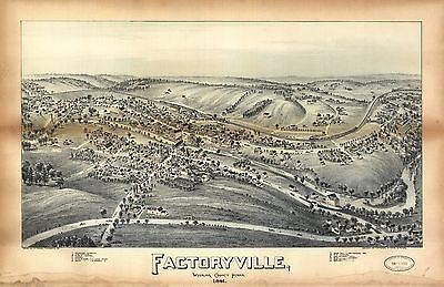
pm007752
|
Fowler, T. M. (Thaddeus Mortimer), 1842-1922.
Factoryville, Wyoming County, Penn’a / drawn by T.M. Fowler, Morrisville,
Pa.
[Morrisville] : T.M. Fowler & James B. Moyer, 1891.
|

pm010680
|
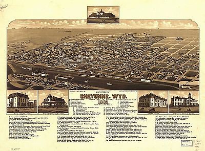
Stoner, J. J.
Bird’s eye view of Cheyenne, Wyo. county seat of Laramie Co. 1882. Beck
& Pauli, lithographers.
Madison, Wis. [1882]
|

pm011080
|
Glover, E. S.
View of Green River, Wyoming Territory (looking north) / drawn by E.S. Glover.
Chicago : Chas. Shober & Co., [1875?].
|

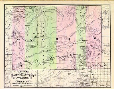
rr003140
|
Cram, George Franklin, 1841-1928.
Cram’s township and railroad map of Wyoming.
Chicago, 1895.
|

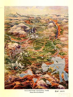
ye000001
|
Fee, Charles S.
Yellowstone National Park, Northern Pacific Railroad.
[S.l.], 1895.
|

ye000002
|
Geological and Geographical Survey of the Territories (U.S.)
Preliminary geological map of the Yellowstone National Park.
[S.l.], 1878.
|

ye000003
|
Yellowstone National Park.
[S.l., 190-?]
|

ye000005
|
Geological Survey (U.S.)
Yellowstone National Park.
[S.l.], 1886.
|

ye000006
|
Geological Survey (U.S.)
Yellowstone National Park and north western Wyoming.
[S.l], 1885.
|

ye000008
|
Proposed line of rail roads and hotels.
[S.l.], 190-?
|

ye000014
|
Geological Survey of the Territories (U.S.)
Upper Geyser Basin, Fire Hole River, Wyoming Territory.
[S.l.], 1871.
|

ye000015
|
Geological Survey (U.S.)
Radar mosaic, Yellowstone National Park, Wyoming.
[Washington, 1968]
|

ye000016
|
Yellowstone National Park.
[S.l.], 1903.
|

ye000017
|
United States. National Park Service.
Yellowstone.
Washington, 1972.
|

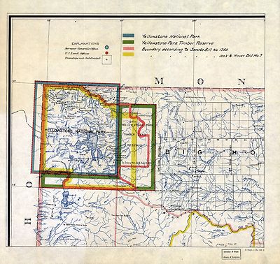
ye000018
|
[Yellowstone National Park boundaries].
[S.l.], 1895.
|

ye000019
|
Boundaries of Yellowstone National Park as revised by act dated March
1, 1929, also the Grand Teton National Park as established by act dated Feb.
26, 1929. |

ye000020
|
Map of the Yellowstone National Park.
[S.l.], 1881.
|

ye000024
|
[Yellowstone National Park, Wyoming]
[S.l., 1880]
|

ye000025
|
Yellowstone National Park.
[S.l., 1910]
|

ye000026
|
Yellowstone National Park.
[S.l., 1910]
|

0027011
|

0152062
|
0408002
|

0408003
|

0408010
|

0425133
|

0592044
|

0594042
|

0740017
|

0740018
|

0806001
|

0806A
|

0833003
|

0834000
|

0993002
|

1071013
|

1550060
|

1582003
|

1954101
|

1974000
|

1976000
|

2039000
|

2041000
|

2042000
|

2054061
|

2083001
|

2083002
|

2083003
|

2094055
|

2134093
|

2212244
|

2212245
|

2307023
|

2452003
|

2585075
|

2756002
|

2769001
|

2809063
|

2844072
|

3381003
|

3530000
|

3531000
|

3888047
|

4060003
|

4088001
|
4118001
|

4118C
|

4574038
|

4727054
|

4977068
|

5028099
|

5028140
|

5028141
|

5041041
|

5216001
|

5216002
|

5216003
|

5216004
|

5302000
|

5415001
|

5755035
|

5797084
|

5802005
|

5939000
|

5940000
|

5941000
|

5942000
|

5943000
|

5944000
|

5945000
|

5946000
|

5947000
|

5948000
|

6001000
|

6322179
|

6322180
|

6322181
|

6322182
|

6722002
|

6921128
|
|
|
Features of this DVD
This auction is for a DVD of the maps listed
in electronic form,
NOT
the maps
themselves.
These maps are VERY high resolution and
can be printed at FULL SCALE or LARGER for framing and display. The results
are very high quality and convincing. |
|
Ad and disk copyright 2013
Euriskodata
All Rights Reserved |
The free listing tool. List your items fast and easy and manage your active items.
|