Click Here. Double your traffic. Get Vendio Gallery - Now FREE!
|
FOR MANY MORE EDUCATIONAL CD TITLES
ON THIS AND MANY OTHER SUBJECTS
PLEASE VISIT OUR EBAY STORE
NO ADDITIONAL SHIPPING ON MULTIBLE CD ORDERS-ONLY $3.50 FOR ANY NUMBER OF CDs SHIPPED TO THE SAME ADDRESS IN THE US. ONLY $4.50 FOR ANY NUMBER TO ANYWHERE ELSE IN THE WORLD |
|
|
VERY LARGE HIGH RESOLUTION
MAP COLLECTION
ON CD-ROM!!
(please see full table of contents and sample illustrations below) |
|
|
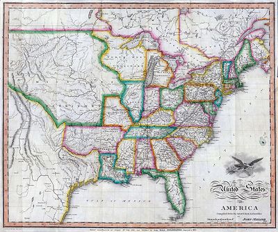
This CD Contains 116 Historic Maps of the United States from the Colonial era to 1930.
Historic Maps of the United States
These are scans of the ORIGINAL maps
on CD-ROM
System requirements
PC or Mac compatible.
Files are simple JPEG images with a basic HTML interface (just like viewing a webpage)
Works with all versions of Windows including 3.1, 95, 98, 2000 or XP. |
|
|
Features of this CD-ROM
This auction is for a CD -ROM of the maps listed in electronic form, NOT the maps themselves.
These maps are VERY high resolution and can be printed at FULL SCALE or LARGER for framing and display. The results are very high quality and convincing.
For a sample map please:
CLICK HERE
WARNING! This is a LARGE file (5 Megabytes) if you are using a slow connection it can take some time to load. |
|
|
|

0041001 |
United States, Territories.
Asher & Adams' new commercial, topographical, and statistical atlas and gazetteer of the United States: with maps showing the Dominion of Canada, Europe and the World
1874 |
|

0041042 |
Asher & Adams' geological map, United States and territories. Entered according to Act of Congress in the year
1874 |
|

0122004 |
United States of America.
Carey, H. C. ; Lea, I.
A Complete Historical, Chronological, And Geographical American Atlas, Being A Guide To The History Of North And South America, And The West Indies ... To The Year
1822. |
|

0131001 |
New Map of North America.
Carver, Jonathan
1781 |
|

0149016 |
The United States Of America.
Colton, G.W.
1856 |
|

0278001 |
Map of North America Including All The Recent Geographical Discoveries.
Finley, Anthony
1826. |
|

0285006 |
United States
Finley, Anthony
1831 |
|

0315004 |
United States
John Grigg
1830 |
|

0373051 |
United States Eastern
Johnston, Alexander Keith
1861 |
|

0466071 |
United States
Martin, R.M. ; Tallis, J. & F.
1851 |
|

0501001 |
United States of America
Melish, John
1822 |
|

0501002 |
A diagram of the United States shewing the bearings and distances.
Melish, John
1822 |
|

0537006 |
United States.
Mitchell, Samuel Augustus
1846 |
|

0586009 |
The 13 colonies 1776
Mitchell, John; Mitchell, Samuel Augustus
1880 |
|

0594009 |
Railroad map U.S.
Mitchell, Samuel Augustus
1890 |
|

0732043 |
United States of America, northern part.
Pinkerton, John
1810 |
|

0732044 |
United States of America, southern part.
Pinkerton, John
1810 |
|

0845003 |
Map of the United States of America.
Reid, John ; Winterbotham, W.
1796 |
|

0936010 |
New rail road map of the United States.
Snyder, Van Vechten & Co.
1878 |
|

0974001 |
A Map Of The Roads, Canals And Steam Boat Routes Of The United States
Tanner, Henry S.
1825 |
|

0975001 |
United States of America.
Tanner, Henry S.
1829 |
|

0977005 |
United States of America.
Tanner, Henry S.
1836 |
|

1070023 |
United States, Territories.
U.S. General Land Office
1866 |
|

1147081 |
Map of the United States of America.
G.W. & C.B. Colton & Co.; Walling, H. F.
1873 |
|

1154003 |
United States & territories.
Walling, H. F.; Gray, Ormando Willis
1871 |
|

1573002 |
United States
Beers, F. W. (Frederick W.)
1872 |
|

1657056 |
United States of America.
Cary, John
1806 |
|

1657058 |
Western Terr., Kentucky, Pennsylvania, etc.
Cary, John
1835 |
|

1882001 |
Map of the United States and Territories.
U.S. General Land Office
1867 |
|

2088001 |
Mitchell's Travellers Guide Through The United States.
Mitchell, Samuel Augustus ; Young, James H.
1832 |
|

2098001 |
United States Of North America.
Arrowsmith, Aaron
1808 |
|

2113105 |
United States - eastern section.
John Bartholomew & Co.
1922 |
|

2113106 |
United States - central section.
John Bartholomew & Co.
1922 |
|

2113107 |
United States - western section.
John Bartholomew & Co.
1922 |
|

2113109 |
United States - North-eastern states.
John Bartholomew & Co.
1922 |
|

2240000 |
Map of the United States of America.
Barber, B.B.; Willard, A.
1835 |
|

2290001 |
A Concise View of the Number, Resources, and Industry of the American People.
Mitchell, Samuel Augustus
1843 |
|

2290002 |
Mitchell's National Map of the American Republic
Mitchell, Samuel Augustus
1843 |
|

2341001 |
Map of the United States of America.
Melish, John
1812 |
|

2449094 |
Vereinigten Staaten von Nord-Amerika
Stieler, Adolf
1875 |
|

2450003 |
United States
Morse, H.; Worcester, J. E.
1821 |
|

2454000 |
Map of the United States.
Ordway, Eliza S.
1829 |
|

2472000 |
Map of the United States.
Huntington, Eleazer ; Willard, A.
1826 |
|

2482000 |
A new and correct map of the United States ... Upper & Lower Canada
Lewis, Samuel
1819 |
|

2486041 |
Etats-Unis d'Amerique.
Andriveau-Goujon, J.
1850 |
|

2612072 |
L'Amerique Septentrionale 2.
Bonne, Rigobert
1783 |
|

2666001 |
United States.
Birkbeck, Morris ; Melish, John
1818 |
|

2710024 |
Map of the United States and Territories.
Walling, H. F.; Gray, Ormando Willis; Lloyd, H. H.
1872 |
|

2723001 |
Map of the United States.
Mitchell, Samuel Augustus ; Young, James H.
1831 |
|

2749001 |
Map of the United States of America.
Observations on the Geology of the United States, explanatory of a Geological Map
Maclure, William
1809 |
|

2788001 |
Map of the Seat of War in North America.
Melish, John
1815 |
|

2788005 |
Southern Section of the United States including Florida.
Melish, John
1815 |
|

2955000 |
A map of the United States, from the latest surveys.
Boynton, George W. ; Tuttle, Joseph Willard
1841 |
|

3007056 |
United States
Fullarton, A. & Co.
1872 |
|

3048001 |
Die Vereinigten Staaten von Nord-America
Bromme, Traugott
1848 |
|

3067001 |
A Connected View of The Whole Internal Navigation of the United States.
Tanner, Henry S.
1830 |
|

3236001 |
United States.
W. & A.K. Johnston Limited ; Stanford, Edward
1861 |
|

3300001 |
Dissected Outline Map of the United States of America.
Bradley, Milton Company
1880 |
|

3324001 |
A Correct Map of the United States.
Lewis, Samuel
1817 |
|

3353100 |
Cours de l'Ohio, Nlle. Angleterre, Nlle. York, Pensylvanie, Virginie, Caroline.
Robert de Vaugondy, Gilles
1755 |
|

3542002 |
United States of America.
Scott, Bradford
1816 |
|

3565063 |
United States
Rand McNally and Company
1897 |
|

3565064 |
United States population increase 1880-1890.
Rand McNally and Company
1897 |
|

3565065 |
United States population density 1890.
Rand McNally and Company
1897 |
|

3602000 |
United States.
Symonds, Maria
1830 |
|

3791001 |
United States.
Lines And Metallic Circuit Connections.
American Telephone and Telegraph Company
1898 |
|

3813001 |
Colton's Plans Of U.S. Harbors.
Colton, J.H.
1862 |
|

3822000 |
American Union Railroad Map Of The United States.
Haasis & Lubrecht
1871 |
|

3825003 |
Map of the United States.
Rogers, Henry Darwin ; Johnston, Alexander Keith
1857 |
|

3830000 |
Map to illustrate the route of Prince Maximilian of Wied in ... North America.
Maximilian of Wied ; Bodmer, Karl ; Thorn, William
1839 |
|

3884002 |
Map of the United States.
Mitchell, Samuel Augustus
1831 |
|

3886000 |
Rambles Through Our Country.
American Publishing Company
1886 |
|

3948000 |
United States with the contiguous British & Spanish Possessions.
Melish, John
1823 |
|

3954001 |
Map of the United States of America.
Maclure, William
1818 |
|

3960001 |
Map of the United States of America.
Colton, J.H.
1848 |
|

3975000 |
PWA rebuilds the Nation.
Purdy, Earl ; United States. Public Works Administration. Division of Information
1935 |
|

4070001 |
United States Of North America.
Maclure, William
1838 |
|

4087001 |
Map of North America.
Wyld, James
1823 |
|

4224045 |
United States.
Hall, Sidney
1828 |
|

4329001 |
United States of America.
Colton, J.H.
1860 |
|

4340001 |
Mitchell's Reference & Distance Map Of The United States
Mitchell, Samuel Augustus ; Young, James H.
1834 |
|

4390001 |
Map Of The United States, British & Central America.
Rogers, Henry Darwin ; Johnston, Alexander Keith
1857 |
|

4453006 |
United States.
Goodrich, S.G. ; Bradford, Thomas G.
1841 |
|

4519008 |
United States.
Melish, John
1820 |
|

4577005 |
Map of the United States of America.
Carey, Mathew
1814 |
|

4584045 |
United States.
Lucas, Fielding Jr.
1823 |
|

4609001 |
Eagle Map of the United States.
Churchman, Joseph and James ; Moore, I.W.
1833 |
|

4613043 |
United States.
Arrowsmith, John
1844 |
|

4628033 |
United States.
Burr, David H
1835 |
|

4633002 |
Map of the United States.
H.W. Burgett and Company; Beers, J.B. & Co.
1876 |
|

4640001 |
National Map Of The Territory Of The United States.
Keeler, William J.
1868 |
|

4664001 |
General Map of North America.
Collot, George Henri Victor ; Tardieu, P.F.
1796 |
|

4714039 |
Stati-Uniti dell'America Settentrionale.
Marzolla, Benedetto; Colton, J. H.
1854 |
|

4775001 |
Radio Broadcasting Stations Of The United States.
Clason Map Company
1930 |
|

4807135 |
Nord-Americanische Freistaaten.
Radefeld, Carl Christian Franz; Meyer, Joseph
1845 |
|

4807136 |
Geognos. Karte, Nord-Amer. Freistaate.
Radefeld, Carl Christian Franz; Meyer, Joseph
1853 |
|

4845001 |
United States of America.
Tanner, Henry S.
1839 |
|

4850033 |
United States.
Greenleaf, Jeremiah
1840 |
|

4863024 |
Map of the United States.
Carey, Mathew
1811 |
|

4865001 |
United States of America.
Carey, Mathew
1796 |
|

4869001 |
United States.
Morse, Sidney Edwards
1823 |
|

4879000 |
Missions Catholiques aux Etats-Unis.
Hausermann, R. ; Catholic Church
1900 |
|

4964001 |
Map of the United States.
Barber, John Warner
1845 |
|

5023052 |
Etats-Unis de l'Amerique en 1855.
Garnier, F. A
1862 |
|

5023053 |
Etats-Unis de l'Amerique en 1860.
Garnier, F. A
1862 |
|

5031004 |
United States.
Woodbridge, William C.
1824 |
|

5168001 |
Map of the United States with the contiguous British & Spanish Possessions.
Melish, John
1816 |
|

5179002 |
United States of America.
Galveston, Houston, & Henderson Railroad
1857 |
|

5218001 |
United States Of North America.
Stanford, Edward
1861 |
|

5370036 |
New Railroad Map of the United States & Territories.
Cram Atlas Company
1875 |
|

5439000 |
Maps showing the Indiana & Illinois Central Railway.
G.W. & C.B. Colton & Co.
1872 |
|

5440000 |
Map of the Atlantic States, Showing Distances From Washington (In BeeLine) By 50 Mile Circles.
Prang, L. & Co.
1861 |
|

5442000 |
United States.
Anonymous
1821 |
|

5471000 |
Map of the United States.
Varle, Charles P.
1817 |
|

5535001 |
Map of the United States of America.
Colton, J.H.
1849 |
|

5574001 |
Map of the United States.
Walker, John & Alexander
1827 |
|
| Buyer to pay 3.50 shipping for ANY quanity of CDs to the same address, international shipping is $4.50 for ANY quanity of CDs to the same address.
Thanks for bidding.
Ad and CD-ROM copyright 2004
Euriskodata, Inc.
All Rights Reserved |
The free listing tool. List your items fast and easy and manage your active items.
|