Click Here. Double your traffic. Get Vendio Gallery - Now FREE!
Rare Map Collection
This DVD is part of our Historic Map and
Atlas Collection.
We have dozens of Atlas maps on DVD and CD ranging from the 1500s
to the 1900s covering many areas and topics.
Please Check our Ebay Store for what's available. |
FOR MANY MORE EDUCATIONAL CD
TITLES
ON THIS AND MANY OTHER
SUBJECTS
PLEASE VISIT OUR EBAY STORE |
VERY LARGE HIGH RESOLUTION
MAP COLLECTION
ON DVD!!
(please see full table of contents and sample
illustrations below) |
|
This DVD Contains
118 Maps
of
New
Mexico
These are scans of the ORIGINAL maps
by various Cartographers.
on DVD
System requirements
PC or Mac compatible.
Files are simple PDF files with a basic HTML
interface (just like viewing a webpage)
Works with ALL versions of Windows.
|
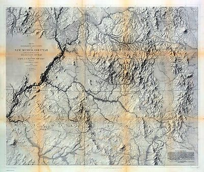
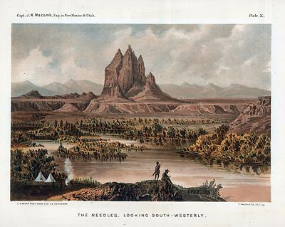
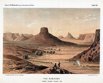
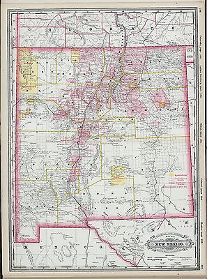
New Mexico
Map Collection |

0041040
|
Asher & Adams
1874
New Mexico.
|

0149056
|
Colton, G.W.
1856
Territories Of New Mexico and Utah.
|

0328008
|
Humboldt, Alexander von, 1769-1859
1807
Carte de la Route qui mene depuis la Capitale de la Nouvelle Espagne.
|

1780098
|
Anderson, Allen; United States. War Department
1895
Mil. Dept. New Mexico.
|

2544006
|
Holdredge, Sterling M.
1866
New Mexico.
|

2738073
|
Wheeler, G.M.
1881
69B, D, 77B, 78A. Parts of Atlas Sheets.
|

2738074
|
Wheeler, G.M.
1876
69D. North Central New Mexico.
|

2738075
|
Wheeler, G.M.
1876
69D. Land Classification Map Of Part Of North Central New Mexico.
|

2738079
|
Wheeler, G.M.
1877
70C. Part Of North Central New Mexico.
|

2738080
|
Wheeler, G.M.
1877
70C. Economic Features Of Part Of North Central New Mexico.
|

2738081
|
Wheeler, G.M.
1881
70C. Part Of North Central New Mexico.
|

2738089
|
Wheeler, G.M.
1882
77. Part of Central New Mexico.
|

2738090
|
Wheeler, G.M.
1882
77. Land Classification Map Of Part of Central New Mexico.
|

2738091
|
Wheeler, G.M.
1877
77B. Part Of Central New Mexico.
|

2738092
|
Wheeler, G.M.
1877
77B. Economic Features Part Of Central New Mexico.
|

2738093
|
Wheeler, G.M.
1878
77D. Central New Mexico.
|

2738094
|
Wheeler, G.M.
1878
77D. Land Classification Map Of Part Of Central New Mexico.
|

2738095
|
Wheeler, G.M.
1879
78A. Part Of Central New Mexico.
|

2738096
|
Wheeler, G.M.
1879
78A. Land Classification Map Of Part Of Central New Mexico.
|

2738099
|
Wheeler, G.M.
1881
84. Land Classification Map Of Part Of Southwestern New Mexico.
|

2738100
|
Wheeler, G.M.
1877
84B. Part Of Southern New Mexico.
|

2738101
|
Wheeler, G.M.
1879
84B. Part Of Southern New Mexico.
|

2738102
|
Wheeler, G.M.
1879
84B. Land Classification Map Of Part Of Southern New Mexico.
|

2738103
|
Wheeler, G.M.
1881
84C. Land Classification Map Of Part Of South Western New Mexico.
|

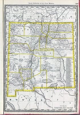
3565144
|
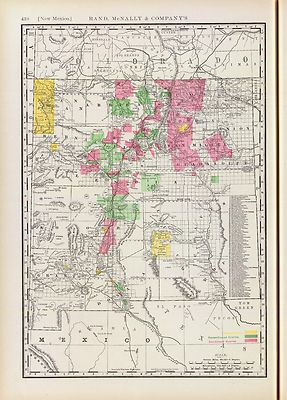
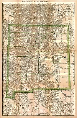
Rand McNally and Company
1897
New Mexico.
|

3825019
|
Rogers, Henry Darwin ; Johnston, Alexander Keith, 1804-1871
1857
Territory Of New Mexico.
|

4520049
|
Rand McNally and Company
1879
New Mexico.
|

4621000
|
U.S. General Land Office
1879
Territory Of New Mexico.
|

5370026
|
Cram Atlas Company
1875
New Mexico.
|

ct000521
|
United States. National Park Service.
Bandelier National Monument, New Mexico / National Park Service, U.S. Department
of the Interior.
[Washington, D.C.] : The Service, [1998]
|

ct000545
|
Morgan, James N., Maj.
Map of the route of B’vt. Maj. A. Moore’s scout, April 11th to
June 12th 1869 / by B’vt. Maj. James N. Morgan, USA.
Phildelphia : J.L. Smith, Map Publisher, [1872]
|

ct001515
|
Ve´lez y Escalante, Antonio.
Derrotero hecho por Antonia Ve´lez y Escalante, misionero para mejor
conocimiento de las misiones, pueblos de indios y presidios que se hallan
en el Camino de Monterrey a Santa Fe de Nuebo Mexico.
1777.
|

ct001843
|
United States. Forest Service. Southwestern Region.
Gila National Forest, New Mexico / compiled and drafted at regional office,
Albuquerque, New Mexico.
[Albuquerque, N.M.] : USFS, 1931.
|

mf000071
|
Narvaes, Jose M.
Carta esferica de los territorios de la alta y baja Californias y estado
de Sonora.
1823.
|

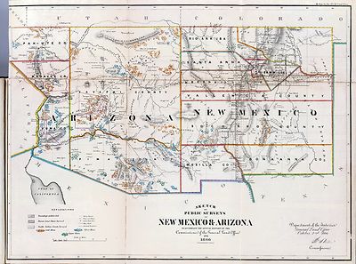
np000065
|
United States. Topographical Bureau.
Old Territory and Military Department of New Mexico.
[Washington, D.C.], 1867.
|

np000066
|
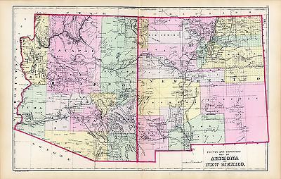
Mitchell, S. Augustus (Samuel Augustus), 1792-1868.
Arizona and New Mexico.
[S.l.], 1867
|

np000067
|
G.W. & C.B. Colton & Co.
Colton’s New Mexico and Arizona.
[S.l.], 1873.
|

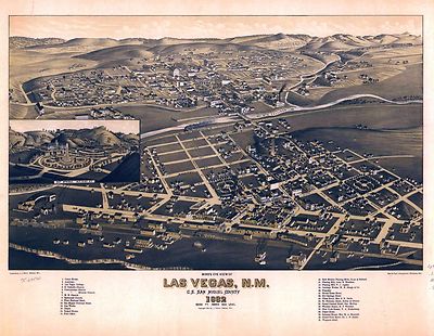
pm005320
|
Stoner, J. J.
Bird’s eye view of Las Vegas, N.M. c.s. San Miguel County 1882. Beck
& Pauli, lithographers.
Madison, Wis., J. J. Stoner, c1882.
|

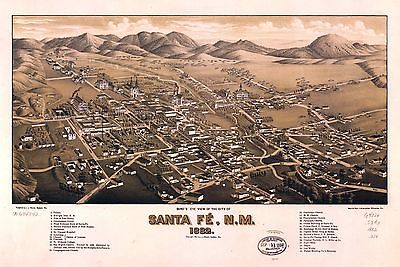
pm005330
|
Wellge, H. (Henry)
Bird’s eye view of the city of Santa Fe´, N.M. 1882. [Drawn by]
H. Wellge. Beck & Pauli, lithographers.
Madison, Wis., J. J. Stoner, c1882
|

rr001590
|
Custer, H.
From the Pimas villages to Fort Fillmore : from explorations and surveys
/ made under the direction of the Hon. Jefferson Davis, Secretary of War
by Lieut. John G. Parke, Topl. Engrs. assisted by Albert H. Campbell, Civil
Engineer and N. H. Hutton, H. Custer and G. G. Garner, 1854 & 55.
[Washington, D.C., 1859]
|

rr001710
|
Pope, John, 1822-1892.
From the Red River to the Rio Grande from explorations and surveys made under
the direction of the Hon. Jefferson Davis, Secretary of War by Captain John
Pope, Corps Topl. Engrs. assisted by Lieutenant Kenner Gerrard, 1st Dragoons,
1854-6.
[Washington, D.C., 1859]
|

rr001720
|
Gray, A. B. (Andrew Belcher), 1820-1862.
Map of proposed Arizona Territory. From explorations by A. B. Gray &
others, to accompany memoir by Lieut. Mowry U.S. Army, Delegate elect.
Cin[cinnati], Middleton, Wallace & Co. Lithos. [1857]
|

rr002580
|
Rand McNally and Company.
Indexed map of New Mexico showing stage lines, counties lake & rivers.
Chicago, 1879.
|

rr003220
|
G.W. & C.B. Colton & Co.
Map showing the Atchison, Topeka and Santa Fe´ Railroad system, with
its connections.
New York, 1883.
|

rr003290
|
Atlantic and Pacific Railroad Company.
Map showing the location of the road and the land grant of the Atlantic and
Pacific R.R. in Arizona ... in New Mexico.
[n.p.], 1883.
|

rr003980
|
Mota, Alb von.
Map of the Denver and Rio Grande Railway and connections.
[n.p., 1873]
|

rr003990
|
Eccles, S. W.
Map of the Denver & Rio Grande Railway, showing its connections and
extensions also the relative position of Denver and Pueblo to all the principal
towns and mining regions of Colorado and New Mexico.
Chicago, c1881.
|

rr004000
|
Rand McNally and Company.
Denver and Rio Grande Railway System, 1886.
[Chicago, 1886]
|

0027005
|

0073017
|

0545040
|

0586029
|

0586047
|

0592049
|

0594030
|

0594047
|

0693035
|

0693037
|

0693038
|

0730003
|

1012077
|

1070017
|

1076001
|

1076002
|

1076004
|

1076005
|

1690121
|

1954103
|

2094052
|

2134088
|

2212252
|

2212259
|

2220028
|

2220047
|

2220077
|

2220241
|

2307024
|

2366002
|

2483038
|

2699002
|

2699005
|

2699006
|

2699016
|

2699017
|

2844075
|

2861020
|

2905031
|

3183003
|

3183004
|

3375003
|

3526000
|

3559007
|
3565144
|

3639001
|

3784002
|

3803041
|
3825019
|

3888051
|

4073001
|

4081000
|

4557037
|

4587066
|

4727048
|

4740055
|

4885002
|

4977076
|

5028109
|

5028126
|

5028128
|

5041040
|

5479099
|

5566003
|

5699013
|

5755032
|

5784030
|

5784046
|

5797092
|

5797112
|

5802001
|
|
|
Features of this DVD
This auction is for a DVD of the maps listed
in electronic form,
NOT
the maps
themselves.
These maps are VERY high resolution and
can be printed at FULL SCALE or LARGER for framing and display. The results
are very high quality and convincing. |
|
Ad and disk copyright 2013
Euriskodata
All Rights Reserved |
The free listing tool. List your items fast and easy and manage your active items.
|