Click Here. Double your traffic. Get Vendio Gallery - Now FREE!
|
|
This DVD is part of our Historic Map and Atlas Collection.
We have dozens of Atlas maps on CD and DVD ranging from the 1500s to the 1900s covering many areas and topics.
Please Check our Ebay Store for what's available. |
FOR MANY MORE EDUCATIONAL DVD TITLES
ON THIS AND MANY OTHER SUBJECTS
PLEASE VISIT OUR EBAY STORE |
|
|
VERY LARGE HIGH RESOLUTION
MAP COLLECTION
ON DVD!!
(please see full table of contents and sample illustrations below) |
|
|
This DVD Contains
127 Maps of
ALASKA
These are scans of the ORIGINAL maps.
on DVD
System requirements
PC or Mac compatible.
Files are simple PDF files with a basic HTML interface (just like viewing a webpage)
Works with ALL versions of Windows. |
|
|

0233009 |
Cote nord-ouest de l'Amerique. Reconnue par le Cape. Vancouver. Ve. partie, depuis 5707'30" de latitude septle. et 22700' de longitude, jusqu'a 59059' de late. et 21900' de longe. (with) Plan du Port Conclusion. (with) Plan de Port Protection. (with) Plan de l'entree de Cross-Sound.
Vancouver, George
1828 |
|

0233010 |
Cote nord-ouest de l'Amerique. Reconnue par le Cape. Vancouver. VIe. partie, depuis 50045' (i.e. 59045') de latitude septle. et 219030' de longde., jusqu'a 59056' de late. et 21208' de longde. (with) Plan du Port Chalmers.
Vancouver, George
1828 |
|

0233011 |
Cote nord-ouest de l'Amerique. Reconnue par le Cape. Vancouver. VIIe. partie, depuis 50030' de latitude seple. et 207020' de longitude or(ienta)le., jusqu'au Cap Douglas par 58052' de lat. et 207020' de long. (with) Port Chatham.
Vancouver, George
1828 |
|

0233025 |
Plan du Port des Francais sur la cote du nord-ouest de l'Amerique, par 58037' de latitude nord et 139050' de longitude occidentale decouvert le 2 Juillet 1786 par les Fregates Francaise la Boussole et l'Astrolabe.
La Perouse, Jean-Francois de Galaup, comte de
1797 |
|

0233026 |
Plan de l'entree du Port de Bucarelli sur la cote du nord-ouest de l'Amerique, par 55015' de latitude nord et 136015' de longitude a l'ouest de Paris. Decouverte en 1775, sur la Goelette Espagnole la Sonora, par D. Juan Fco. de la Quadra et D. Franco. Anto. Maurelle; et reconnue plus amplement dans l'Expedition de 1779, par les memes officiers et autres de la Marine d'Espagne.
La Perouse, Jean-Francois de Galaup, comte de
1797 |
|

1007080 |
Chart of the Northern Passage between Asia & America.
Thomson, John
1816 |
|

1091001 |
The Gold and Coal Fields of Alaska, Together With The Principal Steamer Routes and Trails. Department of the Interior, U.S. Geological Survey
Geological Survey (U.S.) ; Emmons, S.F.
1898 |
|

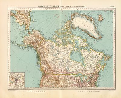
2077051 |
Russische Reich.
Kiepert, Heinrich, 1818-1899; Weiland, Carl Ferdinand; Geographisches Institut (Weimar, Germany)
1855 |
|

2104053 |
Chart of the N.W. coast of America and the N.E. coast of Asia, explored in the years 1778 and 1779.
Delarochette, L.; Roberts, Henry, Lieut.; Cook, James; Faden, William
1808 |
|

2212052 |
Partie de la Russie d'Asie.
Vandermaelen, Philippe
1827 |
|

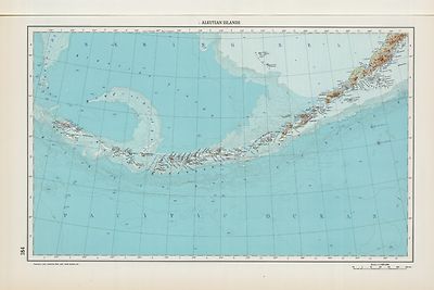
2212070 |
Partie, Iles Aleutiennes.
Vandermaelen, Philippe
1827 |
|

2212071 |
Iles Aleutiennes.
Vandermaelen, Philippe
1827
|
|

2212210 |
Partie, l'Amerique Russe. Amer.
Vandermaelen, Philippe
1827 |
|

2212218 |
Vandermaelen, Philippe
Vandermaelen, Philippe
1827 |
|

2212219 |
Partie, l'Amerique Russe.
Vandermaelen, Philippe
1827 |
|

2212226 |
Presqu'ile d'Alaska.
Vandermaelen, Philippe
1827 |
|

2212227 |
Partie, l'Amerique Russe.
Vandermaelen, Philippe
1827 |
|

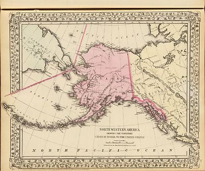
2239020 |
North western America showing the territory ceded by Russia to the United States.
U.S. Coast Survey
1873 |
|

2384001 |
Map Of White Pass & Yukon Route And Connections.
Poole Bros
1922 |
|

2710025 |
North western America showing the territory ceded by Russia to the United States.
U.S. Coast Survey
1872 |
|

3354010 |
The Coast of N.W. America.
Vancouver, George
1798 |
|

3354011 |
The Coast of N.W. America.
Vancouver, George
1798 |
|

3354012 |
The Coast of N.W. America.
Vancouver, George
1798 |
|

3355026 |
Port de Bucarelli.
La Perouse, Jean-Francois de Galaup, comte de, Mourelle de la Rua, Francisco Antonio
1797 |
|

3355069 |
Iles Kuriles, Aleutiennes.
La Perouse, Jean-Francois de Galaup, comte de
1797 |
|

3405013 |
Chart of Cooks River in the N.W. part of America.
Cook, James
1785 |
|

3405014 |
Views of the land on the west coast of America, to the westward of Cook's River
Webber, John
1785 |
|

3405015 |
Sketch of the harbour of Samganooda on the island Oonalaska. Harmar
Bligh, William
1785 |
|

3405016 |
Chart of Norton Sound and of Bherings Strait made by the East Cape of Asia and the West Point of America. (Copied by Lieut. Henry Roberts. London, G. Nicol and T. Cadell, 1785)
Cook, James
1785 |
|

3449001 |
Map Showing Routes From San Francisco To Alaska And The Klondike.
Alaska Exploration Company
1898 |
|

3565063 |
United States with insert of Alaska.
Rand McNally and Company
1897 |
|

3565154 |
Map of Alaska.
Rand McNally and Company
1897 |
|

4092001 |
Sleem's Map Of Central Alaska.
Sleem, D.H.
1910 |
|

4119014 |
Port Du Port Mulgrave
Duflot de Mofras, Eugene
1844 |
|

4476008 |
Plano Del Puerto De Mulgrave.
Espinosa y Tello, J
1802 |
|

4476009 |
Plano del Puerto del Desengano Trabajado de Orden del Rey en 1791. Numo 9. J. Cardano ft.
Espinosa y Tello, J.
1802 |
|

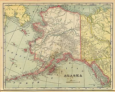
4520005 |
Alaska
Rand McNally and Company
1879 |
|

4714038 |
America Settentrionale Inglese e Russa, Groenlandia, Islanda, Terre Artiche.
Marzolla, Benedetto; Society for the Diffusion of Useful Knowledge (Great Britain)
1854 |
|

4761000 |
Department Of The Interior General Land Office William A. Richards, Commissioner. Alaska. Compiled from the official Records of the General Land Office U.S. Coast and Geodetic Survey; Geological Survey; Canadian and other sources under the direction of Frank Bond, Chief of Drafting Division G.L.O. 1906. (with 4 inset maps).
U.S. General Land Office
1906 |
|

4762001 |
Northwestern America Showing The Territory Ceded By Russia To The United States.
Sumner, Charles ; U.S. Coast Survey
1867 |
|

4794000 |
Map Of Alaska.
Punnett Brothers
1897 |
|

4860001 |
Rand-McNally Official 24x36 Map Of Alaska.
Rand McNally and Company
1897 |
|

5023050 |
Amerique Russe, regions polaires boreales.
Garnier, F. A., 1803-1863
1862 |
|

5186001 |
Map Of The New Alaska Gold Fields
Temple, J.G.
1901 |
|

5300000 |
Territory of Alaska.
Alaska Steamship Company
1936 |
|

ct000179 |
Northwestern America showing the territory ceded by Russia to the United States.
U.S. Coast and Geodetic Survey.
1867 |
|

ct000733 |
.
Merkatorskai?a? karta Proliva Kuprei?a?nova : nakhodi?a?shchagosi?a? mezhdu ostrovami Kad'i?a?kom i Afognakom / sni?a?ta s opisi proizvedennoi? v 1839 i 1840 godakh Korpusa Shturmanov Praporshchikom Murashevym i gravirovana v Gidrograficheskom departamenti?e? Morskago ministerstva.
Murashev
1849 |
|

ct000746 |
Tabula geographica generalis Imperii Russici ad normam novissimarum observationum astronomicarum concinnata / a Joh. Trescotio et Jac. Schmidio ; vyri?e?zyvali K. Frolov, E. Khudi?a?kov, N. Zubkov.
Treskot, Johann, 1719-1786.
1776.
|
|

ct001124 |
[Fairbanks Alaska region showing U.S. military telegraph line].
1906 |
|

ct001210 |
.
North western America, from Port Clarence to mouth of Kvichpak [sic] River / compiled from Russian charts and surveys of W.U. Tel. Ex., Col. C.S Bulkley, eng. in chief ; by M.M. Kadin, drauhtsman [sic].
Kadin, M. M
1864?
|
|

mf000026 |
Karta Ledovitago mori?a? i Vostochnago okeana / sostavlena s novi?e?i?shikh opisei? v Geograficheskom departamenti?e? Morskago ministerstva.
Russia. Gidrograficheski¯i? departament.
1844.
|
|

mf000027 |
Karta morskikh otkryti¯i? Rosi¯i?skimi moreplavateli?a?mi na Tikhom i Ledovitom mori?a?kh : v raznykh godakh uchinennykh / pri sobstvennom Ego Imperatorskago Velichestva Depo kart sochinena i po novi?e?i?shim nabli?u?deni¯i?a?m inostrannykh morekhodt?s?ov vypravlena i gravirovana 1802go goda ; soch. A. Vilbrekht.
Russia. Depo kart.
1898
|
|

mf000029 |
Map of Russian America or Alaska Territory.
Lewis, J. F.
1867
|
|

mf000030 |
The route of the Alaska excursion steamers.
Fee, Charles S.
1891
|
|

mf000033 |
Millroy’s map of Alaska and the Klondyke gold fields.
Millroy, J. J.
1897
|
|

mf000034 |
Map of the Alaskan gold fields.
Lee, T. S.
1897
|
|

mf000035 |
Going to Klondyke.
Bloom, May.
1897
|
|

mf000037 |
The Alaska Line.
Alaska Steamship Co.
1934
|
|

mfa00032 |
Map of Alaska and adjoining regions.
Petroff, Ivan
1882
|
|

mfb00032 |
Map of Alaska and adjoining regions.
Petroff, Ivan
1882
|
|

mfc00032 |
Map of Alaska and adjoining regions.
Petroff, Ivan
1882
|
|

mfd00032 |
Map of Alaska and adjoining regions.
Petroff, Ivan
1882 |
|

mfr00031 |
Map of Alaska, Yukon Territory and British Columbia showing connections of the White Pass and Yukon route.
Marsh & Grant Co.
1904
|
|

rr001800 |
Map of the all American Route showing proposed railroad and U.S. Government Mail Road to the Yukon; issued by Central Alaska Transportation & Trading Co.; compiled by B. F. Millard and Emil Mahlo, Topographical Engineer, U.S. Alaska Exploration Expedition Capt. W.A. Abercrombie, U.S.A. Commanding.
Millard, B. F.
c1899
|
Alaska Map Collection
Additional Maps
|

0028051 |

0102004 |

0151017 |
|

0152016 |

0152017 |
0233009 |
|
0233010 |
0233011 |
0233025 |
|
0233026 |

0458061 |

0586051 |
|

0592052 |

0594050 |
1007080 |
|

1012067 |

1071015 |
1091001 |
|

1550065 |

1603194 |

1603195 |
|

1954065 |
2077051 |

2094003 |
|
2104053 |

2134105 |
2212052 |
|
2212070 |
2212071 |
2212210 |
|
2212218 |
2212219 |
2212226 |
|
2212227 |
2239020 |
2384001 |
|
2710025 |
3354010 |
3354011 |
|
3354012 |
3355026 |
3355069 |
|
3405013 |
3405014 |
3405015 |
|
3405016 |
3449001 |
3565063 |
|
3565154 |
4092001 |
4119014 |
|
4476008 |
4476009 |
4520005 |
|
4714038 |
4761000 |
4762001 |
|
4794000 |
4860001 |
5023050 |
|
5186001 |
5300000 |
|
|
|
|
Features of this DVD
This auction is for a DVD of the maps listed in electronic form, NOT the maps themselves.
These maps are VERY high resolution and can be printed at FULL SCALE or LARGER for framing and display. The results are very high quality and convincing. |
|
|
Ad and disk copyright 2013
Euriskodata
All Rights Reserved |
|