Click Here. Double your traffic. Get Vendio Gallery - Now FREE!
Please title this page. (Page 1)
FOR MANY MORE EDUCATIONAL CD
TITLES
ON THIS AND MANY OTHER
SUBJECTS
PLEASE
VISIT OUR EBAY STORE
NO ADDITIONAL SHIPPING ON MULTIBLE CD ORDERS-ONLY
$3.50 FOR ANY NUMBER OF CDs SHIPPED TO THE SAME ADDRESS IN THE US. ONLY $4.50
FOR ANY NUMBER TO ANYWHERE ELSE IN THE WORLD |
VERY LARGE HIGH RESOLUTION
MAP COLLECTION
ON CD-ROM!!
(please see full table of contents and sample
illustrations below) |
|
This CD Contains 135 Maps of
England
These are scans of the ORIGINAL maps
on CD-ROM
System requirements
PC or Mac compatible.
Files are simple JPEG images with a basic HTML
interface (just like viewing a webpage)
Works with all versions of Windows including
3.1, 95, 98, 2000 or XP. |
Features of this CD-ROM
This auction is for a CD -ROM of the maps listed
in electronic form,
NOT
the maps
themselves.
These maps are VERY high resolution and
can be printed at FULL SCALE or LARGER for framing and display. The results
are very high quality and convincing.
For a sample map please:
CLICK
HERE
WARNING! This is
a LARGE file (5 Megabytes) if you are using
a slow connection it can take some time to load. |
|

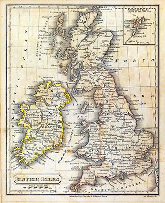
0004006
|
Adams, Daniel
1819
British Isles.
|

0006008
|
Adams, Daniel
1832
British Isles, Asia.
|

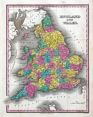
0124003
|
Carey, Mathew
1825
England, Wales.
|

0149070
|
Colton, G.W.
1856
England and Wales.
|

0197021
|
Cornell, S. S. Sarah S.
1864
British Isles.
|

0285040
|
Finley, Anthony
1831
England and Wales.
|

0289009
|
Fitch, George W.; Fairchild, Lucy
1850
British Islands.
|

0294001
|
Gaultier, abbe Aloisius Edouard Camille, 1746?-1818; Wauthier, J. M.
1797
Plain map British Islands.
|

0294002
|
Gaultier, abbe Aloisius Edouard Camille, 1746?-1818; Wauthier, J. M.
1799
British Isles.
|

0315017
|
Grigg, John
1830
British Islands.
|

0372006
|
Johnston, Alexander Keith, 1804-1871; Forbes, Edward, 1815-1854
1854
Palaeontological map British Islands.
|

0372034
|
Kombst, Gustaf; Johnston, Alexander Keith, 1804-1871
1856
Ethnographic, Gt. Brit., Ireland.
|

0373007
|
Johnston, Alexander Keith, 1804-1871
1861
Composite: England, Wales.
|

0411007
|
Kitchin, Thomas
1788
A compleat map of the British Isles.
|

0411010
|
Rocque, John
1790
Composite: England, Wales.
|

0466008
|
Martin, R.M. ; Tallis, J. & F.
1851
England and Wales.
|

0537045
|
Mitchell, Samuel Augustus
1846
England.
|

0565035
|
Mitchell, Samuel Augustus
1860
County Map Of England, And Wales.
|

0586058
|
Mitchell, Samuel Augustus
1880
England, Wales
|

0594057
|
Mitchell, Samuel Augustus
1890
England, Wales.
|

0627003
|
Morse, Jedidiah; Morse, Sidney E. Sidney Edwards, 1794-1871
1828
South America, British Isles.
|

0732006
|
Pinkerton, John, 1758-1826
1812
British Isles.
|

0732014
|
Pinkerton, John, 1758-1826
1814
Remote British Isles: Jersey and Guernsey, Scilly Isles, Shetland Isles.
|

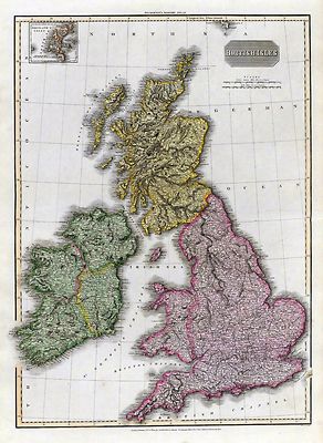
0890011
|
Society for the Diffusion of Useful Knowledge Great Britain
1842
The British Isles.
|

0890012
|
Murchison, Roderick Impey, Sir, 1792-1871; Society for the Diffusion
of Useful Knowledge Great Britain
1843
Geological map, England, Wales.
|

0890023
|
Society for the Diffusion of Useful Knowledge Great Britain
1834
Ancient Britain I.
|

0890164
|
Society for the Diffusion of Useful Knowledge Great Britain
1839
Birmingham.
|

0890182
|
Society for the Diffusion of Useful Knowledge Great Britain
1836
Liverpool.
|

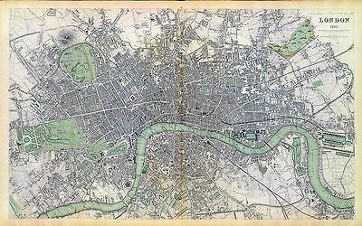
0890183
|
Society for the Diffusion of Useful Knowledge Great Britain
1836
London.
|

0890184
|
Society for the Diffusion of Useful Knowledge Great Britain
1843
London. 1843.
|

0977038
|
Tanner, Henry S.
1836
England.
|

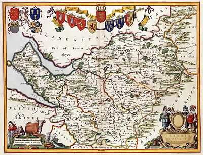
1007013
|
Thomson, John
1814
England.
|

1007014
|
Thomson, John
1817
Remote British islands.
|

1007015
|
Thomson, John
1814
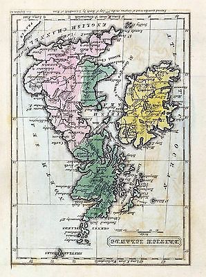
British Channel.
|

1159149
|
Warner & Beers ; Union Atlas Co.
1876
Map of the British Isles
|

126
|
A NEW MAP OF THE KINGDOME of ENGLAND
Nicolas Visscher
1685 |

127
|
DORSET SHIRE
Johannes Jannsonius
1646 |

128
|
SURREY
Johannes Jannonius
1646 |

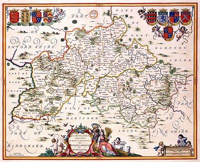
129
|
OXFORD SHIRE
Johannes Jannsonius
1646 |

130
|
SUFFOLKE
Johannes Janssonius
1646 |

131
|
WORCESTER and WARWIK SHIRE
Janssonius
1646 |

132
|
Yorkshire
Joan Blaeu
1645 |

133
|
NORTHUMBERLAND
Joan Blaeu
1645 |

1657005
|
Cary, John, ca. 1754-1835
1807
British Isles.
|

1657006
|
Cary, John, ca. 1754-1835
1807
England.
|

1801009
|
Desmarest, Nicolas, 1725-1815; Bory de Saint-Vincent, M. Jean Baptiste
GeneviFve Marcellin, 1778-1846
1827
La Manche
|

2022013
|
Huntington, Nathaniel G. Nathaniel Gilbert, 1785-1848; Huntington, Eleazer
1836
Great Britain, Ireland
|

2077032
|
Kiepert, Heinrich, 1818-1899; Geographisches Institut Weimar, Germany
1855
Britischen Inseln.
|

2104007
|
Faden, William
1801
England, Wales, Scotland.
|

2104011
|
Dicquemare, Abbe Jacques Francois, 1733-1789; Delarochette, L.; Faden,
William
1794
British Channel, Bay of Biscay.
|

2113015
|
Bartholomew, J. G. John George, 1860-1920 ; John Bartholomew & Co.
1922
British Isles - bathy-orographical.
|

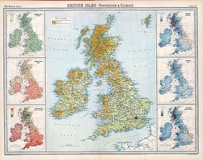
2113016
|
Bartholomew, J. G. John George, 1860-1920 ; John Bartholomew & Co.
1922
British Isles - vegetation & climate.
|

2113017
|
Bartholomew, J. G. John George, 1860-1920 ; John Bartholomew & Co.
1922
British Isles - railways & industrial.
|

2113018
|
Bartholomew, J. G. John George, 1860-1920 ; John Bartholomew & Co.
1922
British Isles - political.
|

2113027
|
Bartholomew, J. G. John George, 1860-1920 ; John Bartholomew & Co.
1922
London.
|

2113028
|
Bartholomew, J. G. John George, 1860-1920 ; John Bartholomew & Co.
1922
Towns of England & Scotland on a uniform scale.
|

2174025
|
Lapie, M. Pierre, 1779-1850; Lapie, Alexandre Emile
1829
Iles Britanniques.
|

221
|
CAPTUM PHILIPSBURGUM A
Romeyn Hooghe
1676
The siege of the German castle Philipsburg. |

226
|
CORNUBIA. sive CORNWALLIA
Johannes Janssonius
1646 |

227
|
CORNUBIA. sive CORNWALLIA
Johannes Janssonius
1646 |

228
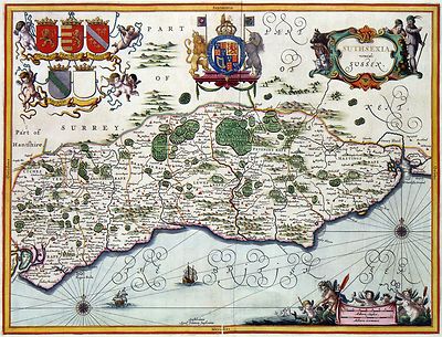
|
SUSSEX
Johannes Jannonius
1646 |

229
|
BUCKINGAMSHIRE and BEDFORDSHIRE
Johannes Jannsonius
1646 |

230
|
NORTFOLKE
Johannes Janssonius
1646 |

231
|
CESTRIA COMITATVS PALATINVS
Johannes Janssonius
1646 |

2319018
|
Patteson, Edward
1804
British Isles.
|

2319019
|
Patteson, Edward
1804
England, Wales
|

2319020
|
Patteson, Edward
1804
England, Wales Roman, modern.
|

2449051
|
Stieler, Adolf
1875
Composite: Grossbritannien.
|

2450007
|
Morse, H.; Worcester, J. E.
1821
United Kingdom of England, Scotland and Ireland.
|

2468016
|
Goodrich, S.G.
1831
Pacific Ocean, British Islands.
|

2483047
|
Mitchell, Samuel Augustus
1870
England, Wales.
|

2515013
|
Berghaus, Heinrich
1838
Karte von dem Deutschen Meere und den Angranzenden Theilen Des Atlantischen
Oceans.
|

2515075
|
Berghaus, Heinrich
1847
Die Britischen Inseln: Volker und Sprachen.
|

2605012
|
Stieler, Adolf; Brudin, J. L.
1852
Brittischen Inseln.
|

2640006
|
Cummings, J. A. Jacob Abbot
1821
Britain.
|

2682003
|
Carey, Mathew
1820
England, Wales.
|

2862007
|
Carey, Mathew
1796
Map of England and Wales.
|

2905040
|
Johnson, A.J.
1860
England and Wales.
|

3007024
|
Fullarton, A. & Co.
1872
Railway Map of the British Isles.
|

3007025
|
Fullarton, A. & Co.
1872
England & Wales.
|

3007026
|
Fullarton, A. & Co.
1872
Channel Islands, Scilly Islands, and Isle of Man.
|

3007027
|
Fullarton, A. & Co.
1872
England and Wales, Cities, Ports & Harbours.
|

3007028
|
Fullarton, A. & Co.
1872
Ports & Harbours on the East Coast of England.
|

3007029
|
Fullarton, A. & Co.
1872
Ports & Harbours on the South East Coast of England.
|

3007030
|
Fullarton, A. & Co.
1872
Ports & Harbours on the North West Coast of England.
|

3007031
|
Fullarton, A. & Co.
1872
Ports & Harbours on the South-West Coast of England.
|

3103
|
lle de bijsondere en particuliere Ceremonien, geschied in en omtrent
de Krooning WILLIAM de III. en MARIA de II. KONING en KONINGINNE Van Groot
Brittanien, Vrankrijk en Yrlandt, Op den 11 Aprl, 1689. Oude Stijl,
R. Hooghe
1689
The coronation of William III and his wife Mary Stuart is depicted in this
beautiful print with 9 scenes . From the fetching of the Crown Jewels from
the Tower of London to the bonfires on the River Thames.
The coronation itself is depicted in the middle of the print. |

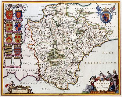
326
|
DEVONIA vulgo DEVON-SHIRE
Johannes Janssonius
1646 |

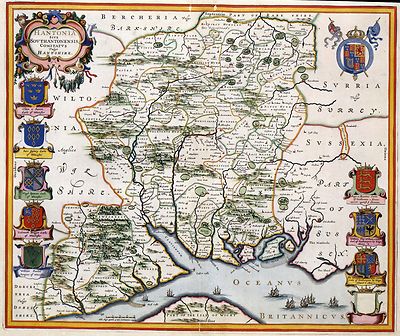
327
|
HANT-SHIRE
Johannes Jannonius
1646 |

328
|
KENT
Johannes Jannonius
1646 |

329
|
Midlesex and Hertford Shire
Johannes Jannsonius
1646 |

330
|
Leicester & Rutland Shire
Johannes Janssonius
1646 |

331
|
Wales
Joan Bleau
1645 |

332
|
LANCASTER
Joan Blaeu
1645 |

3353005
|
Robert de Vaugondy, Didier, 1723-1786 ; Sanson, Nicolas, 1600-1667 ;
Robert de Vaugondy, Gilles, 1688-1766
1750
Britannicae Insulae.
|

3353015
|
Robert de Vaugondy, Gilles, 1688-1766 ; Robert de Vaugondy, Didier, 1723-1786
1754
Isles Britanniques.
|

346
|
BELEGERINGE DER STADT NAERDEN Zijnde de Eerste overwinninge die zijn
Konincklijcke Hoogheyt de Heer Prinse van Oranjen heeft gedaen verovert op
den 12 September 1673 LE SIEGE & LA PRISE DE LA VILLE DE NAERDE qui est
la premiere Conqueste que Son Altesse Royale Monseig: neur le Prince d' Orange
a faitte le 12 Septembre 1673
Romeyn Hooghe
1673
In April 1672 England and France declared war on the Dutch Republic.
The print shows the succesful siege and capture of the fortress town of Naarden
.
In the middle of the print is William III surrounded by his staff. Kneeling
in front of the prince is the Mayor of Naarden. On the right the French troops
leave the battle field. |

3559012
|
Mitchell, Samuel Augustus
1847
Gt. Britain, Ireland.
|

3565007
|
Rand McNally and Company
1897
England, Wales.
|

399
|
The Reception of His Royal Highnesse the Prince of Orange at his entring
London
R Hooghe
1689 |

4105
|
RECEPTION OF HER ROIAL HIGH. THE PRINCESSE OF ORANGE as queen of great
Brittain
1689
In 1688 William III led his invading army to London,
This print by Romeyn de Hooghe shows the arrival of Mary Stuart on the beach
in Margate. On the background part of the accompanying Dutch Fleet can be
seen. The princess - in the middle of the picture - walks with her train
towards the coach waiting for her. |

4107
|
Battleat the Boyne River, July 11, 169
Romeyn Hooghe
1690 |

4122011
|
Schneider, J. H.; Bruyset, Jean-Marie
1784
La Grande-Bretagne
|

4224005
|
Hall, S. Sidney
1829
British Isles.
|

4224006
|
Hall, S. Sidney
1828
England, Wales.
|

426
|
VERTREK VAN S.K.H. NA ENGELAND, den 11. Nov. 1688
R Hooge
1688
This print depicts the departure of William III from Brielle and the arrival
in England. |

427
|
THE ISLE WIGHT, Johannes Jannonius 1646 |

428
|
GLOUCESTER SHIRE
Johannes Jannsonius
1646 |

429
|
DESCRIPTION of ESSEX
Johannes Janssonius
1646 |

430
|
LYNCOLNE SHIRE
Johannes Janssonius
1646 |

431
|
MONMOUTH SHIRE
Joan Blaeu
1645 |

432
|
CUMBERLAND
Joan Blaeu
1645 |

435
|
Ireland
Nicolaas Visscher
1689 |

4584014
|
Lucas, Fielding Jr.
1823
England and Wales.
|

4613004
|
Arrowsmith, John
1844
England.
|

4613005
|
Arrowsmith, John
1844
The Inland Navigation, Rail Roads, Geology and Minerals of England &
Wales.
|

4628006
|
Burr, David H., 1803-1875
1835
British Islands.
|

466
|
NOVI BELGII NOVAEQUE ANGLIAE NEC NON PARTIS VIRGINIAE TABULA
NIcolaas Visscher
1684 |

4714019
|
Marzolla, Benedetto; Brue, Adrien Hubert, 1786-1832; Picquet, C.
1845
Regno Unito della Gran Brettagna e dell'Irlanda.
|

4723001
|
, Thomas
1787
A chart of the British Channel.
|

4757046
|
Clouet, J. B. L. Jean-Baptiste Louis, b. 1730
1787
Isles Britanniques.
|

4764008
|
Lisle, Guillaume de, 1675-1726
1702
Isles Britanniques ou sont le Rme. d'Angleterre.
|

4807021
|
Radefeld, Carl Christian Franz, 1788-1874 ; Meyer, Joseph, 1796-1856
1844
Grossbritannien, Ireland.
|

4807022
|
Radefeld, Carl Christian Franz, 1788-1874 ; Meyer, Joseph, 1796-1856
1844
England.
|

4807025
|
Meyer, Joseph, 1796-1856 ; Society for the Diffusion of Useful Knowledge
Great Britain
1845
London.
|

4850006
|
Greenleaf, Jeremiah
1840
British Islands.
|

5023024
|
Garnier, F. A., 1803-1863
1862
Iles Britanniques, chemins de fer, canaux.
|

5023025
|
Garnier, F. A., 1803-1863
1862
Iles Britanniques
|

5032006
|
Worcester, Joseph E.
1826
British Isles.
|

5580008
|
Moll, Herman, d. 1732
1736
A general map of Great Britain and Ireland.
|

5580009
|
Moll, Herman, d. 1732
1736
The roads of England and Wales.
|

5580010
|
Moll, Herman, d. 1732 ; Collins, Greenvile
1736
Chart of part of coast of England, Holland & Flanders &c.
|

ct000162
|
Stratford on Avon.
Brown, J. Ross.
c1908.
Bird's-eye view showing Shakespearean landmarks and other points of interest.
|

ct000418
|
Tableau général des Isles Britanniques : comprenant les
royaumes dAngleterre et dEcosse sous la dénomination de Grande Bretagne,
et le royaume dIrlande, avec la chronologie généalogique des
rois / par M. Brion de la Tour, ingénieur-géographe du roi,
Brion de la Tour, Louis
1783 |

ct000585
|
Smith's new map of London.
C. Smith & Son.
1860.
|
|
| Thanks for bidding.
Ad and CD-ROM copyright 2007
Euriskodata, Inc.
All Rights Reserved |
The free listing tool. List your items fast and easy and manage your active items.
|