Click Here. Double your traffic. Get Vendio Gallery - Now FREE!
Please title this page. (Page 1)
FOR MANY MORE EDUCATIONAL CD
TITLES
ON THIS AND MANY OTHER
SUBJECTS
PLEASE
VISIT OUR EBAY STORE
NO ADDITIONAL SHIPPING ON MULTIBLE CD ORDERS-ONLY
$3.50 FOR ANY NUMBER OF CDs SHIPPED TO THE SAME ADDRESS IN THE US. ONLY $4.50
FOR ANY NUMBER TO ANYWHERE ELSE IN THE WORLD |
VERY LARGE HIGH RESOLUTION
MAP COLLECTION
ON CD-ROM!!
(please see full table of contents and sample
illustrations below) |
|
This CD Contains 142 Maps of
VIRGINIA
These are scans of the ORIGINAL maps from
the Atlas.
on CD-ROM
System requirements
PC or Mac compatible.
Files are simple JPEG images with a basic HTML
interface (just like viewing a webpage)
Works with all versions of Windows including
3.1, 95, 98, 2000 or XP. |
Features of this CD-ROM
This auction is for a CD -ROM of the maps listed
in electronic form,
NOT
the maps
themselves.
These maps are VERY high resolution and
can be printed at FULL SCALE or LARGER for framing and display. The results
are very high quality and convincing.
For a sample map please:
CLICK
HERE
WARNING! This is
a LARGE file (5 Megabytes) if you are using
a slow connection it can take some time to load. |
|

0043001
|
Panorama of the Seat of War. Birds Eye View Of Virginia, Maryland Delaware
And The District Of Columbia.
Bachmann, John
1861 |

0089025
|
Virginia
Bradford, Thomas G.
1838 |

0104005
|
Map of Virginia, Maryland and Delaware.
Burr, David H.,
1839 |

0122017
|
Map of Virginia
Carey, H. C. ; Lea, I.
1822 |

0149031
|
Virginia.
Colton, G.W.
1856 |

0278007
|
Map of Virginia and Maryland.
Finley, Anthony
1826 |

0285018
|
Virginia.
Finley, Anthony
1831 |

0346023
|
Map of the most Inhabited part of Virginia containing ... Maryland. (Northern
Section)
Jefferys, Thomas
1776 |

0346024
|
Map of the most Inhabited part of Virginia containing ... Maryland. (Southern
Section)
Jefferys, Thomas
1776 |

0537018
|
New Map Of Virginia.
Mitchell, Samuel Augustus
1846 |

0565015
|
County Map Of Virginia, and North Carolina.
Mitchell, Samuel Augustus
1860 |

0586020
|
Virginia, W. Virginia.
Mitchell, Samuel Augustus
1880 |

0632016
|
Virginia, Maryland and Delaware
Morse, Jedidiah
1794 |

0845014
|
State of Virginia.
Reid, John ; Winterbotham, W.
1796 |

0977014
|
New Map Of Virginia.
Tanner, Henry S.
1836 |

2031001
|
Map Of The Seat Of War.
Monk, Jacob
1861 |

2301021
|
Virginia.
Morse, Sidney Edwards, Breese, Samuel
1845 |

2483020
|
Virginia, W. Virginia.
Mitchell, Samuel Augustus
1870 |

2501012
|
Virginia.
Henshaw, Frances H.
1828 |

2542013
|
State of Virginia.
Carey, Mathew ; Lewis, Samuel
1795 |

2755011
|
Virginia Maryland And Delaware.
Tanner, Henry S.
1825 |

2915001
|
Virginia, Maryland, Delaware
Moore, Marinda Branson
1863 |

3130000
|
A Map of the State of Virginia.
Boye, Herman
1827 |

3353101
|
Virginie, Maryland.
Robert de Vaugondy, Didier, Robert de Vaugondy, Gilles, Fry, Joshua, Jefferson,
Peter,
1755 |

3565086
|
Virginia.
Rand McNally and Company
1897 |

3733060
|
Virginia & Maryland.
Bowen, Emanuel
1747 |

3814001
|
Lloyd's official map of the State of Virginia.
Lloyd, J.T
1862 |

3860000
|
Official Plan of The Siege Of Yorktown Va.
Abbot, Henry L.
1862 |

3877000
|
White House To Harrisons Landing.
Abbot, Henry L.
1862 |

3878000
|
Williamsburg To White House.
Abbot, Henry L.
1862 |

3879000
|
Yorktown To Williamsburg.
Abbot, Henry L.
1862 |

3884007
|
Map of Virginia and Maryland.
Mitchell, Samuel Augustus
1831 |

4453027
|
Virginia.
Goodrich, S.G. ; Bradford, Thomas
1841 |

4520034
|
Virginia and West Virginia.
Rand McNally and Company
1879 |

4577017
|
Map of Virginia.
Carey, Mathew
1814 |

4584057
|
Virginia
Lucas, Fielding Jr.
1823 |

4628042
|
Virginia.
Burr, David H.
1835 |

4682000
|
War Telegram Marking Map.
Prang, L. & Co.
1862 |

4807148
|
Virginia.
Meyer, Joseph
1845 |

4850042
|
Virginia.
Greenleaf, Jeremiah
1840 |

4856001
|
Virginia, Maryland, Delaware.
Colton, J.H.
1862 |

4869006
|
Virginia ; Maryland ; Delaware
Morse, Sidney Edwards
1823 |

5370003
|
Virginia & W.V.
Cram Atlas Company
1875 |

5388017
|
Virginia, Maryland and Delaware.
Tanner, Henry S.
1823 |

ar002900
|
North America. From the French of Mr. d’Anville, improved with the back
settlements of Virginia and course of Ohio, illustrated with geographical
and historical remarks.
Jefferys, Thomas
1755
|

ar002901
|
North America. From the French of Mr. d’Anville, improved with the
back settlements of Virginia and course of Ohio, illustrated with geographical
and historical remarks.
Jefferys, Thomas
1758
|

ar008303
|
Dominia Anglorum in America Septentrionali. Specialibus mappis Londini
primum a Mollio edita, nunc recusa ab Hommanianis Hered.
Homann Erben (Firm)
between 1759 and 1784
|

ar070900
|
A general map of the middle British colonies, in America; viz. Virginia,
Mariland, Delaware, Pensilvania, New-Jersey, New-York, Connecticut, and Rhode
Island: Of Aquanishuoni^gy, the country of the Confederate Indians; comprehending
Aquanishuoni^gy proper, their place of residence, Ohio and
Ti¨iuxsoxru´ntie, their deer-hunting countries, Couxsaxra´ge
and Skaniadara^de, their beaver-hunting countries; of the Lakes Erie,
Onta´rio, and Champlain, and part of New-France: Wherein is also shewn
the antient and present seats of the Indian nations. Engraved by Jas. Turner.
Evans, Lewis
1755
|

ar071601
|
A general map of the middle British colonies in America, viz. Virginia,
Maryland, Delaware, Pensilvania, New-Jersey, New York, Connecticut &
Rhode-Island: Of Aquanishuonigy the country of the confederate Indians
comprehending Aquanishuonigy proper, their places of residence, Ohio &
Thuchsochruntie their deer hunting countries, Couchsachrage & Skaniadarade
their beaver hunting countries, of the Lakes Erie, Ontario and Champlain.
Wherein is also shewn the antient & present seats of the Indian nations.
Evans, Lewis
1771
|

ar075100
|
Carte generale des colonies angloises dans l’Amerique Septentrionale
pour l’intelligence de la guerre presente, d’apres des manuscrit
anglais par J. B. Nolin geographe. Corrige´, augmente´ des indications
des principaux e´venemens de la guerre avec le tracee des limites pour
constituer le traite´ de paix propose´ entre la Couronne de la
Grande Bretagne et les Etats Unis, Par R. Phelipeau, ge´ographe.
Phelipeau, Rene
1783
|

ar078904
|
A new map of the western parts of Virginia, Pennsylvania, Maryland and
North Carolina; comprehending the river Ohio, and all the rivers, which fall
into it; part of the river Mississippi, the whole of the Illinois River,
Lake Erie; part of the lakes Huron, Michigan &c. and all the country
bordering on these lakes and rivers. By Thos. Hutchins. Engrav’d by
T. Cheevers.
Hutchins, Thomas
1778
|

ar144300
|
Part of the Province of Virginia.
1779?
|

ar145200
|
Arme´e de Rochambeau, 1782. Carte des environs de Williamsburg en
Virginie ou` les arme´es franc¸oise et ame´ricaine ont
campe´s en Septembre 1781. Desandrou¨ins.
Desandrou¨ins, Jean Nicolas
1782 |

ar146200
|
Carte de la partie de la Virginie ou l’arme´e combine´e
de France & des E´tats-Unis de l’Ame´rique a fait prisonnie`re
l’Arme´e anglaise commande´e par Lord Cornwallis le 19 octobre.
1781, avec le plan de l’attaque d’York-town & de Glocester.
Leve´e et dessine´e sur les lieux par ordre des officiers genx.
de l’Arme´e franc¸aise & ame´ricaine.
Esnauts et Rapilly.
1781?
|

ar300600
|
Campagne en Virginie du Major Ge´ne´ral M’is de LaFayette
: ou se trouvent les camps et marches, ainsy que ceux du Lieutenant
Ge´ne´ral Lord Cornwallis en 1781 / par le Major Capitaine, aide
de camp du G’l LaFayette.
Capitaine du Chesnoy
1781
|

ar300700
|
[Plat of a survey for William Hughes, Jr. of 460 acres in Frederick County,
Va. on the Cacapon River].
Washington, George
1750 |

ar301100
|
Reddition de l’Arme´e angloises commande´e par Mylord
Comte de Cornwallis aux armees combine´es des Etats Unis de
l’Ame´rique et de France aux ordres des Generaux Washington et
de Rochambeau a Yorck Touwn et Glocester dans la Virginie, le 19 Octobre
1781.
Mondhare (Firm)
1781?
|

ct000081
|
A general map of the middle British colonies in America, viz. Virginia,
Maryland, Delaware, Pensilvania, New-Jersey, New York, Connecticut &
Rhode-Island: Of Aquanishuonigy the country of the confederate Indians
comprehending Aquanishuonigy proper, their places of residence, Ohio &
Thuchsochruntie their deer hunting countries, Couchsachrage & Skaniadarade
their beaver hunting countries, of the Lakes Erie, Ontario and Champlain.
Wherein is also shewn the antient & present seats of the Indian nations.
Evans, Lewis
1771 |

ct000085
|
A plan of my farm on Little Huntg. Creek & Potomk. R. G. W.
Washington, George
1766 |

ct000164
|
Atlas of fifteen miles around Washington, including the counties of Fairfax
and Alexandria, Virginia / compiled and published from actual surveys by
G.M. Hopkins.
Hopkins, Griffith Morgan.
c1878
|

ct000165
|
Atlas of fifteen miles around Washington, including the counties of Fairfax
and Alexandria, Virginia / compiled and published from actual surveys by
G.M. Hopkins.
Hopkins, Griffith Morgan.
c1878 |

ct000189
|
A Plan of the entrance of Chesapeak [sic] Bay, with James and York Rivers;
wherein are shewn the respective positions (in the beginning of October)
1. of the British Army commanded by Lord Cornwallis, at Gloucester and York
in Virginia; 2. of the American and French forces under General Washington,
3. and of the French fleet under Count de Grasse.
By an officer.
[1781 |

ct000232
|
A new and exact map of the dominions of the King of Great Britain on
ye continent of North America, containing Newfoundland, New Scotland, New
England, New York, New Jersey, Pensilvania, Maryland, Virginia and Carolina.
[Moll, Herman.
1731
|

ct000358
|
[Plat of a survey of 2,314 acres of land, being the first large bottom
on the east side of the Ohio River, 3 or 4 miles below the mouth, a portion
of which is divided into 17 lots] W. Crawford, surv.
Crawford, William.
1771
|

ct000359
|
Map of the county of Frederick
Moffet, J.
1769
|

ct000360
|
A map of the land abt. Red Stone and Fort Pitt, given to me by Cap. Crawfd.
Washington, George
ca. 1780 |

ct000362
|
A survey of the northern neck of Virginia, being the lands belonging
to the Rt. Honourable Thomas Lord Fairfax Baron Cameron, bounded by &
within the Bay of Chesapoyocke and between the rivers Rappahannock and Potowmack:
With the courses of the rivers Rappahannock and Potowmack, in Virginia, as
surveyed according to order in the years 1736 & 1737.
Warner, John
1747?
|

ct000370
|
A map of the most inhabited part of Virginia containing the whole province
of Maryland with part of Pensilvania, New Jersey and North Carolina. Drawn
by Joshua Fry & Peter Jefferson in 1751.
Fry, Joshua
1755
|

ct000377
|
Virginia / discovered and discribed by Captayn John Smith, 1606 graven
by William Hole.
Smith, John.
1624
|

ct000399
|
A map of Potomack and James rivers in North America shewing their several
communications with the navigable waters of the new province on the river
Ohio.
Ballendine, John.
1773? |

ct000431
|
A new and accurate map of Virginia wherein most of the counties are laid
down from actual surveys. With a concise account of the number of inhabitants,
the trade, soil, and produce of that Province.
Henry, John
1770
|

ct000473r
|
A plan of Mr. Clifton’s neck land platted by a scale of 50 poles
to the inch / by TH 1755 & copied by G W-n 1760. Old plat of the grounds
in the NE part of the pasture of Mount Vernon from the summit of the hills
on which the log’d cabbins are.
Washington, George
1760.
|

ct000473v
|
A plan of Mr. Clifton’s neck land platted by a scale of 50 poles
to the inch / by TH 1755 & copied by G W-n 1760. Old plat of the grounds
in the NE part of the pasture of Mount Vernon from the summit of the hills
on which the log’d cabbins are.
Washington, George
1760
|

ct000577
|
Virginia, Marylandia et Carolina in America septentrionali Britannorum
industria excultæ repræsentatæ a^ Ioh. Bapt. Homann.
Homann, Johann Baptist
1759?
|

ct000592
|
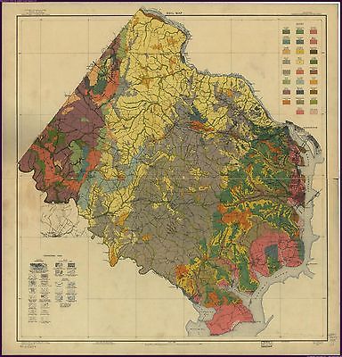
Soil map : West Virginia, Boone county sheet.
West Virginia Geological Survey.
1913
|

ct000693
|
A map of the British and French settlements in North America
T. Bowen
1755
|

ct000706
|
La Floride par N. Sanson d’Abbeville, Georgr. ordre. du Roy¨.
A Paris chez l’Auteur aux Galleries du Louvre. Avec Pri. pour 20 ans.
Sanson, Nicolas
1657
|

ct000777
|
Americæ pars, nunc Virginia dicta : primum ab Anglis inuenta, sumtibus
Dn. Walteri Raleigh, Equestris ordinis Viri, Anno Dn¯i. MDLXXXV regni
Vero Sereniss. nostræ Reginæ Elisabethæ XXVII, hujus vero
Historia peculiari Libro descripta est, additis etiam Indigenarum Iconibus
/ autore Ioanne With ; sculptore Theodoro de Bry¨, qui et. excud.
White, John
1590
|

ct000813
|
Virginia, Fairfax-Alexandria counties sheet, soil map / soils surveyed
by Wm. T. Carter, Jr., in charge, and C.K. Yingling, Jr.
Carter, William Thomas
1915
|

ct000903
|
A mapp of Virginia discovered to ye hills, and in it’s latt. from
35 deg. & 1/2 neer Florida to 41 deg. bounds of New England / Domina
Virginia
Farrer, John
1667
|

ct001068
|
Pascaert van Nieuw Nederlandt Virginia, ende Nieuw-Engelandt verthonendt
alles wat van die landin by See, oft by land is ondect oft Bekent.
Vinckeboons, Joan.
1639?
|

ct001099
|
Map of Virginia and West Va., North & part of South Carolina, Maryland
& Delaware, showing the situation in these states of schools taught by
graduates of the Hampton Normal & Agricultural Institute from 1871 to
1876.
N.Y. : Am. Photo-Lithographic Co.
1876 |

cw0449600
|
Map of the seat of war : [Virginia and Maryland] / compiled & drawn
by M.B. Grant, C.E
Grant, M. B.
1861?
|

cw0451300
|
The seat of war in Virginia. Positions of the rebel forces, batteries,
intrenchments and encampments in Virginia-the fortifications for the protection
of Richmond Waters & So, engravers, N.Y.
New York Herald.
1861
|

cw0452000
|
Bacon’s new army map of the seat of war in Virginia, showing the
battle fields, fortifications, etc., on & near the Potomac River Compiled
from the army map of the Federal Government, and other authentic sources
Bacon & Co.
1862
|

cw0454000
|
Map of the seat of war in Virginia Lith. by E. Sachse & Co., Baltimore.
Bohn, Casimir.
c1862
|

cw0457000
|
Map of the seat of war in Virginia
Duncan, B.
Dec. 1, 1862
|

cw0459000
|
The battle fields and military positions in the Virginian Peninsula,
from surveys supplied by officers of the army
Heald, Daniel Addison
1862 |

cw0464000
|
Lloyd’s new war map of Virginia.
Lloyd H. Hall Co.
c1862
|

cw0465850
|
[Geological map of the state of Virginia] / made under the direction
of Maj. A.A. Humphreys ; by Tho. S. Ridgeway, geologist &c., formerly
of the Geological Survey of Va., March 1862.
Ridgeway, Thomas S.
1862
|

cw0474000
|
Military map of south-eastern Virginia / compiled at the U.S. Coast Survey
Office
U.S. Coast and Geodetic Survey. ; drawn by A. Lindenkohl ; H. Lindenkohl
& Chs. G. Krebs, lith.
1862?
|

cw0480000
|
The battle fields and military positions in eastern Virginia, from surveys
supplied by officers of the army.
Heald, Daniel Addison
1863
|

cw0481000
|
Map of a portion of the Rappahannock River and vicinity, Virginia : to
illustrate the operations of the Army of Northern Virginia C.S. and the Army
of the Potomac U.S. from the close of the Battle of Fredericksburg, Decem.
15th 1862, to the Battle of Chancellorsville, Saturday, May 2nd 1863 / compiled
from surveys by C.S. Engineers by Jed. Hotchkiss, Top. Eng., Staunton Va.
[Hotchkiss, Jedediah; drawn by S.B. Robinson ; W.S. Barnard
1866
|

cw0481600
|
Map of the State of Virginia compiled from the best authorities at the
Coast Survey Office. A. D. Bache, Supdt. July 1863. Compiled by W. L. Nicholson.
Nicholson, W. L. ;Lith by Chas. G. Krebs.
1863 |

cw0484000
|
Bacon’s large print war map showing 50 miles round Washington and
Richmond.
Bacon & Co.
1864 |

cw0488400
|
Isometric view of General Grant’s Virginia campaign.
1864 |

cw0489000
|
Military map of south-eastern Virginia
Lindenkohl, A.
1864 |

cw0493200
|
Important operations in Virginia. The Army of the Potomac across the
Rapidan-Scene of the impending conflict between Generals Grant and Lee.
New York Herald.
1864 |

cw0493600
|
Map of the State of Virginia compiled from the best authorities, and
printed at the Coast Survey Office.
Nicholson, W. L.
1864 |

cw0497500
|
The Potomac army war map. Designed to show the present fighting ground
in Virginia to meet the demand of the times
Russell, Benjamin B.
1864 |

cw0508560
|
Map of country between Fredericksburg and Richmond, Virginia, showing
roads, railroads, and some place names.
1861-1865?
|

cw0509400
|
Map of Virginia and neighboring states showing the location of battles
in the Civil War 1861-1865.
Northrup, William P.
c1912 |

cw0511500
|
Seat of war in Virginia [1861-65].
1865 |

cw0521000
|
Reconnaissance in advance of Camp Mansfield
Church, Benjamin Silliman ,Capt by 12th Regiment Engr.
186?
|

cw0523000
|
[Detailed map of part of Virginia from Alexandria to the Potomac River
above Washington, D.C. 186-].
United States. Army. Corps of Engineers.
186- |

cw0532000
|
Map of Culpeper County with parts of Madison, Rappahannock, and Fauquier
counties
United States. Army. Corps of Topographical Engineers. engr. by J. Schedler
1863? |

cw0545000
|
The key to East Virginia showing the exact relative positions of Fortress
Monroe, Rip Raps, Newport News, Sewalls [sic] Point, Norfolk, Gosport Navy
Yard and expressing the soundings of every part of Hampton Roads & Elizabeth
River Compiled from government surveys
Couzens, M. K. ;Civ. Eng. Litho. Lang & Laing, N.Y.
c1861 |

cw0603000
|
Map of the part of Virginia lying between the York and James rivers :
showing battles and routes of Union forces 1861-62].
1862? |

cwh00012
|
Map of the northern part of Virginia and West Virginia, between the Blue
Ridge and the Alleghany Front, south of the Potomac River and north of New
Market
186-
|

cwh00013
|
Part of map of portions of the milit’y dep’ts of Washington,
Pennsylvania, Annapolis, and north eastern Virginia
United States. Topographical Bureau.
compiled in the Bureau of Topographical Eng’rs, War Department &c.,
July 1861 |

cwh00016
|
Preliminary map of northeastern Virginia embracing portions of Prince
William, Stafford, and Fauquier counties
186- |

cwh00020
|
Map of Albemarle County, north of the Virginia Central Railroad, and
a portion of Augusta County along the south fork of the Shenandoah River].
[186-] |

cwh00024
|
Confederate States of America. Army of Northern Virginia. Corps, 2nd.
Engineer Office.
Caroline County, Virginia / Eng. Office, 2d Corps, A.N.Va.
[186- |

cwh00025
|
Map of parts of Caroline, Hanover, and Henrico counties, Va., west of
the Mattaponi River and the Richmond, Fredericksburg, and Potomac Railroad.
186- |

cwh00029
|
Map of part of Essex, King and Queen, and King William Counties / made
under the direction of Capt. A.H. Campbell, Chief Topographical Dep’t
; traced from a map now in progress ; approved April 21st 1863 by Abert [sic]
H. Campbell, Cap. T.Eng. & Chief Top. Dep. D.N.Va. ; copy certified Oct.
22nd 1863 Eng. Office 2nd. Corps, Jed Hotchkiss, Capt. & top. eng.
Campbell, Albert Henry
1863 |

cwh00033
|
Map of Fauquier & Loudon [sic] co’s. Va. / by order of Lt. Col.
Wm. P. Smith Chf. Eng’r. Topogl. Office A.N.V. ; copied by A. S. Barrows
Ass’t Eng’r.
Barrows, A. S.
1863 |

cwh00034
|
Map of parts of Fauquier, Prince William, and Rappahannock counties,
Va.
186- |

cwh00055
|
Confederate States of America. Army of Northern Virginia. Corps, 2nd.
Engineer Office.
Rappahannock Co., Virginia / Engr. Office, 2nd Corps,
Novr. 1863 |

cwh00062
|
Map of Spotsylvania and Caroline Counties, Virginia
[186- |

cwh00104
|
Map of parts of Orange, Louisa, and Spotsylvania counties, Va.
186-
|

pm009510
|
Perspective map of Bedford City, Va., county seat of Bedford Co. 1891.
Wellge, H. (Henry)
American Publishing Co.
1891 |

pm009505
|
Perspective view of northwest Alexandria : showing location with reference
to cities of Washington & Alexandria / Gedney & Roberts.
Gedney & Roberts.
189- |

pm009504
|
Birds eye view of Alexandria, Va.
Magnus, Charles.
1863 |

pm009520
|
Aero view of Bristol, Va.=Tenn. 1912. Drawn and published by T. M. Fowler.
Fowler, T. M. (Thaddeus Mortimer), 1842-1922.
Passaic, N.J., c1912 |

pm009530
|
Perspective map of Buena Vista, Va. 1891.
American Publishing Co. (Milwaukee, Wis.)
Milwaukee [1891]
|

pm009532
|
View of the University of Virginia, Charlottesville & Monticello,
taken from Lewis Mountain / drawn from nature & print. in colors by E.
Sachse & Co.
E. Sachse & Co.
Washington, D.C. ; Richmond, Va. : C. Bohn, 1856 |

pm009540
|
Birds eye view of Emporia, Virginia 1907. Drawn and published by T. M.
Fowler.
Fowler, T. M. (Thaddeus Mortimer), 1842-1922.
Morrisville, Pa., c1907 |

pm009550
|
Birds eye view of Franklin, Southampton Co., Virginia 1907. Drawn and
published by T. M. Fowler.
Fowler, T. M. (Thaddeus Mortimer), 1842-1922.
Morrisville, Pa., c1907 |

pm009560
|
View of Fredericksburg, Va. Nov. 1862.
E. Sachse & Co.
Balt[im]o[re] 1863 |

pm009570
|
Perspective map of Newport News, Va., county seat of Warwick County 1891.
American Publishing Co. (Milwaukee, Wis.)
Milwaukee [1891] |

pm009580
|
Norfolk & Portsmouth, Virginia 1873. Drawn and published by C. N.
Drie.
Drie, C. N.
[n.p.] 1873. |

pm009590
|
Bird’s eye view of Norfolk, Portsmouth and Berkley, Norfolk Co.,
Va. Morning News Lith.
Koch, Augustus, b. 1840.
[1891?] |

pm009600
|
Panorama of Norfolk and surroundings 1892. H. Wellge, des. Compliments
of Pollard Bros. Real Estate.
Wellge, H. (Henry)
Milwaukee, American Publishing Co.; Hume & Bilisoly pub. agt’s.
[1892] |

pm009610
|
Aero view of Pocahontas, Va. 1911 / drawn and published by T. M. Fowler.
Fowler, T. M. (Thaddeus Mortimer), 1842-1922.
Flemington, N.J. [1911] |

pm009611
|
Richmond, Va. and its vicinity. J. Wells, del. R. Hinshelwood, sc.
Wells, J.
Virtue Yorston & Co., 1863. |

pm009620
|
Perspective map of the city of Roanoke, Va. 1891.
American Publishing Co. (Milwaukee, Wis.)
Milwaukee [1891] |

pm009621
|
Staunton, Va. [graphic] / drawn from nature by Ed. Beyer ; W. Rau.
Rau, Woldemar, 1827-1889, lithographer.
c1857. |

pm009630
|
Perspective map of the city of Staunton, Va., county seat of Augusta
County, Virginia
American Publishing Co. (Milwaukee, Wis.)
1891. |

pm009640
|
Birds eye view of Suffolk, Nansemond Co., Va. 1907. Drawn by T. M. Fowler.
Fowler, T. M. (Thaddeus Mortimer), 1842-1922.
Morrisville, Pa., Fowler & Kelly, c1907.
|

pm009650
|
Perspective map of the city of Waynesboro, Va.
American Publishing Co. (Milwaukee, Wis.)
Milwaukee [1891?] |

pm009660
|
Bird’s eye map of the city of Winchester. .
[Drawn by] Woods; W. A. Ryan,
c1926.
|

rr004800
|
Route of the New River R.R., 188-.
Hotchkiss, Jedediah, 1828-1899.
[188-] |

rr005410
|
Potomac, Fredericksburg, & Piedmont R.R. from Fredg., to O.C.H. 38 miles,
by C. M. Braxton,
Hotchkiss, Jedediah
[1876]. |
|
| No Additional Shipping for multible orders.
Thanks for bidding.
Ad and CD-ROM copyright 2004
Euriskodata, Inc.
All Rights Reserved |
The free listing tool. List your items fast and easy and manage your active items.
|