Click Here. Double your traffic. Get Vendio Gallery - Now FREE!
Rare Map Collection
This DVD is part of our Historic Map and
Atlas Collection.
We have dozens of Atlas maps on DVD and CD ranging from the 1500s
to the 1900s covering many areas and topics.
Please Check our Ebay Store for what's available. |
FOR MANY MORE EDUCATIONAL CD
TITLES
ON THIS AND MANY OTHER
SUBJECTS
PLEASE VISIT OUR EBAY STORE |
VERY LARGE HIGH RESOLUTION
MAP COLLECTION
ON DVD!!
(please see full table of contents and sample
illustrations below) |
|
This DVD Contains
146 Maps
of
Utah
Including 7 PANORAMIC MAPS of various
Utah Cities
These are scans of the ORIGINAL maps
by various Cartographers.
on DVD
System requirements
PC or Mac compatible.
Files are simple PDF files with a basic HTML
interface (just like viewing a webpage)
Works with ALL versions of Windows.
|
Maps of
Utah

0041032
|
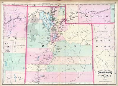
Utah.
Shows townships, distances along railroads, etc.
Asher & Adams
1874 |

0408004
|
Utah Basin. (Geological)
King, Clarence
1876 |

0950001
|
Map of the Great Salt Lake.
Stansbury, Howard; Gunnison, J.W.; Preuss, C.
1852 |

0950002
|
Map of a Reconnoissance between Fort Leavenworth ... and the Great Salt
Lake
Stansbury, Howard; Gunnison, J.W.; Preuss, C.
1852 |

1070018
|
Utah.
Indian reservations are outlined in gray.
U.S. General Land Office
1866 |

2078001
|
Green River from the Union Pacific Rail Road to White River (land cover)
Geological and Geographical Survey of the Territories (U.S.); Powell, John
Wesley, 1834-1902; Thompson, A. H. (Almon Harris), 1839-1906; De Motte, B.
C.; Bishop, F. M.
1876 |

2078002
|
Green River from the Union Pacific Rail Road to White River (geology)
Geological and Geographical Survey of the Territories (U.S.); Powell, John
Wesley, 1834-1902; Thompson, A. H. (Almon Harris), 1839-1906; De Motte, B.
C.; Bishop, F. M.
1876 |

2078003
|
Structure sections through the Uinta Mountains.
Geological and Geographical Survey of the Territories (U.S.); Powell, John
Wesley
1876 |

2078004
|
Displacement diagrams ... through the Uinta Mountains.
Geological and Geographical Survey of the Territories (U.S.); Powell, John
Wesley
1876 |

2078005
|
Stereogram of the displacements of the Uinta Mountains.
Geological and Geographical Survey of the Territories (U.S.); Powell, John
Wesley
1876 |

2078006
|
Bird's-eye view of a part of the Uinta Uplift
Gilbert, Grove Karl, 1843-1918; Geological and Geographical Survey of the
Territories (U.S.); Powell, John Wesley,
1876 |

2080002
|
Geological map of the district of the high plateaus of Utah.
Geographical and Geological Survey of the Rocky Mountain Region (U.S.); Dutton,
Clarence E. (Clarence Edward), 1841-1912; Thompson, A. H. (Almon Harris),
1839-1906; Renshawe, J. H. (John Henry),
1879 |

2080003
|
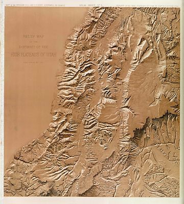
Relief map of the district of the high plateaus of Utah.
Geographical and Geological Survey of the Rocky Mountain Region (U.S.); Dutton,
Clarence E. (Clarence Edward), 1841-1912; Thompson, A. H. (Almon Harris),
1839-1906; Renshawe, J. H. (John Henry),
1879 |

2080004
|
Map of portions of Utah and Arizona showing ... faults and flexures
Geographical and Geological Survey of the Rocky Mountain Region (U.S.); Dutton,
Clarence E. (Clarence Edward),
1879 |

2212252
|
Partie de Mexique. Amer. Sep. 47.
Relief shown by hachures. Shows Indian tribes. Covers parts of Utah, Colorado
and northern Arizona and New Mexico. Includes text: Note sur le Mexique.
... pour la suite de la note voir la carte no. 30.
Vandermaelen, Philippe Delavault, A.
1827 |

2544005
|
Utah.
Holdredge, Sterling M.
1866 |

2738034
|
50. Central & Western Utah.
In hachures with cream under-tint. Salt Lake City noted outside the map border.
Lakes in blue.
Wheeler, G.M.
1873 |

2738035
|
50. Central & Western Utah.
In crayon with cream under-tint and lightened for high lands. Salt Lake City
shown outside the border of the map. Lakes outlined.
Wheeler, G.M.
1873 |

2738036
|
50. Central & Western Utah.
Full color geologic formations shown in crayon on map base used in P1281-64.
Salt Lake City placed outside the map border. Color legend provided at right
of map.
Wheeler, G.M.
1873 |

2738046
|
59. Southwestern Utah.
With hachures and dark cream under-tint.
Wheeler, G.M.
1873
|

2738047
|
59. Southwestern Utah.
In crayon with light cream under-tint, lightened for high land.
Wheeler, G.M.
1873
|

2738048
|
59. Southern And Southwestern Utah.
In crayon and showing geological formations in full color tints. Legend to
the right of map. Top left of map without geologic representation.
Wheeler, G.M.
1873
|

2738104
|
Restored Outline Of Lake Bonneville ... Portions Of Western Utah &
Eastern Nevada.
In crayon with blue tints for lakes and drainage, cream under-tint. Light
blue shows extent of ancient lake surface. Scale incorrectly printed with
correct scale on slip pasted over the map scale.
Wheeler, G.M.
1876 |

3565142
|
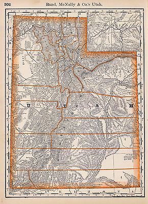
Utah.
Rand McNally and Company
1897 |

3825014
|
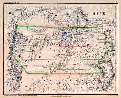
Territory Of Utah.
Rogers, Henry Darwin ; Johnston, Alexander Keith
1857 |

3945001
|
Map of the Territory of Utah.
Froiseth, B.A.M.
1870 |

4520042
|
Utah.
States in outline color by county. Relief shown by hachures and spot heights.
Shows named railroads.
Rand McNally and Company
1879 |

4647000
|
Territory Of Utah.
U.S. General Land Office
1879 |

4713003
|
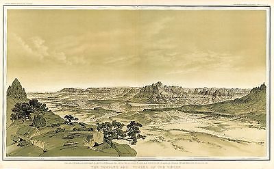
The Temples and Towers of the Virgen.
Holmes, William Henry; Dutton, Clarence E. (Clarence Edward),
1882 |

5370032
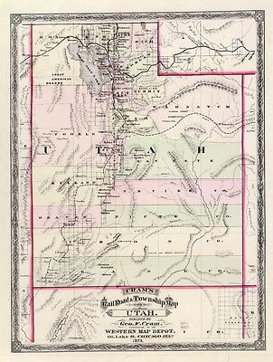
|
Utah.
Map in full color by county. Railroad lines clearly shown.
Cram Atlas Company
1875 |

5425001
|
West's New Sectional & Topographical Map Of Utah.
Inset maps include: Manti City, Nephi City, Provo City, Salt Lake City, Ogden
City, Logan City, and Coalville. Inset chart of area, population and assessed
valuation of the Territory of Utah for 1884.
West, Joseph A.
1885 |

ct000400
|
United States. Bureau of Land Management.
State of Utah shaded relief map / produced by the Bureau of Land Management
in cooperation with the United States Geological Survey.
[Salt Lake City, Utah] : U.S. Dept. of the Interior, Bureau of Land Management,
Utah State Office, 1993.
|

ct000806
|
Hall, Mosiah.
Relief map of Utah / drawn by Mosiah Hall, Superintendent of Schools, Weber
County, assisted by Charles Wright, from the latest government surveys, and
from information furnished by county superintendents and local surveyors
; location of minerals carefully corrected by Don Maguire, Chief of Department
of Mines, etc., Columbian World’s Fair Exposition.
Salt Lake City : Pierce & McMillen, 1895.
|

mf000047
|
[West Coast Art Co.]
[Mormon Temple Salt Lake City].
[S.l., 1910]
|

pm009230
|
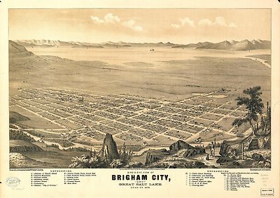
Glover, E. S.
Bird’s-eye view of Brigham City and Great Salt Lake, Utah, Ty. 1875.
Strobridge & Co. Lith.
Salt Lake City, 1875.
|

pm009240
|
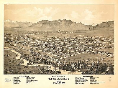
Glover, E. S.
Birds eye view of Ogden City, Utah, Ty. 1875. Strobridge & Co. Lith.
Salt Lake City [1875] c1874.
|

pm009250
|
Darling, Eugene F.
View of Ogden City, Utah Territory. From a drawing by Eugene F. Darling.
[n.p.] c1889.
|

pm009260
|
American Publishing Co. (Milwaukee, Wis.)
Perspective map of Ogden, Utah 1890.
Milwaukee; W.W. Browning & Co. genl. agents for Ogden perspective views
[1890]
|

pm009280
|
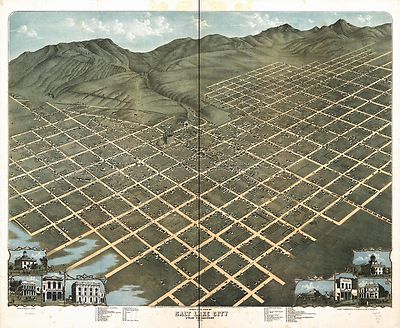
Koch, Augustus, b. 1840.
Bird’s eye view of Salt Lake City, Utah Territory 1870. Chicago
Lithographing Co.
Chicago, 1870.
|

pm009290
|
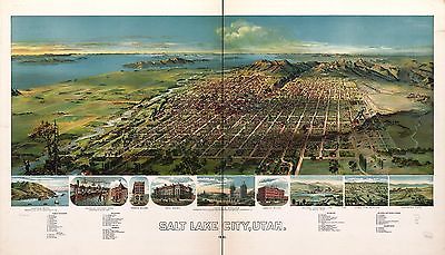
Glover, E. S.
Birds-eye view of Salt Lake City, Utah 1875. Strobridge & Co. Lith.
Salt Lake City, 1875.
|

pm009300
|
Wellge, H. (Henry)
Salt Lake City, Utah 1891. H. Wellge, sk.
Milwaukee, American Publishing Co. [1891]
|

rr003050
|
Rand McNally and Company.
Indexed map of Utah with a new and original compilation and index.
Chicago, 1876.
|

0027007
|

0149056
|

0151062
|

0152064
|

0352044
|

0358049
|

0408003
|

0535041
|

0586046
|

0592048
|

0594046
|

0693005
|

0693006
|

0693007
|

0693008
|

0693009
|

0693028
|

0693029
|

0693036
|

0740003
|

0740019
|

0740020
|

0740022
|

0740027
|

0740031
|

0740032
|

0740034
|

1012075
|

1012076
|

1071012
|

1144000
|

1550061
|

1582003
|

1690121
|

1954104
|

2054059
|

2080008
|

2094058
|

2134092
|

2220004
|

2220005
|

2220007
|

2220008
|

2307024
|

2366002
|

2483037
|

2585076
|

2699002
|

2699011
|

2699013
|

2699015
|

2738019
|

2738020
|

2738021
|

2738022
|

2738032
|

2738033
|

2738043
|

2738044
|

2738045
|

2738066
|

2738067
|

2738068
|

2738069
|

2738106
|

2738112
|

2739000
|

2809062
|

2844073
|

2871015
|

2905031
|

3054019
|

3372002
|

3374003
|

3803041
|

3888048
|

4107001
|

4107A
|

4107B
|

4324023
|

4574040
|

4587064
|

4713002
|
4713003
|

4713022
|

4713023
|

4727026
|

4727053
|

4803002
|

4820001
|

4825060
|

4835047
|

4977062
|

5022031
|

5028127
|

5028132
|

5041039
|

5198004
|

5479099
|

5755034
|

5784045
|

5840078
|

5940000
|

5943000
|

5948000
|
|
Features of this DVD
This auction is for a DVD of the maps listed
in electronic form,
NOT
the maps
themselves.
These maps are VERY high resolution and
can be printed at FULL SCALE or LARGER for framing and display. The results
are very high quality and convincing. |
|
Ad and disk copyright 2013
Euriskodata
All Rights Reserved |
The free listing tool. List your items fast and easy and manage your active items.
|