Click Here. Double your traffic. Get Vendio Gallery - Now FREE!
|
|
This DVD is part of our Historic Map and Atlas Collection.
We have dozens of Atlas maps on DVD ranging from the 1500s to the 1900s covering many areas and topics.
Please Check our Ebay Store for what's available. |
FOR MANY MORE EDUCATIONAL DVD TITLES
ON THIS AND MANY OTHER SUBJECTS
PLEASE VISIT OUR EBAY STORE |
|
|
VERY LARGE HIGH RESOLUTION
MAP COLLECTION
ON DVD!!
(please see full table of contents and sample illustrations below) |
|
|
This DVD Contains
150 Rare Antique Maps of Relating to
Indian Villages, Territories and Reservations on DVD
(please see full table of contents and sample illustrations below)
These are scans of the ORIGINAL maps from the Atlas.
on DVD
System requirements
PC or Mac compatible.
Files are simple PDF files with a basic HTML interface (just like viewing a webpage)
Works with ALL versions of Windows. |
|
|
Indian land cessions in the
United States
Smithsonian Institution. Bureau of American Ethnology. Eighteenth annual report ... 1896-1897 |

Alabama |

Northern Alabama |

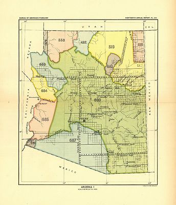
Arizona 1 |

Arizona 2 |

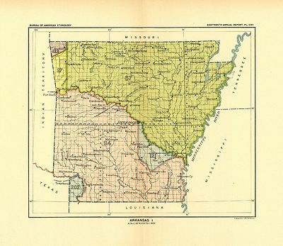
Arkansas 1 |

Arkansas 2 |

California 1 |

California 2 |

Colorado 1 |

Colorado 2 |

Dakota 1 |

Dakota 2 |

Dakota 3 |

Florida 1 |

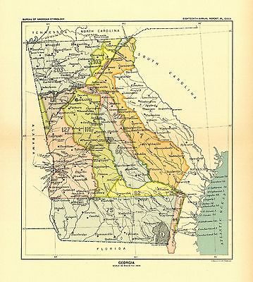
Georgia 1 |

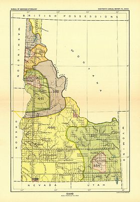
Idaho 1 |

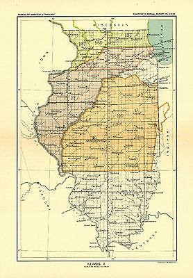
Illinois 1 |

Illinois 2 |

Indiana |

Indiana Detail |

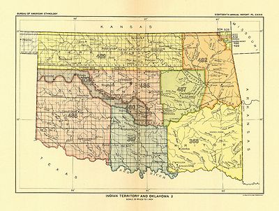
Indian Territory 1 |

Indian Territory 2 |

Indian Territory 3 |

Iowa |

Iowa 2 |

Kansas 1 |

Kansas 2 |

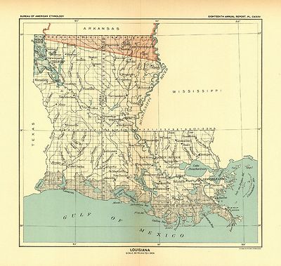
Louisiana |

Michigan 1 |

Michigan 2 |

Michigan (Saginaw bay to Lake Erie) |

Michigan (region about Mackinac and Detroit) |

Minnesota 1 |

Minnesota 2 |

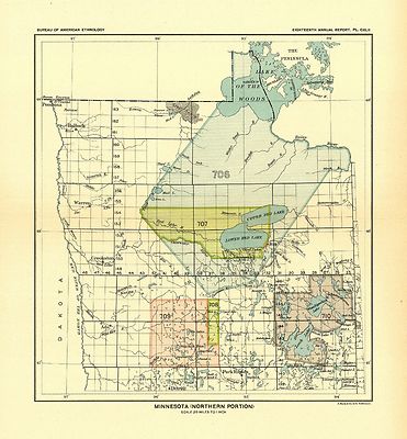
Minnesota (northern portion) |

Mississippi |

Missouri 1 |

Missouri 2 |

Montana 1 |

Montana 2 |

Nebraska |

Nebraska (eastern portion) |

Nevada |

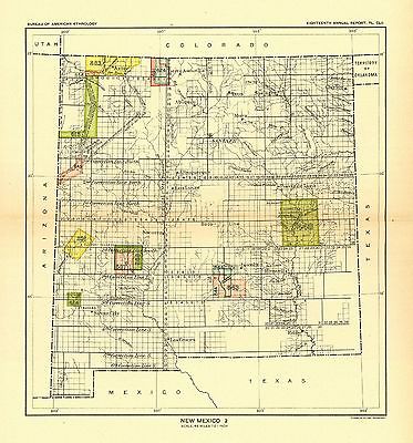
New Mexico 1 |

New Mexico 2 |

New Mexico and Texas (detail) |

New York |

North Carolina |

Ohio |

Ohio (detail) |

Oregon 1 |

Oregon 2 |

Pennsylvania |

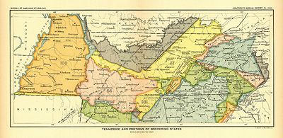
Tennessee and bordering States |

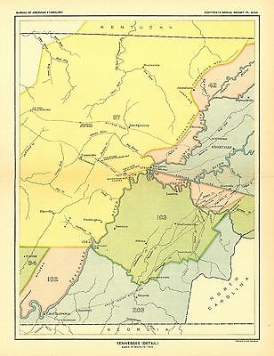
Tennessee (detail) |

Tennessee and Alabama (portions of) |

Texas (portion of) |

Utah 1 |

Utah 2 |

Washington 1 |

Washington 2 |

Washington (along Admiralty inlet) |

Washington (northwestern) |

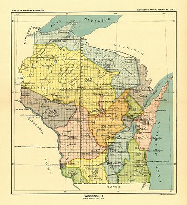
Wisconsin 1 |

Wisconsin 2 |

Wyoming 1 |

Wyoming 2 |
Historic Maps Relating to Indian tribes, Territories, and Reservations
| Historical map of the United States indicating battlefields, names of commanders, number of troops engaged, number of killed and captured during French and Indian and Revolutionary wars, Mexican War, and the late Civil War Buxton & Skinner litho. 1890 |
 |
| Route of the late expedtion [sic] commanded by Act'g. Rear Admiral D. D. Porter U.S.N. attempting to get into the Yazoo River by the way of Steels Bayou and Deer Creek Compiled & drawn by A. Strausz, U.S. Coast Survey. Indicates the location of bridges, Indian mounds, and names or residents along Deer Creek. 1863 |
 |
| Map of Missouri, Tennessee, and parts of Nebraska, Kansas, Indian Territory, Arkansas, Illinois, Indiana, Ohio, Kentucky, Virginia, North Carolina, and South Carolina, showing cities and towns, rivers, and railroads. Some important or strategic places are underlined in red or indicated by red dots. |
 |
| View of the Mississippi Valley from Cairo to the Gulf of Mexico Drawn from government surveys and other authentic sources by M.K. Couzens, Civ. Eng. Printed by Lang & Laing, lith. Covers Louisiana, Mississippi, Arkansas, Alabama, and parts of Florida, Georgia, Kentucky, Tennessee, Illinois, Missouri, Kansas, Indian Territory, and Texas, and indicates forts, towns, rivers, roads, railroads, state boundaries, and relief by shading. |
 |
| Premier series map of Oklahoma and Indian Territory. "Indian nations and Indian, forest, grazing, saline, and wood reservations shown by red boundaries." 1905. |
 |
| Indian territory: compiled under the direction of the Hon. John H. Oberly, Commissioner of Indian Affairs, by C.A. Maxwell. 1889 |
 |
| Map of the Spokane Indian Reservation, Stevens County, Washington.1910 |
 |
| Indian Reservations west of the Mississippi River. 1923 |
 |
| Indian territory: compiled from the official records of the records of the General Land Office and other sources under supervision of Geo. U. Mayo. 1887 |
 |
| Map of the former territorial limits of the Cherokee "Nation of" Indians ; Map showing the territory originally assigned Cherokee "Nation of" Indians. Map 1 |
 |
| Map of the former territorial limits of the Cherokee "Nation of" Indians ; Map showing the territory originally assigned Cherokee "Nation of" Indians. Map 2 |
 |
| Map of the Indian tribes of North America, about 1600 A.D. along the Atlantic, & about 1800 A.D. westwardly / published by the Amer. Antiq. Soc. from a drawing by Hon. A. Gallatin. 1836 |
 |
| Copy of a sketch of the Monongahela, with the field of battle, done by an Indian. French and Indian War 1755 |
 |
| Map of the Indian and Oklahoma territories. 1892 |
 |
| Map showing the lands assigned to emigrant Indians west of Arkansas and Missouri. 1836 |
 |
| Map of linguistic stocks of American Indians. 1890 |
 |
| Map of the Indian and Oklahoma territories, 1894; compiled from the official records of the General Land Office and other sources. |
 |
| A map of the north west parts of America, with the utmost respect, inscrib'd to His Excellency, Sir Guy Carleton, Knight of the Bath: Captain General and Governor of the province of Quebec: General and Commander in Chief of His Majesty's forces in the said province, and frontiers thereof. &c. &c. &c., by his most obedient humble servt. Alexr. Henry. Shows Indian tribes of western Ontario, Manitoba, and Saskatchewan. |
 |
| Shows northern Pennsylvania and western New York, detailed mapping showing numerous forts, Indian villages, and trails, is restricted to the Susquehanna Valley north of Sunbury Town. 1778 |
 |
| A plan of part of the rivers Tombecbe, Alabama, Tensa, Perdido, & Scambia in the province of West Florida; with a sketch of the boundary between the nation of upper Creek Indians and that part of the province which is contigious thereto, as settled at the congresses at Pensacola in the years 1765 & 1771. Collected from different surveys at the desire of the Honble John Stuart, Esquire, sole agent and superintendant of Indian Affairs for the southern district of North America. By David Taitt. 1771? |
 |
| A plan of the lands in New London sequestred for the sole use and improvement of the Mohegan Indian tribe / survey'd and measured the 7th, 8th & 9th of Septr. 1736 and protracted by the above scale of 60 pts. to an inch by me, Humphry Avery, survr, for the county of New London. |
 |
| Map of the United States and territories showing the extent of public surveys, Indian and military reservations, land grant R.R.; rail roads, canals, and other details compiled from the official surveys of the General Land Office and other authentic sources. 1873 |
 |
| An Indian map of the Upper-Missouri. 1801 |
 |
| The Mississippi / by Franquelin. 1682. Shows trees, animals, and names of the Indian nations. |
 |
| A general map of the middle British colonies in America, viz. Virginia, Maryland, Delaware, Pensilvania, New-Jersey, New York, Connecticut & Rhode-Island: Of Aquanishuonigy the country of the confederate Indians comprehending Aquanishuonigy proper, their places of residence, Ohio & Thuchsochruntie their deer hunting countries, Couchsachrage & Skaniadarade their beaver hunting countries, of the Lakes Erie, Ontario and Champlain. Wherein is also shewn the antient & present seats of the Indian nations. 1771 |
 |
| A general map of the middle British colonies, in America; viz. Virginia, Mariland, Delaware, Pensilvania, New-Jersey, New-York, Connecticut, and Rhode Island: Of Aquanishuonîgy, the country of the Confederate Indians; comprehending Aquanishuonîgy proper, their place of residence, Ohio and Tïiuxsoxrúntie, their deer-hunting countries, Couxsaxráge and Skaniadarâde, their beaver-hunting countries; of the Lakes Erie, Ontário, and Champlain, and part of New-France: Wherein is also shewn the antient and present seats of the Indian nations. Engraved by Jas. Turner. 1755 |
 |
| Colton's new map of the state of Texas : the Indian Territory and adjoining portions of New Mexico, Louisiana, and Arkansas / compiled from the official county maps of the General Land Office, the personal reconnaisances and geological explorations of Prof. A.R. Roessler, the surveys of the Mexican Boundary Commission, U.S. Coast Surveys, U.S. General Land Office, the various Rail Road Cos., information furnished by Mr. Pressler, and other authentic materials by G. Woolworth Colton. 1872 |
 |
| [Mapa del Golfo y costa de la Nueva España : desde el Río de Panuco hasta el cabo de Santa Elena ...]. Shows the coast from the vicinity of the Cape Fear River in North Carolina of the United States, location of Indian settlements, and lakes and rivers in the region to the Pánuco River in Mexico; the interior is as far north as the latitude of the Tennessee River. 1572 |
 |
| Map of the territory of the United States from the Mississippi to the Pacific Ocean; ordered by Jeff'n Davis, Secretary of War to accompany the reports of the explorations for a railroad route. Compiled from authorized explorations and other reliable data by G. K. Warren ... under the direction of W. H. Emory in 1854 and of A. A. Humphreys 1854-5-6-7. Engr. by Selmar Siebert. Annotated in color to show Indian reservations and military departments, and colored flags to show military establishments. Shows Indian tribal locations, military posts, routes and dates of expeditions and surveys.1858 |
 |
| A general map of the middle British colonies in America: Viz. Virginia, Maryland, Delaware, Pensilvania, New-Jersey, New-York, Connecticut and Rhode-Island: Of Aquanishuonigy the country of the confederate Indians comprehending Aquanishuonigy proper, their places of residence, Ohio and Thuchsochruntie their deer hunting countries, Couchsachrage and Skaniadarade their beaver hunting countries, of the Lakes Erie, Ontario and Champlain, and of part of New France: Wherein is also shewn the antient and present seats of the Indian nations; carefully copied from the original published at Philadelphia, by Mr. Lewis Evans 1755, with some improvements by I. Gibson. 1758 |
 |
| North America. 175? Shows colonies, a few cities and towns, and Indian tribal territory. |
 |
| A general map of the middle British colonies in America: Viz. Virginia, Maryland, Delaware, Pensilvania, New-Jersey, New-York, Connecticut, and Rhode-Island: Of Aquanishuonîgy the country of the Confederate Indians comprehending Aquanishuonigy proper, their places of residence, Ohio and Tuchsochruntie their deer hunting countries, Couchsachrage and Skaniadarade, their beaver hunting countries, of the Lakes Erie, Ontario, and Champlain, ... exhibiting the antient and present seats of the Indian nations. Published by Lewis Evans at Philadelphia; corr. and improved with the addition of the line of forts on the back settlements, by Thos. Jefferys. 1758 |
 |
| Ardmore, Indian Territory, 1891. Drawn by T. M. Fowler. 1891 |
 |
| A general map of the middle British colonies, in America; viz Virginia, Màriland, Dèlaware, Pensilvania, New-Jersey, New-York, Connecticut, and Rhode Island: of Aquanishuonîgy, the country of the confederate Indians; comprehending Aquanishuonîgy proper, their place of residence, Ohio and Tïiuxsoxrúntie their deer-hunting countries; Couxsaxráge and Skaniadarâde, their beaver-hunting countries; of the Lakes Erie, Ontario and Champlain, and of part of New-France: Wherein is also shewn the antient and present seats of the Indian nations. By Lewis Evans. Engraved by Jas. Turner. 1755 |
 |
| A general map of the middle British colonies in America, viz. Virginia, Maryland, Delaware, Pensilvania, New-Jersey, New York, Connecticut & Rhode-Island: of Aquanishuonigy the country of the confederate Indians comprehending Aquanishuonigy proper, their places of residence, Ohio & Thuchsochruntie their deer hunting countries, Couchsachrage & Skaniadarade their beaver hunting countries, of the Lakes Erie, Ontario and Champlain. Wherein is also shewn the antient & present seats of the Indian nations. Carefully copied from the original published at Philadelphia, by Mr. Lewis Evans. 1771 |
 |
| Carte de l'Amérique septentrionale, 1754. Shows boundaries, some cities and towns, forts, and Indian tribal territory. |
 |
| An Accurate map of North America from the latest discoveries. 175? so shows colonies, a few cities and towns, and Indian tribal territory. |
 |
| Map of Nebraska published by the Burlington Route 1886, compiled from the official records of the government and rail road offices. Township and county map showing drainage, cities and towns, Indian and military reservations, land districts, and the railroad network with names along the lines. 1886 |
 |
| Indexed county and township pocket map and shippers guide of Nevada, accompanied by a new and origianl compilation and ready reference index, showing in detail the entire railroad network. Shows relief by hachures, drainage, counties, township lines, Indian reservations, roads, and railroads with names. Title from cover. 1893 |
 |
| Indexed county and township pocket map and shippers guide of South Dakota. Shows relief by hachures, drainage, counties, township lines, cities and towns, Indian and military reservations, area "opened for settlement by treaty of 1889," and the railroad network with named lines. 1892 |
 |
| A map of the United States of America, as settled by the peace of 1783. Shows boundaries, major towns and cities, forts Indian villages and tribal territory, rivers, and relief. |
 |
| Carta geografica dell' America settentrionale. Shows boundaries, cities and towns, forts, some trails, routes of exploration, and Indian villages and tribal territory. 1750 |
 |
| [Bend of the Missouri River]. Gives number of warriors, houses and tents of six Mandan and Pawnee Indian villages in the vicinity of the junction of the Missouri and Knife Rivers. 1798 |
 |
| A map of the United States of America agreeable to the peace of 1783. Shows provincial boundaries, Indian villages and tribal territory, rivers and lakes, a few forts and place-names. |
 |
| Colton's township map of Oregon & Washington Territory, issued by the Oregon Railway and Navigation Co. Shows Indian reservations, ocean routes, and railroads with emphasis on the main lines. 1890 |
 |
| Sectional map of the state of North Dakota published by authority of the commissioners of railroads under the direction of the governor; drawn and compiled from official maps of the General Land Office and other authentic sources. Township and county map showing relief by hachures, drainage, cities and towns, military and Indian reservations, and the operating and proposed railroads with names along the lines. 1882 |
 |
| Official railroad map of Dakota issued by the railroad commissioners, November 1st, 1886. Shows relief by hachures, drainage, cities and towns, township and county boundaries, Indians, and the railroads with lines named. |
 |
| The Santa Fé Route and connections, 1888. Map of the southwestern United States and northern Mexico showing relief by hachures, drainage, cities and towns, stations, Indian reservations, state boundaries, and the railroad network emphasizing the main line. Includes railroad names. Profiles in lower left of map. |
 |
| Map of northern United States from the Great Lakes to the Pacific Ocean showing reliief by hachures, drainage, cities and towns, forest and timber, Indian and military reservations. 1900 |
 |
| State of Kansas, 1884; compiled from the official records of the General Land Office and other sources under supervision of G.P. Strum, Principal Draughtsman, photo lith & print by Julius Bien & Co. N.Y. 1884. Township map showing drainage, cities and towns, Indian and military reservations, railroads, and the limit of grants. |
 |
| Discovering the legacy of Lewis and Clark : bicentennial commemoration 2003-2006 / preparation route source: Frank Muhly. Legend includes preparation, recruitment, exploration and homecoming, Indian reservations, Louisiana Purchase boundary, and Lewis and Clark National Historic Trail. |
 |
| Correct map of the Chicago, Burlington, and Quincy Rail Road and its principal connecting lines. Map of the United States, eastern and western sheets, with relief by hachuring, drainage, cities and towns, county boundaries, and Indian reservations. 1881 MAP 1 |
 |
| Correct map of the Chicago, Burlington, and Quincy Rail Road and its principal connecting lines. Map of the United States, eastern and western sheets, with relief by hachuring, drainage, cities and towns, county boundaries, and Indian reservations. 1881 MAP 1 |
 |
| Orinoco, nuebamente obserbado en bajante, afin de espresar sus raudales, yslas y bajos, rios y caños que vezibe : año 1732. Also shows locations of Indian tribes and missions. |
 |
| Carte generale des États Unis de l'Amerique Septentrionale, avec les limites de chacun des dits Etats, convenus par le traité provisional du mois de novembre 1782. Par J. B. Eliot. Shows states, towns and cities, forts, Indian villages and tribal territory, shoals and banks along the coast and relief. |
 |
| Map of the country about the Mississippi. Drawn by Chegeree (the Indian) who says he has travelled through the country. 1755 |
 |
| Carte de la Nouvelle Angleterre, Nouvelle Yorck, et Pensilvanie. Pour servir à l'Histoire générale des voyages. Par M. B., ing. de la mare. Shows provices, towns, forts, rivers, Indian tribal territory, and relief. 1757 |
 |
| Partie occidentale de la Nouvelle France ou du Canada par Mr. Bellin, ingénieur du roy de la marine pour servir à l'intelligence des affaires de l'etat present en Amerique, communiquée au public par les Héritiers de Homan. Shows a few towns, missions, forts, Indian villages and tribal territory, rivers and lakes, portages, and early place-names. 1755 |
 |
| Map of the military dep't of Texas : being a section of the map of the territory of the U.S. from the Mississippi River to the Pacific Ocean / compiled from all the reliable data by Lt. G.K. Warren, T.E., under the direction of Capt. A.A. Humphreys, T.E. ; lith. of J. Bien. Shows Indian tribal locations, military posts, and routes and dates of expeditions and surveys. 1859 |
 |
| A new sectional map of the state of Kansas showing the route of the Union Pacific Railway--E. D. to Denver City. Col. and complete system of projected rail roads. Information compiled & collected from departments of the government at Washington, D.C. and other authentic sources by W. J. Keeler, C. E. 1867. Includes Indian reservations, roads and railroads, and the land grants of the Union Pacific in Kansas. 1867 |
 |
| Map of the Red River in Louisiana from the Spanish camp where the exploring party of the U.S. was met by the Spanish troops to where it enters the Mississippi, reduced from the protracted courses and corrected to the latitude / by Nichs. King. Also shows cities and towns, Indian settlements, and features in the region along the Red River. King's final work based on the Freeman-Curtis expedition of 1806. |
 |
| A new and accurate map of New Jersey, Pensilvania, New York and New England with the adjacent countries. Drawn from surveys, assisted by the most approved modern maps & charts and regulated by astronomical observations. By Eman. Bowen. Shows towns and cities, forts, Indian villiages and tribal territory, some vegetation, shoals and banks along the coast, and relief. 1752 |
 |
| A map of the British and French settlements in North America. J. Lodge, delin. et sculp. Shows boundaries, cities and towns, forts, Indian villages and tribal territory, and "Earl Granville's Property." 175? |
 |
| A new map of the western parts of Virginia, Pennsylvania, Maryland and North Carolina; comprehending the river Ohio, and all the rivers, which fall into it; part of the river Mississippi, the whole of the Illinois River, Lake Erie; part of the lakes Huron, Michigan &c. and all the country bordering on these lakes and rivers. By Thos. Hutchins. Engrav'd by T. Cheevers. One annotation shows "Indian line as of treaty in 1784." |
 |
| Carte du théatre de la guerre actuel entre les Anglais et les Treize Colonies Unies de l'Amerique Septentrionale, dressée par J. B. Éliot, ingénieurs des Etats Unis. Shows states, some counties, towns and cities, forts, Indian villages and tribal territory, roads, and relief. 1778 |
 |
| A new and accurate map of the English empire in North America: Representing their rightful claim as confirm'd by charters, and the formal surrender of their Indian friends; likewise the encroachments of the French, with the several forts they have unjustly erected therein. By a Society of Anti-Gallicans. 1755 |
 |
| The Santa Fé route Atchison, Topeka & Santa Fé R.R. 3 lines between the Missouri River and the Pacific coast to the city of Mexico via the A.T.&S. and Mexican Central R.R. Map of the western United States from Kansas City to the Pacific showing relief by shading, drainage, state boundaries, military and Indian reservations, railroads with main lines in heavy black; lists stage connections on each side of map. |
 |
| A new map of North America, with the British, French, Spanish, Dutch & Danish dominions on that great continent; and the West India Islands, done from the latest geographers, with great improvements from the Sieurs d'Anville & Robert. Shows boundaries, cities and towns, roads, forts, Indian villages and tribal territory, and vegetation. 1750? |
 |
| Partie de l'Amérique septentrionale, qui comprend le cours de l'Ohio, la Nlle. Angleterre, la Nlle York, le New Jersey, la Pensylvanie, le Maryland, la Virginie, la Caroline. Par le Sr. Robert de Vaugondy, géographe ordinaire du roi. M. C. Haussard, fecit Shows provinces, counties, towns and cities, riviers, Indian villages and tribal territory, forts, numerous place-names, and relief. 1755 |
 |
| A new map for travelers through the United States of America showing the railroads, canals & stage roads with the distances, by J. Calvin Smith. Indian tribes are indicated west of the Mississippi River. |
 |
| Nieuwe en nauwkeurige kaart van een gedeelte van Noord Amerika, behelzende Nieuw Engeland, New York, Pensylvania, New Jersey, Connecticut, Rhode Island, een stuk van Virginia, Kanada en Halifax, ter opheldering der reizen van den Heer P. Kalm. C. J. de Huyser, direx., 1772. P. Mol, geletterdt. Shows provinces, towns and cities, some residences, industries, forts, Indian villages, mountain passes, waterfalls, meadows, swamps, deposits of salt, coal, and limestone. |
 |
| Carte de la Louisiane et des pays voisins, dédiée à M. Rouillé, sécretaire d'État, ayant le Département de la marine. Par le Sr. Bellin, ingr. ordre. de la marine, 1750. Shows cities and towns, forts, some trails, and Indian villages and tribal territory. |
 |
| A new map of the United States. Upon which are delineated its vast works of internal communication, routes across the continent &c. showing also Canada and the Island of Cuba, by W. Williams. Indian tribes are shown west of the Mississippi River. 1851 |
 |
| Les costes aux environs de la rivière de Misisipi : découvertes par Mr. de la Salle en 1683 et reconnues par Mr. le Chevallier d'Iberville en 1698 et 1699 / par N. de Fer ; Vincent de Ginville, sculpsit. Shows locations of Indian villages found by La Salle during his explorations of the coastal areas of the United States. |
 |
| Pensilvaniæ, Novæ-Cæsareæ, Novi-Eboraci, Aquanishuonigæ et Canadæ, brevis delineatio, juxta itinera P. Kalm a Ludovico Evans, 1750. Æri incisa a Fr. Akrel, cura S. Kreander. Shows a few provincial boundaries, towns, Indian villages and trading posts, forts, rivers, and relief. |
 |
| North America. Performed under the patronage of Louis Duke of Orleans, by the Sieur d'Anville. Greatly improved by Mr. Bolton. Engrav'd by R. W. Seale. Gravelot, delin. A. Walker, del. & sculp. Shows provinces, cities and towns, forts, Indian villages and tribal territory. 1763 |
 |
| Carte particulière d'une partie de la Louisianne ou les fleuve et rivierres [i.e. rivières] onts etés relevé a l'estime & les routtes [i.e. routes] par terre relevé & mesurées aux pas, par les Srs. Broutin, de Vergés, ingénieurs & Saucier dessinateur / Demarigny. "This map of the Mississippi River Valley from Memphis to the Gulf of Mexico as far east as Mobile includes interior streams, routes, European communities, and Native American settlements and nations, fortifications ... Map concentrates on the surveys of Broutin, Vergés, and Saucier in Mississippi and Alabama ..." |
 |
| The Oztoticpac lands map. Aztec pictorial document showing litigation map of Oztoticpac, an estate in Texcoco, ca. 1540. |
 |
| Map of the territory of the United States from the Mississippi River to the Pacific Ocean; ordered by Jeff'n Davis, Secretary of War to accompany the reports of the explorations for a railroad route. Compiled from authorized explorations and other reliable data by G. K. Warren ... under the direction of W. H. Emory in 1854 and of A. A. Humphreys 1854-5-6-7-8. Drawn by E. Freyhold. Engr. on stone by J. Bien. Shows Indian tribal locations, military posts, routes and dates of expeditions and surveys. |
 |
| North America, performed under the patronage of Louis Duke of Orleans, First Prince of the Blood; by the Sieur d'Anville, greatly improved by Mr. Bolton. Engraved by R. W. Seale. For Mr. Postlethwayte's Dictionary of trade and commerce. Gravelot, delin; Walker, sculp. 1752. Shows provinces, cities and towns, forts, Indian villages and tribal territory. |
 |
| A new and accurate map of the English empire in North America; Representing their rightful claim as confirmed by charters and the formal surrender of their Indian friends; likewise the encroachments of the French, with the several forts they have unjustly erected therein. |
 |
| An accurate map of North America. Describing and distinguishing the British, Spanish and French dominions on this great continent; exhibiting the present seat of war, and the French encroachments. Also all the West India Islands belonging to, and possessed by the several European princes and states. The whole laid down according to the latest and most authentick improvements, by Eman. Bowen, geogr. to His Majesty and John Gibson, engraver. Also shows Indian villages and tribal territories, routes of navigation in the Gulf of Mexico, and navigational hazards along the coast. 1755 |
 |
| Map of the territory of the United States from the Mississippi River to the Pacific Ocean; ordered by Jeff' Davis, Secretary of War to accompany the reports of the explorations for a railroad route. Compiled from authorized explorations and other reliable data by G. K. Warren ... under the direction of W. H. Emory in 1854 and of A. A. Humphreys 1854-5-6-7-8. Drawn by E. Freyhold. Engr. on stone by J. Bien. Shows Indian tribal locations, military posts, and routes and dates of expeditions and surveys. 1858. |
 | |
|
|
Features of this DVD
This auction is for a DVD of the maps listed in electronic form, NOT the maps themselves.
These maps are VERY high resolution and can be printed at FULL SCALE or LARGER for framing and display. The results are very high quality and convincing. |
|
|
Ad and disk copyright 2013
Euriskodata
All Rights Reserved |
|