Maps of
Arizona

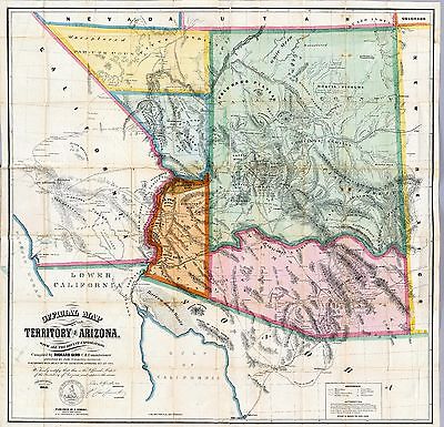
0027012
|
Territory of Arizona
Arbuckle Brothers
1889 |

0041041
|
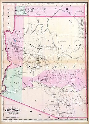
Arizona
Asher & Adams
1874 |

0341002
|
Rio Colorado of the West
Uncolored map showing the Grand Canyon in superb detail. The "line of
exploration" and camps are shown.
Ives, J.C.
1858 |

0341004
|
Color washed map showing the Grand Canyon in superb detail with geological
information included. The "line of exploration" and camps are shown.
Ives, J.C.
1858 |

2544007
|
Arizona. Map in outline color with color delineations between the counties.
Holdredge, Sterling M.
1866 |

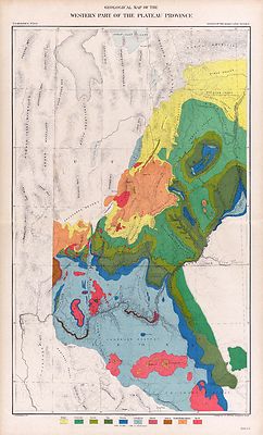
2738086
|
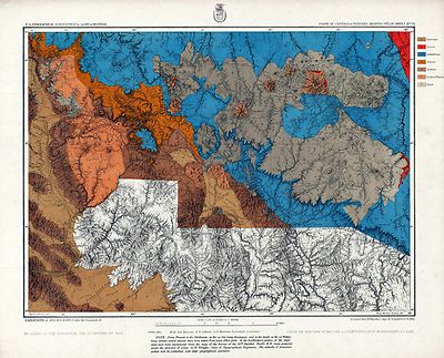
75. Cent., W. Arizona. Base map of P1281-140 overlaid with full color
representation of geological formations.
Wheeler, G.M.
1877 |

2738112
|
A composite of six maps of the Wheeler Survey fitted together.
Wheeler, G.M.
1873 |

2980001
|
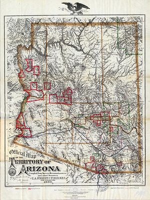
Official Map Of The Territory Of Arizona.
Eckhoff, E.A. ; Riecker, P.
1880 |

3327001
|
New Map Of The Territory Of Arizona, Southern California And Parts Of Nevada,
Utah And Sonora.
Mallery, J.C. ; Ward, J.W.
1877 |

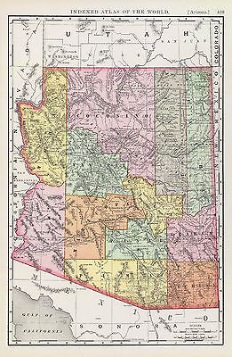
3565145
|
Arizona. Relief shown by hachures. Shows railroads, townships, reservations,
etc. Title in margin: Indexed atlas of the world.
Rand McNally and Company
1897 |

4217001
|
Official Map Of The Territory Of Arizona.
Gird, Richard
1865 |

4520050
|
Arizona. Counties in outline color. Relief shown by hachures. Prime
meridians: Greenwich and Washington.
Rand McNally and Company
1879 |

4646000
|
Territory Of Arizona.
U.S. General Land Office
1879 |

5370027
|
Arizona. Map in full color by county.
Cram Atlas Company
1875 |

ct000172
|
Geological and Geographical Survey of the Territories (U.S.)
Preliminary map no.2 of the country surveyed in 1872 and 1873.
1873 |

ct001515
|
Ve´lez y Escalante, Antonio.
Derrotero hecho por Antonia Ve´lez y Escalante, misionero para mejor
conocimiento de las misiones, pueblos de indios y presidios que se hallan
en el Camino de Monterrey a Santa Fe de Nuebo Mexico.
1777 |

cw0233000
|
United States Coast Survey.
Approaches to Fort Butte La Rose, Louisiana, captured by the U.S. fleet,
co-operating with the forces under the command of Major Gen. N. P. Banks.
April 20th 1863. Surveyed by J. G. Oltmanns, Sub-asst., U.S. Coast Survey,
acting under orders of Major Gen. N. P. Banks. J. W. Maedel.
1863 |

np000064
|
Hartley, William B.
Hartley’s map of Arizona.
1865 |

np000066
|
Mitchell, Samuel Augustus
Arizona and New Mexico.
1867
|

np000067
|
G.W. & C.B. Colton & Co.
Colton’s New Mexico and Arizona.
1873 |

np000068
|
United States. General Land Office.
Territory of Arizona.
1876 |

np000069
|
Geological Survey (U.S.)
Parts of Northern and North Western Arizona and Southern Utah.
1873 |

np000070
|
United States. General Land Office.
Territory of Arizona.
1887 |

np000095
|
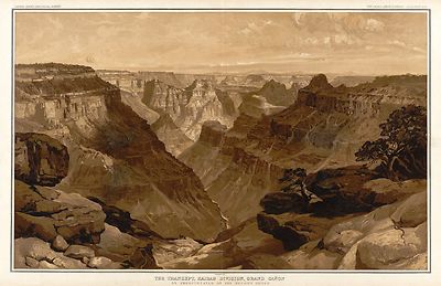
Underwood & Underwood.
Grand Canyon of the Colorado.
1904 |

np000096
|
United States. National Forest Service.
Grand Canyon National Monument within Grand Canyon National Forest Arizona.
1908 |

np000097
|
Geological Survey (U.S.)
The Grand Canon [sic] of the Colorado of the West and the cliffs of southern
Utah.
191- |

np000098
|
Rand McNally and Company.
Map of Hermit Rim Road and Hermit Trail.
1915 |

np000099
|
Rand McNally and Company.
Grand Canyon National Park Arizona.
1919 |

np000100
|
Geological Survey (U.S.)
Topographic map of the Grand Canyon National Park Arizona .
1948 |

np000102
|
Geological Survey (U.S.)
Topographic map of the Grand Canyon National Park Arizona .
1948 |

np000103
|
Geological Survey (U.S.)
Topographic map of the Grand Canyon National Park Arizona .
1948 |

np000104
|
Geological Survey (U.S.)
Topographic map of the Grand Canyon National Park Arizona .
1948 |

np000105
|
Geological Survey (U.S.)
Topographic map of the Grand Canyon National Park Arizona .
1948 |

np000115
|
Arizona.
Geological Survey (U.S.)
shaded relief - Bright Angel
1962 |

np000116
|
Arizona.
Geological Survey (U.S.)
regular relief - Bright Angel
1962 |

np000117
|
Arizona.
Geological Survey (U.S.)
Tuckup Canyon
1962 |

np000118
|
Arizona.
Geological Survey (U.S.)
Kanab Point
1962 |

np000119
|
Arizona.
Geological Survey (U.S.)
Powell Plateau
|

np000120
|
Arizona.
Geological Survey (U.S.)
DeMotte Park
1962 |

np000121
|
Arizona.
Geological Survey (U.S.)
Nankoweap
1962 |

np000122
|
Arizona.
Geological Survey (U.S.)
National Canyon
1962 |

np000123
|
Arizona.
Geological Survey (U.S.)
Supai
1962 |

np000124
|
Arizona.
Geological Survey (U.S.)
Havasupai Point
1962 |

np000125
|
Arizona.
Geological Survey (U.S.)
Vishnu Temple
1962 |

np000126
|
Arizona.
Geological Survey (U.S.)
Grandview Point
1962 |

np000127
|
Arizona.
Geological Survey (U.S.)
Bright Angel Point
1988 |

np000128
|
Arizona.
Geological Survey (U.S.)
Phantom Ranch
1988 |

np000129
|
Arizona.
Geological Survey (U.S.)
Grand Canyon
1988 |

np000130
|
Arizona.
Geological Survey (U.S.)
Shiva Temple
1988 |

np000131
|
United States. National Park Service.
Map of Grand Canyon National Park.
1926 |

np000132
|
United States. National Park Service.
Visitors’ guide to Grand Canyon National Park, North Rim.
1955 |

np000133
|
United States. National Park Service.
Visitors’ guide to Grand Canyon National Park, South Rim.
1957 |

np000134
|
United States. National Park Service.
North Rim, Grand Canyon National Park, Arizona.
Rev. Dec. 1975 |

np000135
|
United States. National Park Service.
South Rim, Grand Canyon National Park, Arizona.
Rev. Dec. 1975 |

np000136
|
United States. National Park Service.
Grand Canyon.
1977 |

np000137
|
United States. National Park Service.
Grand Canyon.
1977 |

np000138
|
United States. National Park Service.
Grand Canyon / National Park Service, U.S. Department of the Interior.
1984
|

np000142
|
National Wetlands Inventory (U.S.)
National Wetlands Inventory, [Arizona].
1972 |

pm000110
|
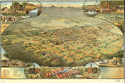
Dyer, C. J.
Bird’s eye view of Phoenix, Maricopa Co., Arizona. Sketched by C. J.
Dyer. W. Byrnes litho. Schmidt, Label & Litho. Co.
c1885 |

rr001590
|
Custer, H.
From the Pimas villages to Fort Fillmore : from explorations and surveys
/ made under the direction of the Hon. Jefferson Davis, Secretary of War
by Lieut. John G. Parke, Topl. Engrs. assisted by Albert H. Campbell, Civil
Engineer and N. H. Hutton, H. Custer and G. G. Garner, 1854 & 55.
1859 |

rr001720
|
Gray, Andrew Belcher
Map of proposed Arizona Territory. From explorations by A. B. Gray &
others, to accompany memoir by Lieut. Mowry U.S. Army, Delegate elect.
1857
|

rr001750
|
Fiala, John T.
General map of the United States & their territory between the Mississippi
& the Pacific Ocean. 1. Showing the different surveyed routes from the
Mississippi valley to the coast of Pacific Ocean, 2. the new established
& proposed Post Routes, 3. the recently discovered gold, silver, and
copper region in Kansas, Nebraska and Arizona. Compiled from the various
P.R.R. Surveys & the best authorities which could be obtained.
1859 |

rr001810
|
Rand McNally and Company.
Indexed map of Arizona showing the stage lines, counties, lakes & rivers.
1876 |

rr001820
|
Cram, George Franklin
Railroad and county map of Arizona
1887 |

rr003220
|
G.W. & C.B. Colton & Co.
Map showing the Atchison, Topeka and Santa Fe´ Railroad system, with
its connections.
1883 |

rr003280
|
G.W. & C.B. Colton & Co.
Maps showing the Atlantic & Pacific Railroad and leased lines.
1873 |

rr003290
|
Atlantic and Pacific Railroad Company.
Map showing the location of the road and the land grant of the Atlantic and
Pacific R.R. in Arizona ... in New Mexico.
1883 |
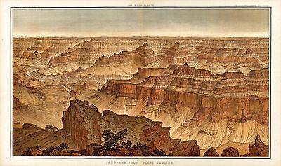
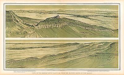
Tertiary history of the Grand cañon
district
by Clarence E. Dutton
Dutton, Clarence E. 1841-1912. (Clarence Edward),
Washington, Govt. print. off.,
1882

4713A
|

4713B
|

4713C
|

4713001
|

4713002
|

4713003
|

4713004
|

4713005
|

4713006
|

4713007
|

4713008
|

4713009
|

4713010
|

4713011
|

4713012
|

4713013
|

4713014
|

4713015
|

4713016
|

4713017
|

4713018
|

4713019
|

4713020
|

4713021
|

4713022
|

4713023
|

4713024
|

4713025
|

4713026
|
|
Additional
Maps

0151062
|

0152064
|

0358049
|

0425009
|

0535041
|

0579044
|

0586047
|

0592049
|

0594047
|

0693038
|

0730004
|

1582004
|

1582005
|

2054053
|

2080004
|

2134089
|

2212252
|

2220025
|

2298000
|

2307024
|

2449091
|

2483038
|

2736001
|

2736002
|

2738045
|

2738087
|

2738088
|

2738097
|

2738098
|

2738105
|

2738106
|

2738113
|

2809055
|

2844076
|

2861014
|

2871021
|

2905031
|

3054030
|

3773001
|

3773002
|

3773003
|

3773005
|

3773006
|

3773007
|

3773008
|

3773009
|

3773010
|

3888051
|

4324024
|

4574040
|

4578037
|

4587066
|

4727047
|

4740055
|

4887001
|

5028129
|

5041040
|

5198004
|
|
|
|