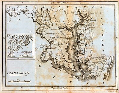
Maryland
Map Collection

0027006
|
Maryland
Arbuckle Bros.
1889 |

0089023
|
Maryland.
Bradford, Thomas G.
1838 |

0089024
|
Baltimore
Bradford, Thomas G.
1838
|

0122015
|
Map Of Maryland.
Carey, H. C. ; Lea, I.
1822 |

0149028
|
Delaware And Maryland. (with) District of Columbia.
Colton, G.W.
1856 |

0149029
|
City Of Baltimore Maryland
Colton, G.W.
1856 |

0285017
|
Maryland.
Finley, Anthony
1831 |

0537016
|
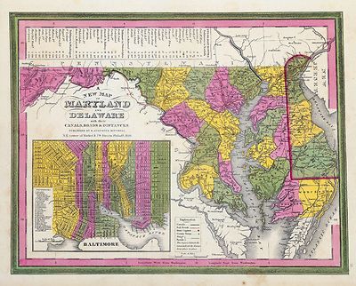
New Map Of Maryland and Delaware.
Mitchell, Samuel Augustus
1846 |

0565014
|
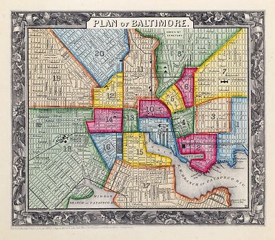
Plan Of Baltimore.
Mitchell, Samuel Augustus
1860 |

0586021
|
Baltimore.
Mitchell, Samuel Augustus
1880 |

0594021
|
Baltimore.
Mitchell, Samuel Augustus
1890 |

0845013
|
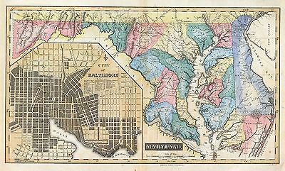
States of Maryland and Delaware.
Reid, John ; Winterbotham, W
1796 |

0977013
|
New Map Of Maryland and Delaware.
Tanner, Henry S.
1836 |

2239001
|
Map of Maryland and the District of Columbia geological formations.
Tyson, Philip T.
1873 |

2239002
|
Climatological map of the State of Maryland and the District of
Columbia.
Blodget, Lorin
1873 |

2239003
|
City of Baltimore.
Martenet, Simon J.; Walling, H. F.; Gray, Ormando Willis
1873 |

2239004
|
City of Cumberland, Alleghany Co., Maryland.
Martenet, Simon J.; Walling, H. F.; Gray, Ormando Willis
1873 |

2239005
|
Hagerstown, Annapolis, Frederick City.
Martenet, Simon J.; Walling, H. F.; Gray, Ormando Willis
1873 |

2239006
|
New railroad map of the states of Maryland, Delaware, & District
of Columbia.
Gray, Frank Arnold
1873 |

2239007
|
Topographical atlas of Maryland: counties of Alleghany and Garrett.
Martenet, Simon J.; Walling, H. F.; Gray, Ormando Willis
1873 |

2239008
|
Topographical atlas of Maryland: County of Washington.
Martenet, Simon J.; Walling, H. F.; Gray, Ormando Willis
1873 |

2239009
|
Topographical atlas of Maryland: counties of Carroll and Frederick.
Martenet, Simon J.; Walling, H. F.; Gray, Ormando Willis
1873 |

2239010
|
Topographical atlas of Maryland: counties of Baltimore and Harford.
Martenet, Simon J.; Walling, H. F.; Gray, Ormando Willis
1873 |

2239011
|
Topographical atlas of Maryland: counties of Cecil and Kent.
Martenet, Simon J.; Walling, H. F.; Gray, Ormando Willis
1873 |

2239012
|
Topographical atlas of Maryland: counties of Howard and Montgomery
and D.C.
Martenet, Simon J.; Walling, H. F.; Gray, Ormando Willis
1873 |

2239013
|
Topographical atlas of Maryland: counties of Anne Arundel and Prince
George.
Martenet, Simon J.; Walling, H. F.; Gray, Ormando Willis
1873 |

2239014
|
Topographical atlas of Maryland: counties of Calvert, Charles and St.
Marys.
Martenet, Simon J.; Walling, H. F.; Gray, Ormando Willis
1873 |

2239015
|
Martenet, Simon J.; Walling, H. F.; Gray, Ormando Willis
1873 |

2239016
|
Topographical atlas of Maryland: counties of Caroline, Queen Anne and
Talbot.
Martenet, Simon J.; Walling, H. F.; Gray, Ormando Willis
1873 |

2301017
|
Maryland, Delaware, D.C.
Morse, Sidney E. (Sidney Edwards); Breese, Samuel
1845
|

2483018
|
Baltimore.
Mitchell, Samuel Augustus
1870 |

2501010
|
Maryland.
Henshaw, Frances H.
1828 |

2542012
|
State of Maryland
Carey, Mathew ; Lewis, Samuel
1795 |

2646012
|
Road from Philadelphia to Washington. (Maps) 21, 22 and 23.
Moore, S.S. ; Jones, T.W.
1802 |

2862035
|
State of Maryland.
Carey, Mathew
1796 |

3565082
|
Baltimore.
Rand McNally and Company
1897 |

3565083
|
Maryland, Delaware.
Rand McNally and Company
1897 |

4453025
|
Maryland.
Goodrich, S.G. ; Bradford, Thomas G.
1841 |

4453026
|
Baltimore.
Goodrich, S.G. ; Bradford, Thomas G.
1841 |

4520019
|
Maryland, D.C., and Delaware.
Rand McNally and Company
1879 |

4577016
|
Maryland
Carey, Mathew
1814 |

4584056
|
Maryland.
Lucas, Fielding Jr.
1823 |

4742000
|
Baltimore.
Lucas, Fielding Jr.
1852 |

4807146
|
Maryland, Delaware.
Meyer, Joseph
1846 |

4863035
|
Maryland.
Carey, Mathew
1811 |

4865013
|
Maryland.
Carey, Mathew
1796 |

ct000793
|
Lucas, Fielding, 1781-1854.
Map of the State of Maryland. Constructed from the best authorities
by Fielding Lucas, Jr. Engraved by John Warr.
Baltimore, [1841] |

cw0244000
|
Sheppard, Eric W.
Map of the Maryland Campaign, Sept. 3rd to 29th 1862 George Allen &
Co., Ltd., London.
London, E. W. Sheppard, [1911]
|

cw0245390
|
E. Sachse & Co.
Parole Camp Annapolis, M’d.
Balt[im]o[re] : Lith. by E. Sachse & Co., [1864]
|

cw0257000
|
Everett, George, publisher.
Point Lookout, Md. View of Hammond Genl. Hospital & U.S. genl.
depot for prisoners of war Lith. by E. Sachse & Co., Baltimore.
Point Lookout 1864.
|

la000283
|
Sidney, J. C.
Map of the city and county of Baltimore, Maryland. From original surveys
by J.C. Sidney, C.E.
Baltimore, James M. Stephens, c1857.
|

la000287
|
Martenet, Simon J.
Martenet’s Map of Carroll County, Maryland : entirely from actual
surveys / by S.J. Martenet, lith. by A. Hoen & Co.
Baltimore : [s.n.]. c1862.
|

la000290
|
Martenet, Simon J.
Martenet’s Map of Cecil County, Maryland : from the coast, and
original surveys / by Simon J. Martenet ... Baltimore.
[Baltimore? : S. J. Martenet, 1858].
|

la000292
|
Bond, Isaac.
Map of Frederick County, Md. accurately drawn from correct instrumental
surveys of all the county roads, & by Issac Bond C.E. Lithographed by
E. Sachse & Co.
[Baltimore?], c1858.
|

la000294
|
Herrick, L. W.
A map of Harford Co., Maryland, 1858. Entirely from original surveys
by L.W. Herrick civil engineer. Engr. & Print. by L.N. Rosenthal.
[Philadelphia?] Jennings & Herrick
c1858.
|

la000295
|
Martenet, Simon J.
Martenet’s Map of Harford County, Maryland : shore lines and tide
water from U.S. Coast Survey, the county from actual surveys / under direction
of Simon J. Martenet, Baltimore. Schmidt & Trowe, lithographers.
Corr. and rev. / by J.W. McNabb, County Surveyor.
Baltimore : Simon J. Martenet, 1878.
|

la000296
|
Martenet, Simon J.
Martenet’s Map of Howard County, Maryland : drawn entirely from
actual surveys / by Simon J. Martenet, lith. by A. Hoen & Co.
Baltimore : John Schofield, c1860.
|

la000297
|
Martenet, Simon J.
Martenet’s map of Kent County, Maryland ; shore lines and soundings
from U.S. Coast Survey, roads and inland from actual surveys by C.H. Baker,
county surveyor, under the direction, and drawn, and published by Simon J.
Martenet.
Baltimore, c1860.
|

la000299
|
Martenet, Simon J.
Martenet and Bond’s map of Montgomery County, Maryland / from
actual surveys by S.J. Martenet & assistants ; drawn and published by
Simon J. Martenet C.E.
Baltimore : Simon J. Martenet, [1865]
|

la000302
|
Martenet, Simon J.
Martenet’s Map of Prince George’s County, Maryland.
Baltimore, [1861?]
|

la000304
|
Taggart, Thomas.
A map of Washington Co., Maryland. Exhibiting the farms, election
districts, towns, villages, roads, etc., etc. From actual survey by Thomas
Taggart. Assisted by S.S. Downin. Manufactured by Chas DeSilver. Herline
& Hensel, lithrographers.
[S.l.], L.McKee and C.G. Robertson, 1859.
|

lva00027
|
Pictorial map of the seat of war, showing parts of the states of Maryland,
Delaware, Virginia, and North Carolina, and also the coast line from Cape
Henry to Fort Pickens, with the United States blockading fleet.
New York : Harper's, 1861 |

pm002540
|
E. Sachse & Co.
E. Sachse, & Co.’s bird’s eye view of the city of Baltimore,
1869.
Baltimore, 1870.
|

pm002550
|
Spofford, Edward W.
A birds-eye view of the heart of Baltimore.
Baltimore, Norman T.A. Munder & Co., c1912.
|

pm002560
|
Fowler, T. M. (Thaddeus Mortimer), 1842-1922.
Birds eye view of Chestertown, Kent Co., Maryland 1907. Drawn by T.
M. Fowler.
Morrisville, Pa. : Fowler & Kelley [sic] c1907.
|

pm002570
|
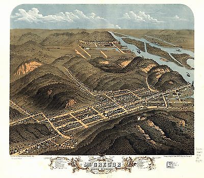
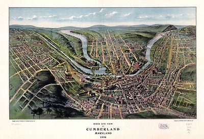
Fowler, T. M. (Thaddeus Mortimer), 1842-1922.
Bird’s eye view of Cumberland, Maryland 1906. By Thaddeus M.
Fowler.
Morrisville, Pa., Fowler & Kelly, c1906.
|

pm002580
|
Fowler & Kelly.
View of Elkton, Maryland 1907.
Morrisville, Pa. [1907]
|

pm002590
|
Fowler, T. M. (Thaddeus Mortimer), 1842-1922.
View of Frostburg, Maryland 1905 / drawn and published by T. M.
Fowler.
Morrisville, Pa. : [s.n., 1905]
|

pm002600
|
Fowler, T. M. (Thaddeus Mortimer), 1842-1922.
Birds eye view of Havre de Grace, Maryland 1907. Drawn by T. M.
Fowler.
Morrisville, Pa., Fowler & Kelly, c1907.
|

pm002610
|
Fowler & Kelly.
Birds eye view of Mountain Lake Park, Garrett Co., Maryland 1906.
Morrisville, Pa., c1906.
|

pm002620
|
Fowler & Kelly.
Bird’s eye view of Oakland, Maryland 1906.
Morrisville, Pa., c1906.
|

pm002630
|
Fowler, T. M. (Thaddeus Mortimer), 1842-1922.
Birds eye view of Rising Sun, Cecil County, Maryland 1907. Drawn by
T. M. Fowler.
Morrisville, Pa., Fowler & Kelly, c1907.
|

wd000015
|
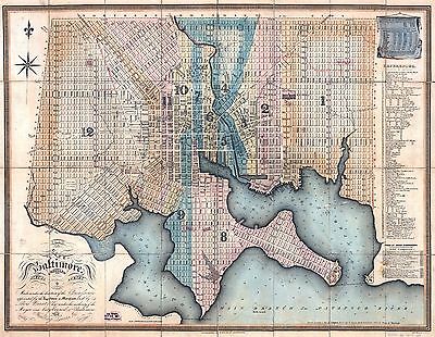
Lucas, Fielding, 1781-1854.
Plan of the city of Baltimore compiled from actual survey. Made under
the direction of the commissioners appointed by the legislature of Maryland
and by Lewis Brantz, Esqr. under authority of the Mayor and City Council
of Baltimore by Fielding Lucas, Jr., Engraved by B.T. Welch & Co.
Baltimore, 1822.
|

wd000016
|
Lucas, Fielding, 1781-1854.
Plan of the city of Baltimore compiled from actual survey by Fielding
Lucas, Jr., 1822.
Improved to 1836.
|
Additional
Maps

0028041
|

0041008
|

0043001
|

0073010
|

0102020
|

0104005
|

0151035
|

0151036
|

0152034
|

0152035
|

0209002
|

0238000
|

0278007
|

0280007
|

0300046
|

0346023
|

0352024
|

0352027
|

0358030
|

0358031
|

0425053
|

0495002
|

0535023
|

0545019
|

0565012
|

0565015
|

0572021
|

0572022
|

0579021
|

0579022
|

0586019
|

0592022
|

0594022
|

0632016
|

0887008
|

0978007
|

0983007
|

1550032
|

1550033
|

1690074
|

1701002
|

2045002
|

2054025
|

2134060
|

2230002
|

2436046
|

2467051
|

2483017
|

2755011
|

2782008
|

2788006
|

2844027
|

2844028
|

2866041
|

2905016
|

4534020
|

4542007
|

4557015
|

4578016
|

4587035
|

4628041
|

4825033
|

4825034
|

4835022
|

4850041
|

4864021
|

4866043
|

4869006
|

4920001
|

4947007
|

4960003
|

5028043
|

5041016
|

5363016
|

5438000
|

5479048
|

5479051
|

5580050
|

5745044
|

6727017
|
|
|