|
Inserted Spanish letter |
 |
Inserted Spanish letter |
 |
World |
 |
Plans of ports in the West Indies |
 |
North Atlantic |
 |
Plans of cities, ports ... in Portugal, Spain, Brazil, and Rio de la Plata |
 |
South Atlantic |
 |
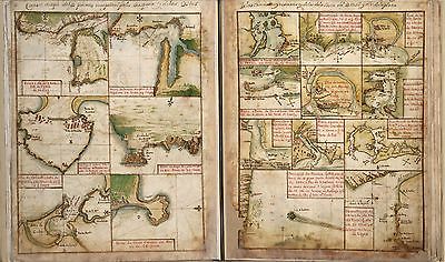
Plans of ports, islands, and cities on the coast of Africa and India |
 |
Indian Ocean |
 |
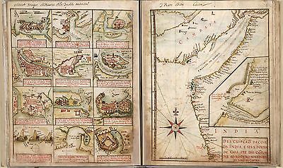
Plans of cities, ports, and islands in East Africa, Asia, and the coast of India |
 |
Asia |
 |
Plans of ports, islands, and straits of the Red Sea, East Asia, and Philippines |
 |
North Pacific |
 |
Plans of ports in Mexico, west coast |
 |
Northern Europe |
 |
Southern part of Baltic Sea |
 |
Holland |
 |
Plans of ports in Italy and Malta |
 |
Chart of the Mediterranean Sea |
 |
The Levant: Sea of Marmora, Alexandria, Alexandretta, Nile delta, and Gallipoli |
 |
Mediterranean Sea |
 |
Chart of the mouth of the Para, Curupa, and Amazon rivers |
 |
Aegean Sea |
 |
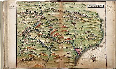
Zambezia and surrounding regions |
 |
Southeast Africa |
 |
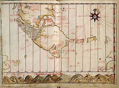
Chart of Ceylon |
 |
Plans of ports and islands on the coasts of Peru and Chile |
 |
South Pacific |
 |
Strait of Magellan and Tierra del Fuego |
 |
Strait of Magellan and Tierra del Fuego (1690 Spanish map insert) |