Maps of Tennessee'
| A preliminary agricultural map of Tennessee based on the distribution
of geological formations. 1896 |
 |
| Tennessee Centennial Exposition, Nashville, Tennessee, 1897. |
 |
| Sketch of the environs of Shelbyville, Wartrace & Normandy,
Tennessee Compiled from the best information under the direction of Capt.
N. Michler, Corps of Topographical Engrs. U.S.A., by John E. Weyss, Maj.
Ky. Vols., Chief Asst. Drawn by C. S. Mergell. Photographed by M. Carpenter.].
1863 |
 |
| Tennessee-North Carolina. |
 |
| A map of the Tennessee government, formerly part of North Carolina.
1795 |
 |
| Reconnaissance erosion survey of the State of Tennessee. 1934 |
 |
| Middle Tennessee / G.H. Blakeslee--1863. Alternate title at bottom:
Fourteen trips across Tennessee 1862-1864 |
 |
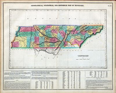
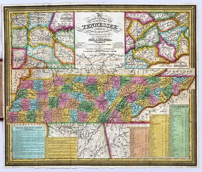
| Tennessee. 1826 |
 |
| National Park Service recreational map of Tennessee.195? |
 |
| State of Tennessee, roadless and undeveloped area evaluation II,
RARE II final environmental statement : January 1979 / U.S. Department of
Agriculture, Forest Service, Southern Region. |
 |
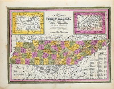
| A new map of Tennessee. 1850 |
 |
| Mountain region of North Carolina and Tennessee. 1864 |
 |
| The state of Tennessee. 181? |
 |
| The Virginia, Tennessee, and Georgia Air Line; the Shenandoah Valley
R.R.; Norfolk & Western R.R.; East Tennessee, Virginia, & Georgia
R.R. (its leased lines,) and their connections.1882 |
 |
| An outline geological map of Tennessee, including portions of
Mississippi, Alabama, and Georgia. 1866 |
 |
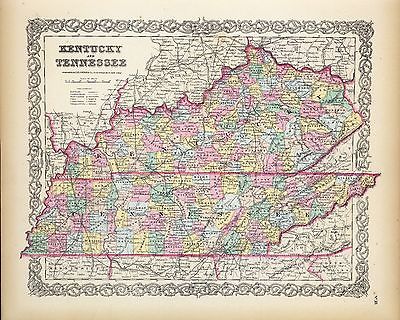
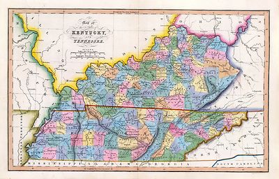
| Map of Kentucky and Tennessee.1864 |
 |
| Sketch showing the relative positions of Fort Henry and Fort Donelson
: with the roads connecting the two places / drawn under the direction of
Lt. Col. J.B. McPherson, Chief Engineer, by Chas. Lambecker. 1862 |
 |
| Lloyd's official map of the State of Tennessee Drawn & engraved
from actual surveys and used by our commanders. 1862 |
 |
| Fort Donelson National Military Park, Tennessee Drawn by R. M.
Montesano, January 1947. |
 |
| Map showing the line of the Virginia, Tennessee, & Georgia Air
Line composed of the Shenandoah Valley R.R., Norfolk & Western R.R. and
the East Tennessee, Virginia, & Georgia R.R. 1881 |
 |
| Map of Fort Henry, Tennessee, and environs 1863? |
 |
| New enlarged scale railroad and county map of Tennessee showing
every railroad station and post office in the state, 1888. |
 |
| Vicinity map of the suggested Cove Creek Reservoir. 1925 |
 |
| Great Smoky Mountains National Park, North Carolina/Tennessee, trail
map / U.S. Department of the Interior, National Park Service. 1988 |
 |
| Military map of middle Tennessee and parts of East Tennessee and
the adjoining states, being part of the Department of the Cumberland, commanded
by Maj. Gen. Geo. H. Thomas, U.S.A. Compiled and drawn under the direction
of Col. Wm. E. Merrill, 1st U.S.V.V. Eng'rs, Capt. Corps of Eng's, &
Chief Engr. Dept of the Cumberland, with the assistance of Prof. J. M. Safford,
late State Geologist of Tennessee, by C. S. Mergell, Asst. Engr., 1865. Published
by authority of the Hon. Secretary of War, and the office of the Chief of
Engineers, U.S. Army, 1874. |
 |
| Mountain region of North Carolina and Tennessee, compiled by W.
L. Nicholson & A. Lindenkohl, with corrections to January 1865. Drawn
by A. Lindenkohl. H. Lindenkohl & Chas. G. Krebs, lith. |
 |
| Chattanooga and surrounding battlefields [By Reginald]
Purse.1913 |
 |
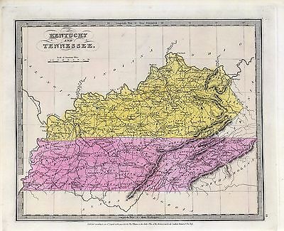
| New map of Kentucky and Tennessee from authentic reports of county
surveyors throughout the states of Kentucky and Tennessee with a new key
for measuring distances and specifying localities (which key is secured by
copyright.). c1861 |
 |
| Map of the surveys of the Cincinnati Railway, W.A. Gunn, Ch. Eng.
Outline map of central Kentucky and Tennessee with railroads in red. 1873 |
 |
| New map of Kentucky and Tennessee from authentic reports of county
surveyors throughout the states of Kentucky and Tennessee with a new key
for measuring distances and specifying localities (which key is secured by
copyright.). 1861 |
 |
| Map of Kentucky & Tennessee exhitibing the post offices, post
roads, canals, rail roads, &c.; by David. H. Burr (Late topographer to
the Post Office,) Geographer to the House of Representatives of the U.S.
1839 |
 |
| Lloyd's official map of the State of Tennessee Compiled from actual
surveys and official documents, showing every rail road & rail road station
with the distances between each station. Also the counties and county seats,
cities, towns, villages, post offices, wagon roads, canals, forts,
fortifications, &c. 1863 |
 |
| Map showing the proposed Tennessee, Alabama, and Georgia Railroad
connecting and extending the Chattanooga Southern Railway, Marietta and North
Georgia Railway, Knoxville, Cumberland Gap and Louisville Railroad, and
Morristown and Cumberland Gap Railroad. 1892 |
 |
| Topographic map, Great Smoky Mountains National Park, Tennessee
and North Carolina / United States, Department of the Interior, Geological
Survey. Map 1 |
 |
| Topographic map, Great Smoky Mountains National Park, Tennessee
and North Carolina / United States, Department of the Interior, Geological
Survey. Map 2 |
 |
| Mountain region of North Carolina and Tennessee / compiled by W.
L. Nicholson & A. Lindenkohl, 1863 ; drawn by A. Lindenkohl ; H. Lindenkohl
& Chas. G. Krebs, lith. |
 |
| Birds eye view of Kentucky and Tennessee showing Cairo and part
of the southern states. Drawn from nature and lith. by John Bachmann.
1862 |
 |
| Western Tennessee, and part of Kentucky Prepared by order of Capt.
McAlester, Chief Engr. M.D.W.M. under direction of Capt. P. C. Hains, U.S.
Engr. & Actg. Chief Engr. Dept. of the Gulf. Compiled & drawn for
stone by B. von Reizenstein, & F. D'Avignon. Printed by E. Boehler. Feb.
1865. |
 |
| Boones map of the Black Diamond System of Railways, J. D. McKisson
del., Perysville Ohio.Indicates coal fields of Kentucky and
Tennessee.1896 |
 |
| Map of Nashville, Tennessee. 186? |
 |
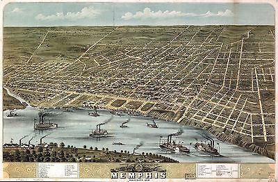
| Bird's eye view of the city of Memphis, Tennessee 1870. |
 |
| Military map of the States of Kentucky and Tennessee, within eleven
miles of the 35th parallel of latitude or southern boundary of Tennessee;
compiled from the best authentic original maps, various documents, and
miscellaneous latest sources of information; commenced under the authority
of Major General Don Carlos Buell, commanding the Department of the Ohio,
by Capt. N. Michler, Corps Topogl. Engrs. U.S.A., continued under Major General
H. G. Wright by Maj. L. Sitgreaves Corps Topogl. Engrs. U.S.A., and completed
under Major General Ambrose E. Burnside, commanding the Department, by Lieut.
Col. J. H. Simpson, Corps Engrs. U.S.A., Chief Engr. in the Department. Drawn
by Charles E. Swann, Ass't. Engr. 1863 |
 |
| Proposed Great Smoky Mountains National Park, North Carolina-Tennessee.
1926 |
 |
| Chattanooga, county seat of Hamilton County, Tennessee 1886. H.
Wellge, del. Beck & Pauli, litho. |
 |
| Plan of Fort Henry and its outworks. [Feb. 1862] Drawn under the
direction of Lieut. Col. J. B. McPherson, A.D.C. and Capt. of Engineers.
Published by authority of the Hon. the Secretary of War, office of the Chief
of Engineers, U.S. Army, 1875. |
 |
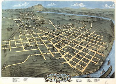
| Birds eye view of the city of Chattanooga, Hamilton County, Tennessee
1871. Drawn & published by A. Ruger. |
 |
| Map & profile of the Virginia & Tennessee Rail Road. Prepared
by W. W. Blackford, asst. engr. 1856 |
 |
| Military map of the States of Kentucky and Tennessee, within eleven
miles of the 35th parallel of latitude or southern boundary of Tennessee;
compiled from the best authentic original maps, various documents, and
miscellaneous latest sources of information; commenced under the authority
of Major General Don Carlos Buell, commanding the Department of the Ohio,
by Capt. N. Michler, Corps Topogl. Engrs. U.S.A., continued under Major General
H. G. Wright by Maj. L. Sitgreaves Corps Topogl. Engrs. U.S.A., and completed
under Major General Ambrose E. Burnside, commanding the Department, by Lieut.
Col. J. H. Simpson, Corps Engrs. U.S.A., Chief Engr. in the Department. Drawn
by Charles E. Swann, Ass't. Engr. Ehrgott, Forbriger & Co., Lithographers,
Engraphers [sic] and Printers, Cincinnati, O. 1863 |
 |
| Map of the Nashville, Chattanooga and St. Louis Ry.; and connections.
1889 |
 |
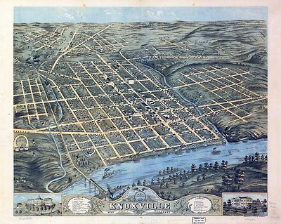
| Bird's eye view of the city of Knoxville, Knox County, Tennessee
1871. |
 |
| From Mitchelsville [sic] to Gallatin--Sumner Co., Tenn., 1862 |
 |
| Map of the environs of Fort Donelson, Tennessee, Feb. 1862 |
 |
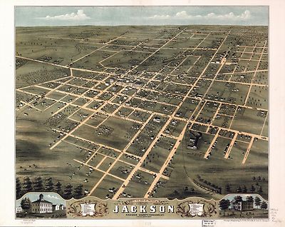
| Bird's eye view of the city of Jackson, Madison County, Tennessee
1870. Drawn by A. Ruger. |
 |
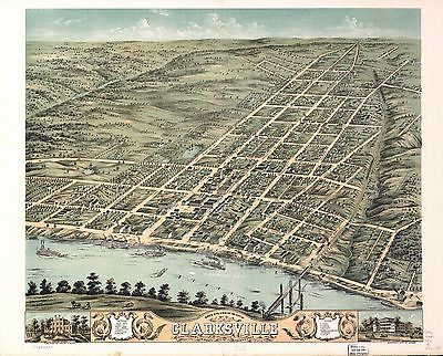
| Bird's eye view of the city of Clarksville, Montgomery County, Tennessee
1870. Merchant Lith. Co. |
 |
| Great Smoky Mountains National Park. 1971. |
 |
| Map of Fort Sanders, Knoxville, Tennessee, showing the Confederate
assault of Nov. 29, 1863 Sheet 1 |
 |
| Map of Fort Sanders, Knoxville, Tennessee, showing the Confederate
assault of Nov. 29, 1863 Sheet 2 |
 |
| Great Smoky Mountains National Park, North Carolina/Tennessee /
U.S. Department of the Interior, National Park Service. 1982 |
 |
| Stones River National Military Park, Tennessee.1957 |
 |
| Tour route, Chickamauga Battlefield, Chickamauga and Chattanooga
National Military Park, Georgia and Tennessee. 1957 |
 |
| Map of the Atlanta campaign. [May-Sept. 1864]. 1887.
|
 |
| Plan of Fort Donelson and outworks : [Tennessee] / surveyed by
Lieut's Janney and Kossak ; under the direction of Lieut. Col. J.B. McPherson,
Chief Eng'r ; drawn by Otto H. Matz, Ass't Top'l Eng'r. 1862 |
 |
| Map illustrating the operations of the Seventh Division under
Brig. General G. W. Morgan at Cumberland Gap, Tennessee, during a portion
of the year 1862 Compiled by Edward Ruger at Headqr's., Dept. of the Cumberland.
Published by authority of the Hon. the Secretary of War in the office of
the Chief of Engineers, U.S. Army, 1877. |
 |
| Shiloh National Military Park, Tenn. Albert Pike, Division Engineer.
Topography by J. K. Bailey and F. H. Sargent. Control by U.S. Geological
Survey. Surveyed in 1934. |
 |
| Sketch showing the relative positions of Fort Henry and Fort
Donelson, also the roads connecting the two positions / drawn under the direction
of Lieut. Col. J. B. McPherson, A.D.C. & Capt. of Engineers.
1875 |
 |
| Topographical sketch of the battlefield of Stone's River near
Murfreesboro, Tennessee, December 31st, 1862 to Jan. 3d, 1863 : Major General
W.S. Rosecrans, Commanding of the Forces of the United States : General Braxton
Bragg, Commanding the enemy's forces. |
 |
| Rough plan of part of battle of Wauhatchie, Tenn., night of Oct.
28-29, 1863 Drawn from memory by H. T. [i.e., Hector Tyndale.
188-]. |
 |
| Topographical map of the approaches and defences of Knoxville,
E. Tennessee, shewing the positions occupied by the United States &
Confederate forces during the siege Surveyed by direction of Capt. O. M.
Poe, Chf. Engr., Dept. of the Ohio, during Dec., Jan. and Feb. 1863-4. Published
by authority of the Hon. Secretary of War in the office of the Chief of
Engineers, U.S. Army. |
 |
| Topographical sketch of the environs of Murfreesboro, Tennessee.
Surveyed Jan. 1863 under the direction of Capt. N. Michler, U.S.A., Chief
Topl. Engr., Army of the Cumberland, by Maj. John E. Weyss, assisted by Captains:
W. Starling, D. Thruston, J.W. Stinchcomb, R. Rose and Lts. M. Allen and
H. Greenwood, U.S. Volunteers. 1863 |
 |
| Topographical sketch of the battle field of Stone River near
Murfreesboro, Tennessee, December 30th 1862 to January 3d 1863 . . . Position
of the U.S. troops on the 2d of Jan. 1863. Surveyed under the direction of
Capt. N. Michler, Corps of Topogl. Engrs., U.S.A., by Major J.E. Weyss, assisted
by Captains W. Starling, D.P. Thruston, J.W. Stinchcomb, and Lieut. M. Allen,
U.S. Vols. 1863 |
 |
| Chattanooga Tenn. 1863 / G.H. Blakeslee, U.S. Top. Eng. 1863
Page 1 |
 |
| Chattanooga Tenn. 1863 / G.H. Blakeslee, U.S. Top. Eng. 1863
Page 2 |
 |
| General Buell's map of the battle-field of Shiloh. [April 6-7,
1862] Copyright, 1886, by the Century Co. |
 |
| Topographical sketch of the battle field of Stone River near
Murfreesboro, Tennessee, December 30th 1862 to January 3d 1863 . . . Position
of the U.S. troops on the 31st of December, 1862. Surveyed under the direction
of Capt. N. Michler, Corps of Topogl. Engrs., U.S.A., by Major J.E. Weyss,
assisted by Captains W. Starling, D.P. Thruston, J.W. Stinchcomb, and Lieut.
M. Allen, U.S. Vols. |
 |
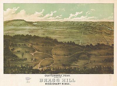
| Chattanooga, Tenn. as seen from Bragg Hill, Missionary Ridge.
Copyrighted for J. C. Anderson, trustee. 1887? |
 |
| [Map of Fort Henry, Tennessee, and environs] / J. Pitzman.
1862 |
 |
| Great Smoky Mountains National Park. 1935 |
 |
| Original maps of Forts Henry & Donelson and
vicinity.1862 |
 |
| Perspective map of the city of Memphis, Tenn. 1887. |
 |
| Fisheye view of Chattanooga and vicinity showing troop positions
in 1863 |
 |
| Harriman, Tenn. 1892. Drawn & published by Geo E. Norris.
Burleigh Lith. Co. |
 |
| Winter quarters 1864 : [vicinity of Lookout Mountain, Tennessee]
/ profile by G.H. Blakeslee T.E., March 10-1864. Page 1 |
 |
| Winter quarters 1864 : [vicinity of Lookout Mountain, Tennessee]
/ profile by G.H. Blakeslee T.E., March 10-1864. Page 2 |
 |
| Knoxville, Tenn. county seat of Knox County 1886. [Drawn by]
H. Wellge. Beck & Pauli, litho. |
 |
| Franklin--Tenn. profield [sic] June 1863 / by G.H. Blakeslee.
Part 1 |
 |
| Franklin--Tenn. profield [sic] June 1863 / by G.H. Blakeslee.
Part 2 |
 |
| Aero view of Bristol, Va.=Tenn. 1912. Drawn and published by
T. M. Fowler. |
 |
| Map of the battlefield of Shiloh. 1920 |
 |
| Battle of Chattanooga, Nov. 23, 24, 25, 1863. |
 |
| Across Kentucky Drawn by G.H.B. [i.e., G.H. Blakeslee].
1862 |
 |
| Battlefield of Franklin, Tenn. Nov. 3rd 1864 Compiled from the
official map. |
 |
| Map of the battle field of Shiloh, April 6 & 7, 1862 / Léon
J. Frémaux, Capt. of Engrs. P.A.C.S. |
 |
| Map of the battle of Nashville, dec. 15th & 16th 1864 Based
on the government surveyed and drawn under the direction of Gen. Tower by
M. Peseux. 1887 |
 |
| [Eastern Tennessee, with parts of Alabama, Georgia, South Carolina,
North Carolina, Virginia, and Kentucky] Drawn by A. Lindenkohl. H. Lindenkohl
& Chas. G. Krebs, lith. 1865 |
 |
| Map of Chattanooga and environs. Copyright 1895 by W. E. Birchmore.
Engraved by Buff[alo] Elec. & Eng. Co. |
 |
| Map showing the Consolidated Southern Railway, Kentucky
Division--Eastern Kentucky R.R. Virginia Division--Norfolk & Cincinnati
R.R. Tennessee & Carolina Division and its connections. 1883 |
 |
| Map of the Shenandoah Valley route via Luray Caverns, Natural
Bridge & the Grottos. The Shenandoah Valley R.R. Norfolk & Western
R.R. and East Tennessee, Virginia & Georgia System and their
connections.1890 |
 |
| Field works at Franklin, Tenn., occupied by the 23d and 4th corps
during engagement of Nov. 30th 1864, Maj. Gen. J. M. Schofield, comdg
1864 |
 |
| Map of Chattanooga and vicinity. [1863-1864] Prepared for and
presented with compliments of Western and Atlantic R.R. Co. |
 |
| Map of the battlefield of Chattanooga Prepared to accompany report
of Maj. Genl. U.S. Grant. By direction of Brigd. Genl. W. F. Smith, Chief
Engr., Milty. Div. Miss. 1864. Published by authority of the Secretary of
War in the office of the Chief of Engrs., U.S.A. 1875. |
 |
| Magnus's county map of the United States, showing the forts,
railroads, canals, and navigable waters. Published to trace the progress
of operations by the government, as they occur, during the War of the
Rebellion.1862 |
 |
| Nashville--Tenn. and vicinity 1863 / G.H. Blakeslee, Topo. Eng.
|
 |
| Map of Chickamauga & Chattanooga National Park The
Matthews-Northrup Co., Buffalo, N.Y. 1895 |
 |
| Map of the field of Shiloh, near Pittsburgh Landing, Tenn., shewing
the positions of the U.S. forces under the command of Maj. Genl. U. S. Grant,
U.S. Vol. and Maj. Genl. D. C. Buell, U.S. Vol. on the 6th and 7th of April
1862 Surveyed under the direction of Col. Geo. Thom, Chief of Topl. Engrs.
Drawn by Otto H. Matz, Asst. Topl. Engr. Lith. by Chas. Robyn & Co.,
St. Louis, Mo. 1862 |
 |
| Topographical map of Nashville, Tenn. / from a survey made by
Lieut. Jas. R. Willett, 38th Ill. Vol. Infantry. 186? |
 |
| Plan of Fort Donelson and its outworks. [Feb. 1862] Surveyed
under the direction of Lieut. Col. J. B. McPherson, A.D.C. & Capt. of
Engineers, by Lieuts. Janney and Kossak. Published by authority of the Hon.
the Secretary of War, office of the Chief of Engineers, U.S. Army, 1875.
|
 |
Map of the Tennessee River for the use of the Mississippi Squadron
under command of Acting Rear Admiral S. P. Lee, U.S.N., from reconnaissance
by a party of the United States Coast Survey. 1864-'65.
Title page |
 |
Index map |
 |
Sheet no. 1: Paducah Ky. To Florence Ala. |
 |
Sheet no. 2: 17 to 30 miles above Paducah, Ky. |
 |
Sheet no. 3: 30 to 44 miles above Paducah |
 |
Sheet no. 4: 44 to 57 miles above Paducah |
|
Sheet no. 5: 57 to 70 miles above Paducah |
 |
Sheet no. 6: 70 to 84 miles above Paducah |
 |
Sheet no. 7: 84 to 98 miles above Paducah |
 |
Sheet no. 8: 98 to 116 miles above Paducah |
 |
Sheet no. 9: 116 to 129 miles above Paducah |
 |
Sheet no. 10: 129 to 143 miles above Paducah |
 |
Sheet no. 11: 145 to 174 miles above Paducah |
 |
Sheet no. 12: 174 to 195 miles above Paducah |
 |
Sheet no. 13: 196 to 216 miles above Paducah |
 |
Sheet no. 14: 216 to 231 miles above Paducah |
 |
Sheet no. 15: 231 to 246 miles above Paducah |
 |
Sheet no. 16: 246 to 263 miles above Paducah |
 |
| Knoxville 1892 |
 |
| (1901) - Knoxville |
 |
| (1893) - Mt. Guyot |
 |
| (1912) - Mt. Guyot |
 |
 |
(1941) - Blockhouse |
 |
(1966) - Blockhouse |
 |
(1935) - Calderwood |
 |
(1964) - Calderwood |
 |
(1941) - Kinzel Springs |
 |
(1978) - Kinzel Springs |
 |
(1976) - Cades Cove |
 |
(1942) - Wear Cove |
 |
(1974) - Wear Cove |
 |
(1936) - Gatlinburg |
 > > |
(1942) - Gatlinburg |
 |
(1956) - Gatlinburg |
 |
(1935) - Richardson Cove |
 |
(1940) - Richardson Cove |
 |
(1964) - Mount Le Conte |
 |
(1935) - Jones Cove |
 |
(1978) - Jones Cove |
 |
(1964) - Mount Guyot |
 |
(1940) - Hartford |
 |
(1968) - Hartford |
 |
(1940) - Waterville |
 |
(1964) - Cades Cove |
Additional
Maps

0028047
|

0041012
|

0073012
|

0089028
|

0102028
|

0122023
|

0149043
|

0151049
|

0152048
|

0278010
|

0280010
|

0285025
|

0352034
|

0358039
|

0537027
|

0565016
|

0586023
|

0592025
|

0594024
|

0632020
|

0845019
|

0977023
|

1550044
|

1690102
|

1780123
|

1780124
|

1780130
|

2094030
|

2134069
|

2301022
|

2305057
|

2483021
|

2542018
|

2721027
|

2743007
|

2755013
|

2844038
|

2866049
|

3471010
|

3565101
|

3884010
|

4324018
|

4328029
|

4416003
|

4453030
|

4520029
|

4534026
|

4628049
|

4727033
|

4807156
|

4928003
|

4966007
|
|
|
|