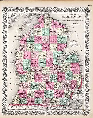
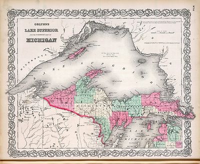
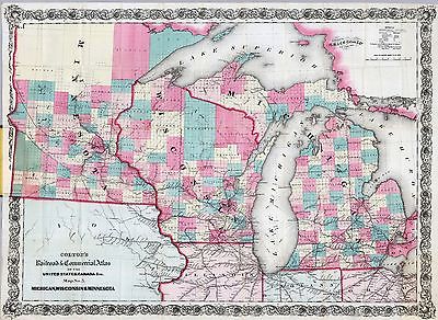
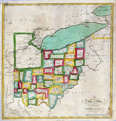
Maps of Michigan
Map of Michigan showing the Toledo, Ann Arbor, & North Michigan Railway
and connecting lines. 1886 |
 |
| Map of the northwestern states. Shewing [sic] what proportion lies north
of the parallel of South Bend of Lake Michigan. It will be seen at a glance,
that the unbroken line of communication with the Atlantic seaboard, and the
only winter route for northern Indiana, northern Illinois, Michigan, Iowa,
Wisconsin, and Minnesota, will be by the Michigan Southern Railway, and south
shore of Lake Erie. 1850 |
 |
| Railroad map of Michigan prepared for the commissioner of railroads.
c1874 |
 |
| Skeleton map, showing the position and connections of the Michigan Southern
Rail Road (from Toledo to Chicago) with the several great rail road routes
to the Atlantic seaboard and New York City via the south shore of Lake Erie.
1850 |
 |
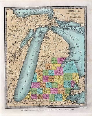
| Official map of Michigan, railroad, township and sectional, prepared
under the direction of the commissioner of railroads. 1855 |
 |
| A map of part of the continent of North America : between the 35th and
51st degrees of north latitude, and extending from 890 degrees of west longitude
to the Pacific Ocean / compiled from the authorities of the best informed
travellers by M. Lewis ; copied by Nicholas King, 1805. |
 |
| Carte de la riviere Longue : et de quelques autres, qui se dechargent
dans le grand fleuve de Missisipi [sic] ... ; Carte que les Gnacsitares :
ont dessine sur des paux de cerfs 1703 |
 |
| Railroads in Michigan, with steamboat routes on the Great Lakes. Drawn
and engraved for Doggett's railroad guide & gazetteer. 1848 |
 |
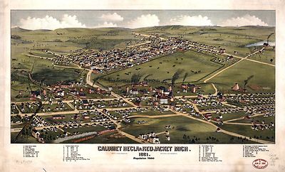
| Calumet, Hecla & Red Jacket, Mich. : 1881 / [signed] H. Wellge, Milw.
; Beck & Pauli, lith., Milwaukee, Wis. |
 |
| Birds eye view of the city of Port Huron, Sarnia & Gratiot, St. Clair
Co., Michigan 1867 & Point Edwards, Lambton Co., Canada west. Drawn &
published by A. Ruger. |
 |
| Birds eye view--showing about three miles square--of the central portion
of the city of Detroit, Michigan. Calvert Lith Co. 1889 |
 |
| A map showing the route of the proposed rail road from the Copper and
Iron Mining District of Lake Superior to connect with rail roads built or
being constructed in the state of Wisconsin as adopted by the citizens of
Ontonagon and Marquette counties Mich. at public meetings held in November
and December 1855; (subject to such changes of location of the road as a
general survey of the line shall prove to be desirable.) |
 |
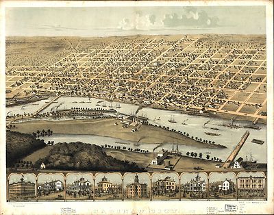
| East Saginaw, Michigan, 1867 / drawn & published by A. Ruger ; Chicago
Lithographing Co. |
 |
| Ypsilanti, Washtenaw Co., Michigan. Drawn & published by A. Ruger.
1868? |
 |
| Niles, Berrien County, Michigan. Drawn & published by A. Ruger. 1868? |
 |
| Monroe, Monroe Co., Michigan 1866. Drawn & published by A. Ruger.
1866 |
 |
| Grand Rapids, Michigan 1868. Drawn by A. Ruger. 1868 |
 |
| Birds eye view of the city of Jackson, Michigan. Drawn & published
by A. Ruger. 1869? |
 |
| Adrian, Michigan 1866. Drawn & published by A. Ruger. 1866 |
 |
| Birds-eye view of Muskegon, Michigan 1889, from Muskegon Lake looking
east. E. S. Glover, sketch. Shober Carqueville Lith. Co. |
 |
| Saint Johns, Clinton Co., Michigan 1868. Drawn by A. Ruger. |
 |
| Muskegon, Michigan 1874. |
 |
| Ionia, Ionia Co., Michigan 1868. Drawn by A. Ruger. |
 |
| Saginaw City [Michigan 1867] Drawn from nature by A. Ruger. |
 |
| Pontiac, Oakland Co., Michigan 1867. Drawn & published by A. Ruger. |
 |
| Bird's eye view of the city of Muskegon, Muskegon Co., Michigan 1868.
Drawn by A. Ruger. |
 |
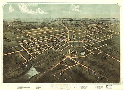
| Birds eye view of the city of Marshall, Calhoun Co., Michigan. Drawn
& published by A. Ruger. 1868? |
 |
| Birds eye view of the city of Coldwater, Branch Co., Michigan. Drawn
& published by A. Ruger. 1868? |
 |
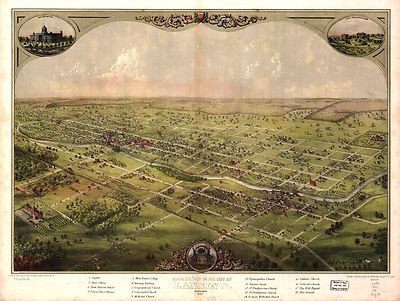
| Birds eye view of the city of Lansing, Michigan 1866. Drawn & published
by A. Ruger. |
 |
| Birds eye view of the city of Albion, Calhoun Co., Michigan. Drawn &
published by A. Ruger. 1868 |
 |
| Galbraith's railway mail service maps, Michigan. 1898 |
 |
| Bird's eye view of Bay City, Portsmouth, Wenona & Salzburg, Bay Co.,
Michigan 1867. Drawn by A. Ruger. |
 |
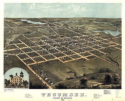
| Tecumseh, Lenawee Co., Michigan 1868. Drawn by A. Ruger. Chicago Lithogr.
Co. |
 |
| Hudson, Lenawee Co., Michigan 1868. Drawn by A. Ruger. Chicago Lithogr.
Co. |
 |
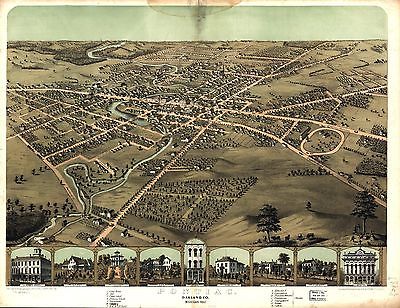
| Kalamazoo, Michigan 1874. Chas. Shober & Co. props. Chicago Litho.
Co. |
 |
| Bird's eye view of Saint Clair, St. Clair Co., Michigan 1868. Drawn by
A. Ruger. Chicago Lith. Co. |
 |
| Panoramic view of the city of Ann Arbor, Washtenaw Co., Michigan 1880.
Beck & Pauli Lith. |
 |
| Panoramic view of the city of Jackson, Michigan 1881. [By] A. Ruger.
Beck & Pauli Lith. |
 |
| Wyandotte, Michigan 1896. Drawn by T. M. Fowler. |
 |
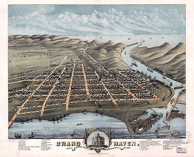
| Birds eye view of the city of Grand Haven, Ottawa Co., Michigan 1868.
Drawn by A. Ruger. Merchants Lithographing Co. |
 |
| Mills & manufacturing establishments of the city of Battle Creek,
Calhoun Co., Mich. Drawn & published by A. Ruger. 1869? |
 |
| Grand Haven, Ottawa County, Michigan 1874. Chas. Shober & Co. props.
Chicago Lithographing Co. |
 |
| Proposed route for a rail road from Copper Harbor, to Fond Du Lac, Winnebego.
1853 |
 |
| Bird's-eye-view of Battle Creek, Mich. 188? |
 |
| Lake Superior's Queen City (Marquette, Mich.) 1897. |
 |
| Bird's eye view of Bessemer, Mich., Ontonagon County 1886. Beck &
Pauli, litho. |
 |
| Benton Harbor, Mich. 1889. |
 |
| Port Huron, Mich. 1894. |
 |
| Bird's-eye view of Kalamazoo / this drawing produced by the Benford-Bryan
Co. Incorporated, artists.1908 |
 |
| Ironwood, Mich., Ontonagon County 1886. H. Wellge, sk. Beck & Pauli,
litho. |
 |
| Panoramic view of Mt. Clemens 1881, Macomb Co., Mich. Beck & Pauli,
lith. |
 |
| Chapman's rail road map of Ohio, Indiana, Michigan, Illinois, Missouri,
Minnesota, & Wisconsin. 1859 |
 |
| Bird's eye view of the city of Battle Creek, Calhoun Co., Mich. Drawn
and published by A. Ruger. 1870? |
 |
| Negaunee, Mich. 1871. Drawn by H. H. Bailey. C.H. Vogt Lith. |
 |
| International rail road guide of the Great Central Route. 1855 |
 |
| Bird's eye view of Romeo 1868. Drawn by A. Ruger. Chicago Lithogr. Co. |
 |
| An accurate map of the English colonies in North America, bordering on
the river Ohio. 1754 |
 |
| Bird's eye view of Kalamazoo, Mich. 1883. Drawn by H. Wellge & A.
F. Poole. Beck & Pauli, lithographers. |
 |
| Birds eye view of the city of Hillsdale, Hillsdale Co., Mich. 1866. Drawn
& published by A. Ruger. |
 |
| Map of the Milwaukee & Superior Rail Road and its connections. 1857 |
 |
| Colton's county & township rail road map of Ohio, Indiana, &
Michigan, with parts of adjoining states & Canada; printed by Lang &
Laing, 1859. |
 |
| Guide through Ohio, Michigan, Indiana, Illinois, Missouri, Wisconsin
& Iowa; by J. Calvin Smith, engraved by S. Stiles, Sherman & Smith.
c1840 |
 |
| Map showing the location of the Chicago & Northwestern Railway with
its branches & connections through Illinois, Iowa, Nebraska, Wisconsin,
Minnesota, Michigan. 1862 |
 |
| A Plan of the Straits of St. Mary, and Michilimakinac, to shew the situation
& importance of the two westernmost settlements of Canada for the fur
trade. 175? |
 |
| Map showing the Grand Rapids & Indiana Railroad, and its connections.
1871 |
 |
| Map of the Great Central Route and its connections, the most central,
attractive, direct and reliable thoroughfare between the eastern and western
states. 1856 |
 |
| [Lewis and Clark map, with annotations in brown ink by Meriwether Lewis,
tracing showing the Mississippi, the Missouri for a short distance above
Kansas, Lakes Michigan, Superior, and Winnipeg, and the country onwards to
the Pacific]. 1803? |
 |