Click Here. Double your traffic. Get Vendio Gallery - Now FREE!
|
FOR MANY MORE EDUCATIONAL CD TITLES
ON THIS AND MANY OTHER SUBJECTS
PLEASE VISIT OUR EBAY STORE
NO ADDITIONAL SHIPPING ON MULTIBLE CD ORDERS-ONLY $3.50 FOR ANY NUMBER OF CDs SHIPPED TO THE SAME ADDRESS IN THE US. ONLY $4.50 FOR ANY NUMBER TO ANYWHERE ELSE IN THE WORLD |
|
|
VERY LARGE HIGH RESOLUTION
MAP COLLECTION
ON CD-ROM!!
(please see full table of contents and sample illustrations below) |
|
|
This CD Contains 58 Maps Of
IRELAND
These are scans of the ORIGINAL maps
on CD-ROM
System requirements
PC or Mac compatible.
Files are simple JPEG images with a basic HTML interface (just like viewing a webpage)
Works with all versions of Windows including 3.1, 95, 98, 2000 or XP. |
|
|
Features of this CD-ROM
This auction is for a CD -ROM of the maps listed in electronic form, NOT the maps themselves.
These maps are VERY high resolution and can be printed at FULL SCALE or LARGER for framing and display. The results are very high quality and convincing.
For a sample map please:
CLICK HERE
WARNING! This is a LARGE file (5 Megabytes) if you are using a slow connection it can take some time to load. |
|
|
|

0124005 |
Ireland
Carey, Mathew
1825 |
|

0149073 |
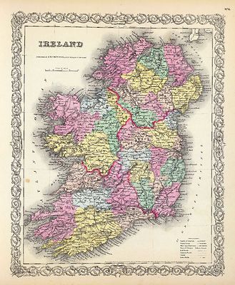
Ireland.
Colton, G.W.
1856 |
|

0285042 |
Ireland.
Finley, Anthony
1831 |
|

0373011 |
Ireland.
Engraved map. County boundaries hand col.; hydrography, shipping lanes printed in blue. Relief shown by hachures and spot heights.
Johnston, Alexander Keith
1861 |
|

0411016 |
Ireland
Shows classified roads with distances, etc. Relief shown pictorially. Inset map: The sea coasts of Great Britain and Ireland. Has ornamental cartouche and historical note.
Rocque, John
1790 |
|

0466009 |
Ireland
In outline color by county with illustrations of famous sites throughout the land. Border includes a harp and clover.
Martin, R.M. ; Tallis, J. & F.
1851 |
|

0537047 |
Ireland
In full color by county.
Mitchell, Samuel Augustus
1846 |
|

0732013 |
Ireland
Pinkerton, John
1813 |
|

0890026 |
Northern Ireland.
Engraved map. County boundaries hand col. Relief shown by hachures. Includes table of round towers.
Society for the Diffusion of Useful Knowledge (Great Britain)
1838 |
|

0890027 |
Southern Ireland.
Engraved map. County boundaries hand col. Relief shown by hachures. Includes table of round towers.
Society for the Diffusion of Useful Knowledge (Great Britain)
1838 |
|

0890172 |
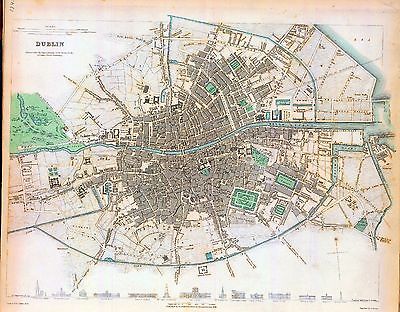
Dublin
Engraved map. Hand col. Includes drawings of 14 structures "A comparison of the principal buildings in Dublin."
Society for the Diffusion of Useful Knowledge (Great Britain)
1836 |
|

0890173 |
Dublin environs.
Society for the Diffusion of Useful Knowledge (Great Britain)
1837
|
|

0977040 |
Ireland.
In full color by county
Tanner, Henry S.
1836 |
|

1007011 |
Ireland
Thomson, John
1815 |
|

1657012 |
Ireland
Engraved map. County and province boundaries in outline hand col. Relief shown by hachures. Shows distances to Dublin.
Cary, John
1799 |
|

2077035 |
Ireland
Weiland, C. F. (Carl Ferdinand), d. 1847; Geographisches Institut (Weimar, Germany)
1853 |
|

2104009 |
Ireland
Faden, William
1798 |
|

2113024 |
Ireland - northern section.
Bartholomew, J. G. (John George), 1860-1920 ; John Bartholomew & Co.
1922 |
|

2113025 |
Ireland - southern section.
Bartholomew, J. G. (John George), 1860-1920 ; John Bartholomew & Co.
1922 |
|

2319023 |
Ireland.
Engraved outline map to be completed by students. Faces a corresponding map with place names, etc. Relief shown by hachures.
Patteson, Edward
1804 |
|

2319024 |
Ireland.
Engraved map. County boundaries in outline color. Faces a corresponding outline map. Relief shown by hachures. Shows modern and ancient settlements, episcopal sees, etc.
Patteson, Edward
1804 |
|

2449052 |
Ireland
In outline color with two inset maps: Dublin and Dublin Bay and the area around Killarney.
Stieler, Adolf
1875 |
|

2612042 |
Irlande.
Engraved map. Boundaries outlined in hand col. Relief shown pictorially. Ornamental cartouche.
Bonne, Rigobert
1781 |
|

2682005 |
Ireland
Carey, Mathew
1820 |
|

2862008 |
Map of Ireland.
Uncolored with counties numbered and a reference list included.
Carey, Mathew
1796 |
|

3007035 |
Ireland According To The Government Survey By G.H. Swanston, Edinr. XXXIV.
Fullarton, A. & Co
1872 |
|

3007036 |
Irish Ports & Harbours
Eight maps in color. (1) Environs of Dublin. (2) Belfast & Environs. (3) Londonderry & Lough Foyle. (4) Galway. (5) Sligo. (6) Wexford. (7) Kingstown. (8) Waterford Harbour & Environs. (9) Cork Harbour & Environs.
Fullarton, A. & Co
1872 |
|

3353018 |
Royaume d'Irlande.
Relief shown pictorially. Ornamental cartouche.
Robert de Vaugondy, Gilles; Robert de Vaugondy, Didier
1750 |
|

3362033 |
Ireland
(Thomas, Joseph, publisher); Fenner, Rest.
1835 |
|

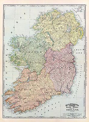
3565009 |
Ireland.
Rand McNally and Company
1897 |
|

3733008 |
Map of Ireland.
Shows forested areas, banks, etc. Relief shown pictorially. Includes geographic notes.
Bowen, Emanuel
1747 |
|

4224008 |
Ireland.
County boundaries hand col. Relief shown by hachures. Also numbered VIII.
Hall, S. (Sidney)
1830 |
|

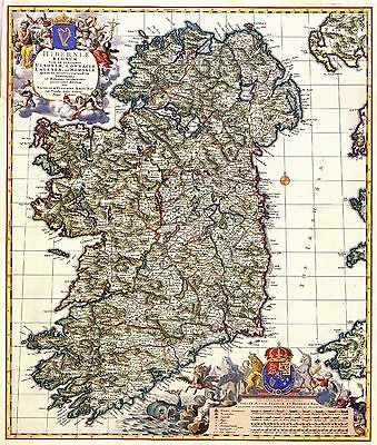
435 |
Ireland
This map of Ireland was published by Nicolaas Visscher II .
Map is dedicated to stadholder William III and his wife Mary Stuart who were crowned as king and queen of England, Scotland and Ireland in 1689.
1689 |
|

4536008 |
Ireland.
Seaman, James V.
1821 |
|

4577042 |
Map of Ireland.
Outline by region with counties numbered according to legend.
Carey, Mathew
1814 |
|

4584016 |
Ireland
Lucas, Fielding Jr.
1823 |
|

4613007 |
Ireland
Arrowsmith, John
1844 |
|

4863008 |
Ireland.
Uncolored with counties numbered and listed in a reference table.
Carey, Mathew
1811 |
|

4871006 |
Ireland
Manuscript map. Pen-and-ink and watercolor.
Bowen, Frances
1810 |
|

5580012 |
A pocket companion of Ireland.
Hand col. engraved map. Relief shown pictorially. Includes geographical notes and ornamental cartouche with dedication to Charles Duke of Graham.
Moll, Herman
1736 |
|

ca000009 |
Caricature cartoon map of Ireland.
Geographical fun : being humourous outlines of various countries, with an introduction and descriptive lines / by "Aleph".
Harvey, William
1868 |
|

ct000133 |
Wit, Frederik de.
Regni et insulæ Hiberniæ delineatio in qua sont Lagenia, Ultonia, Connachia et Momonia provenciæ.
[17--] |
|

ct000402 |
Beaufort, Daniel Augustus
Memoir of a map of Ireland.
London : Sold by W. Faden [etc.] 1797
|
|

ct000403 |
Boazio, Baptista.
Baptista Boazio’s Irlandiæ c. 1606 = Irlandiæ accvrata descriptio.
[Antwerp : A. Ortelius, 1606]
|
|

ct000405 |
Ballance, Jas.
Home Rule Map of Ireland.
[S.l.], 1893
|
|

ct000407 |
Thompson, S., engraver.
Ortelius Improved, or a new map of Ireland : Wherin are inserted the principal families of Irish and English extraction, who possess’d that kingdon[sic] on the commencement of the seventeenth century / S. Thompson sculpt.
Dublin : [s.n., 1795?]
|
|

ct000409 |
Sanson, Nicolas, 1600-1667.
Partie septentr, le du royaume d’Irlande, ou sont la province d’Ulster, et partie des prov.ces [sic] de Leinster, et Connaugh.
[S.l.], 1665.
|
|

ct000410 |
Sanson, Nicolas, 1600-1667.
Partie meridio. le du royaume d’Irlande, ou sont la province de Mounster, et partie des prov.ces [sic] de Leinster, et Connaugh.
[S.l.], 1665.
|
|

ct000411 |
Mercator, Gerhard, 1512-1594.
Irlandiæ regnum.
[S.l., 16--?]
|
|

ct000412 |
Doncker, Hendrick, 1626-1699.
Paskaarte om achter Yrlant om te zeylen, van Hitlant tot aen Hey¨ssant.
[S.l.], 1658.
|
|

ct000413 |
Chatelain, Henri Abraham.
Carte ancienne et moderne de l’Irlande, avec quelques remarques sur son gouvernement et sur l’etat present de cette isle.
[S.l, 1705?]
|
|

ct000414 |
Wit, Frederik de.
Regni et insulæ Hiberniæ delineatio in qua sont Lagenia, Ultonia, Connachia et Momonia provenciæ.
[S.l., 17--?]
|
|

ct000415 |
Brion de la Tour, Louis.
L’Irlande divise´e par provinces civiles et ecclesiastiques.
[S.l.], 1766.
|
|

ct000416 |
Faden, William, 1750?-1836.
A plan of the city of Dublin : as surveyed for the use of the division[a]l justices to which have been added plans of the canal harbour and its junction with the Grand Canal, the Royal Canal, and every projection and alteration to the present time, 1797 / published by W. Faden, geographer to the King & to H.R.H. the Prince of Wales ; engraved by S.J. Neele.
London : W. Faden ; Dublin : Sold by W. Allen & J. Archer, 1797.
|
|

ct000417 |
Weidner, I. G. A.
Charte der vereinigten Ko¨nigreiche Gros Britanien und Ireland : nach den neuesten Berichtigungen und Astronomischen Ortsbesti[m]mungen entworfen auf den Sternwarte Seeberg, bey Gotha / gezeichnet von I.G.L. Weidner.
Weimar : Im Verlage des Industrie Comptoirs, 1801.
|
|

ct000418 |
Brion de la Tour, Louis.
Tableau ge´ne´ral des Isles Britanniques : comprenant les royaumes dA?ngleterre et dE?cosse sous la de´nomination de Grande Bretagne, et le royaume dI?rlande, avec la chronologie ge´ne´alogique des rois / par M. Brion de la Tour, inge´nieur-ge´ographe du roi, 1783.
A Paris : Chez les Campions fre`res, mds. de?stampes, rue St. Jacques, a` la ville de Rouen, 1783.
|
|

cwh00340 |
[Map of Ulster County, Ireland].
[188-?]
|
|

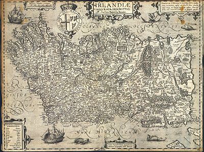
ea000001 |
Ortelius, Abraham, 1527-1598.
Hiberniae, Britannicae Insvlæ,Nova Descripto.
[S.l.], 1598. |
|
| Thanks for bidding.
Ad and CD-ROM copyright 2004
Euriskodata, Inc.
All Rights Reserved |
The free listing tool. List your items fast and easy and manage your active items.
|