Click Here. Double your traffic. Get Vendio Gallery - Now FREE!
|
FOR MANY MORE EDUCATIONAL CD TITLES
ON THIS AND MANY OTHER SUBJECTS
PLEASE VISIT OUR EBAY STORE
NO ADDITIONAL SHIPPING ON MULTIBLE CD ORDERS-ONLY $3.50 FOR ANY NUMBER OF CDs SHIPPED TO THE SAME ADDRESS IN THE US. ONLY $4.50 FOR ANY NUMBER TO ANYWHERE ELSE IN THE WORLD |
|
|
VERY LARGE HIGH RESOLUTION
MAP COLLECTION
ON CD-ROM!!
(please see full table of contents and sample illustrations below) |
|
|
This CD Contains 85 Maps of
Russia
These are scans of the ORIGINAL maps
on CD-ROM
System requirements
PC or Mac compatible.
Files are simple JPEG images with a basic HTML interface (just like viewing a webpage)
Works with all versions of Windows including 3.1, 95, 98, 2000 or XP. |
|
|
Features of this CD-ROM
This auction is for a CD -ROM of the maps listed in electronic form, NOT the maps themselves.
These maps are VERY high resolution and can be printed at FULL SCALE or LARGER for framing and display. The results are very high quality and convincing.
For a sample map please:
CLICK HERE
WARNING! This is a LARGE file (5 Megabytes) if you are using a slow connection it can take some time to load. |
|
|
|

0149088 |
Colton, G.W.
1856
Russia.
|
|

0285037 |
Finley, Anthony
1831
Russia In Europe.
|
|

0285053 |
Finley, Anthony
1831
Russia In Asia.
|
|

0466014 |
Martin, R.M. ; Tallis, J. & F.
1851
Russia In Europe.
|
|

0466046 |
Martin, R.M. ; Tallis, J. & F.
1851
Russia In Asia.
|
|

0537061 |
Mitchell, Samuel Augustus
1846
Russia In Europe.
|
|

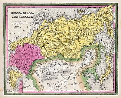
0537064 |
Mitchell, Samuel Augustus
1846
Russia In Asia and Tartary.
|
|

0565033 |
Mitchell, Samuel Augustus
1860
Russia In Europe, Sweden, And Norway.
|
|

0890063 |
Society for the Diffusion of Useful Knowledge (Great Britain)
1835
Russia in Europe. Part II.
|
|

0890065 |
Society for the Diffusion of Useful Knowledge (Great Britain)
1834
Russia Part lV.
|
|

0890090 |
Society for the Diffusion of Useful Knowledge (Great Britain)
1838
E. Siberia.
|
|

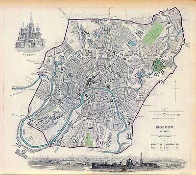
0890189 |
Society for the Diffusion of Useful Knowledge (Great Britain)
1836
Moscow. Moskvy.
|
|

0890198 |
Society for the Diffusion of Useful Knowledge (Great Britain)
1834
St. Petersburg.
|
|

0977054 |
Tanner, Henry S.
1836
Russia In Europe.
|
|

0977057 |
Tanner, Henry S.
1836
Russia In Asia and Tartary.
|
|

1007039 |
Thomson, John
1814
Russian Empire.
|
|

1007039 |
Thomson, John
1814
Russian Empire.
|
|

1007080 |
Thomson, John
1816
Northern Passage.
|
|
|
|
|
|

1657039 |
Cary, John, ca. 1754-1835
1799
Russian Empire east.
|
|

19 |
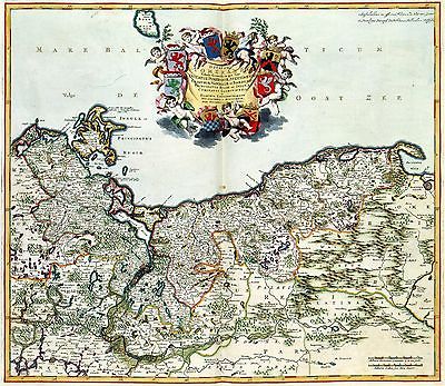
RVSSIAE vulgo MOSCOVIA
1638)This map of Northeastern Russia was published in 1638 by Joan (1598-1673) and Cornelis Blaeu (1610-1646). |
|

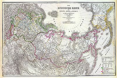
2077051 |
Kiepert, Heinrich, 1818-1899; Weiland, C. F. (Carl Ferdinand), d. 1847; Geographisches Institut (Weimar, Germany)
1855
Russische Reich.
|
|

2104039 |
Cary, John, ca. 1754-1835
1799
Russian Empire.
|
|

2113076 |
Bartholomew, J. G. (John George), 1860-1920 ; John Bartholomew and Son
1922
Siberia.
|
|
|
|
|

2212010 |
Vandermaelen, Philippe, 1795-1869
1827
Partie, Russie d'Europe. Europe 6.
|
|

2212014 |
Vandermaelen, Philippe, 1795-1869
1827
Partie, Russie d'Europe. Europe 10.
|
|

2212015 |
Vandermaelen, Philippe, 1795-1869
1827
Partie, Russie d'Europe. Europe 11.
|
|

2449053 |
Stieler, Adolf
1875
Russland Und Skandinavien.
|
|

2449055 |
Stieler, Adolf
1875
Ost-Europa, Bl. 2: Nordost-Russland.
|
|

2449057 |
ieler, Adolf
1875
Ost-Europa, No. 4: Central-Russland.
|
|

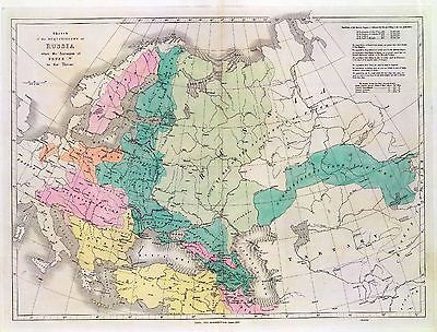
2515076 |
Berghaus, Heinrich
1848
Das Russische Reich nach seinen ethnographischen.
|
|

2603007 |
Anville, Jean Baptiste Bourguignon d, 1697-1782
1753
Asie 3.
Russia in Asia. |
|

2612045 |
Bonne, Rigobert, 1727-1794
1785
Russie orientale.
|
|

28 |
MOSCOVIAE seu RUSSIAE MAGNAE
1681
This map of West-Russia was published by Nicolaas Visscher II |
|

2862005 |
Carey, Mathew
1796
The Russian Empire, in Europe and Asia.
|
|

3007006 |
Fullarton, A. & Co.
1872
Russian Empire.
|
|

3007007 |
Fullarton, A. & Co.
1872
Russian In Europe.
|
|

3007008 |
Fullarton, A. & Co.
1872
Russian Empire in Eastern & Western Asia.
|
|

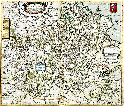
310 |
MAGNI DVCATVS LITHVANIAE, et Regionum Adiacentium exacta Descriptio
This map of the Grand Duchy of Lithuania is dedicated by Joan Blaeu (1598-1673) to a member of the Russian Sovereignty Radziwill.
1638 |
|

3355052 |
Bernizet, Sebastien; La Perouse, Jean-Francois de Galaup, comte de, 1741-1788
1797
Baie Castries.
|
|

3355069 |
La Perouse, Jean-Francois de Galaup, comte de, 1741-1788
1797
Iles Kuriles, Aleutiennes.
|
|

3405016 |
Cook, James, 1728-1779
1785
Norton Sound, Bherings Strait.
|
|

3405020 |
Bligh, William, 1754-1817; Cook, James, 1728-1779
1785
Awatska Bay.
|
|

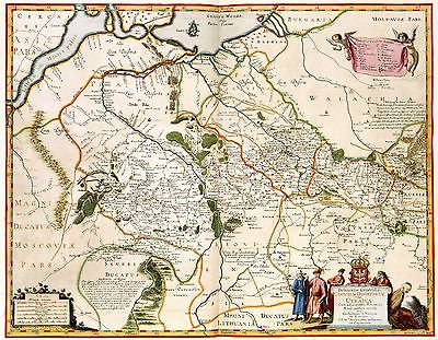
38 |
RVSSIAE vulgo MOSCOVIA, Pars Australis
638)This map of South Russia was published in 1638 by the brothers Joan (1598-1673) and Cornelis Blaeu (1610-1642).
|
|

410 |
Delineatio Generalis CAMPORUM DESERTORUM vulgo UKRAINA, Cum adjacentibus Provinciis Bono publico erecta,Willem Hondius
1648
The Ukraine was divided between Poland and Russia in the 17th century.
|
|

4122015 |
(Schneider, J. H.; Bruyset, Jean-Marie)
1784
(La Russie Europeenne)
|
|

4584019 |
Lucas, Fielding Jr.
1823
Russian Empire.
|
|

4613051 |
Arrowsmith, John
1844
Sketch of the Acquisitions of Russia since the Accession of Peter 1st. to the Throne.
|
|

4613056 |
Arrowsmith, John
1844
The Caspian Sea.
|
|

4614010 |
(Brue, Adrien Hubert, 1786-1832)
1816
Europe 2.
|
|

4628018 |
Burr, David H., 1803-1875
1835
Russian Empire.
|
|

4628019 |
Burr, David H., 1803-1875
1835
Russian In Europe.
|
|

4764013 |
Lisle, Guillaume de, 1675-1726
1706
Moscovie (nord)
|
|

48 |
RVSSIAE Vulgo MOSCOVIA dictae
Joan Blaeu
1638
|
|

4807088 |
Meyer, Joseph, 1796-1856 ; Society for the Diffusion of Useful Knowledge (Great Britain)
1844
St. Petersburg, Sanktpeterburga.
|
|

4807090 |
Radefeld, Carl Christian Franz, 1788-1874 ; Meyer, Joseph, 1796-1856
1855
Ostsee.
|
|

4807102 |
Radefeld, Carl Christian Franz, 1788-1874 ; Meyer, Joseph, 1796-1856
1845
Asiat. Russland.
|
|

4850018 |
Greenleaf, Jeremiah
1840
Russian Empire.
|
|

4850019 |
Greenleaf, Jeremiah
1840
Russia In Europe
|
|

4863005 |
Carey, Mathew
1811
Russian Empire, in Europe and Asia.
|
|

5023038 |
Garnier, F. A., 1803-1863
1862
Asie Boreale.
|
|

ct000625 |
Homann, Johann Baptist, 1663-1724.
Generalis totius imperii Moscovitici : novissima tabula magnam orbis terrarum partem a Polo Arctico usq[ue] ad mare Iaponicum, et Chinae Septentrionalis confinia exhibens : cum via Czaricae nuper Legationis ex urbe Moscua per universam Tartariam, ad magnu[m?] Chinae imperatorem.
Norimbergae : ex conatibus Iohannis Baptistae Homanni, [1704?]
|
|

ct000644 |
Kartograficheskoe zavedeni¯e A. Il'ina.
Empire Russe.
S. Petersburg : Kartograficheskoe zavedeni¯e A. Il’ina, 190-?
|
|

ct000746 |
Treskot, Johann, 1719-1786.
Tabula geographica generalis Imperii Russici ad normam novissimarum observationum astronomicarum concinnata / a Joh. Trescotio et Jac. Schmidio ; vyri?e?zyvali K. Frolov, E. Khudi?a?kov, N. Zubkov.
[St. Petersburg : s.n.], 1776.
|
|

ct000890 |
Russia. Ministerstvo putei? soobshcheni¯i?a?. Otdi?e?l statistiki i kartografi¯i.
Karta putei? soobshcheni¯i?a? Rossi¯i?skoi? Imperi¯i / sostavlena Otdi?e?lom statistiki i kartografi¯i M-va p.s.
[St. Petersburg? : Otdi?e?l statistiki i kartografi¯i Ministerstva putei? soobshcheni¯i?a?], 1916
|
|

ct001067 |
C.S. Hammond & Company.
Large scale map of Russia in Europe.
[S.l.], 1918
|
|

ct001128 |
Spruner von Merz, Karl, 1803-1892.
Il successivo incremento dell’Impero Russo dalla met'a del XVto secolo in poi
Gotha : Perthes, [1876]
|
|

ct001468 |
Roth, Christoph Melchior, d. 1798.
Novoi? plan stolichnago goroda i kri?e?posti Sanktpeterburga. Nouveau plan de la ville et de la forteresse de St. Pe´tersbourg. Grid: Kh. M. Rot. Par C. M. Roth.
[n.p.] 1776
|
|

ct001574 |
United States. Central Intelligence Agency.
Russia’s administrative divisions.
[Washington, D.C. : Central Intelligence Agency, 2001]
|
|

hl000004 |
Michurin, Ivan Fedorovich, 1700-1763.
Plan imperatorskago stolichnago goroda Moskvy. Sochinennoi? pod smotreni¯em arkhitektora Ivana Michurina v 1739 godu.
Petropoli, 1745.
|
|

hl000005 |
Seutter, Matthaeus, 1678-1756.
Nova et accuratissima urbis St. Petersburg a` Russorum Imperatore Petro Alexiewiz ao. 1703 ad ostium Nevæ Fl. conditæ et regionis circumjacentis delineatio / per Matth. Seutter, Chalc. August. = Neue u. accurate Abbildung der von dem grossen Russ. Kaiser Petro Alexiewiz Ao. 1703 an dem Aussfl. dess Neva Stroms erbaueten Statt St. Petersburg samt d. umligend. Gegend / heraussgegeb. von M. Seutter.
[Augsburg, Germany] : Matth. Seutter, [1734?]
|
|

mf000003 |
L’Isle, Guillaume de, 1675-1726.
Carte de Tartarie.
[S.l.], 1706
|
|

mf000008 |
Veni?u?kov, M. (Mikhail), 1832-1901.
E?tnograficheskai?a? karta Azi¯i?a?tskoi? Rossi¯i / sostavil M. Veni?u?kov ; gr. Shr. Makhotin.
[St. Petersburg?] : Kartograficheskoe zavedeni¯e A. I'lina, [187-?]
|
|
| Buyer to pay 3.50 shipping for ANY quanity of CDs to the same address, international shipping is $4.50 for ANY quanity of CDs to the same address.Thanks for bidding.
Ad and CD-ROM copyright 2004
Euriskodata, Inc.
All Rights Reserved |
The free listing tool. List your items fast and easy and manage your active items.
|