Click Here. Double your traffic. Get Vendio Gallery - Now FREE!
Rare Map Collection
This DVD is part of our Historic Map and
Atlas Collection.
We have dozens of Atlas maps on DVD and CD ranging from the 1500s
to the 1900s covering many areas and topics.
Please Check our Ebay Store for what's available. |
FOR MANY MORE EDUCATIONAL CD
TITLES
ON THIS AND MANY OTHER
SUBJECTS
PLEASE VISIT OUR EBAY STORE |
VERY LARGE HIGH RESOLUTION
MAP COLLECTION
ON DVD!!
(please see full table of contents and sample
illustrations below) |
|
This DVD Contains
94 Maps and Antique Prints
of
Hawaii
These are scans of the ORIGINAL maps
by various Cartographers.
on DVD
System requirements
PC or Mac compatible.
Files are simple PDF files with a basic HTML
interface (just like viewing a webpage)
Works with ALL versions of Windows.
|
Maps of
Hawaii

0149100
|
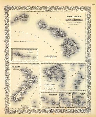
Hawaiian Group Or Sandwich Islands ... New Zealand ... Galapagos Islands.
Colton, G.W.
1856 |

0197026
|
Oceania. Designed to accompany Cornell's High school geography. (with)
Sandwich Islands. (with) Van Diemens Land and south eastern Australia
Cornell, Sarah S.
1864 |

0372011
|
The phenomena of volcanic action showing the regions visited by earthquakes
and the distribution of volcanoes over the globe. With corrections and additions,
to 1854
Johnston, Alexander Keith,
1856 |

0565042
|
Map Of Oceanica Exhibiting Its Various Divisions, Island Groups &c.
73. (with) inset Map Of The Sandwich Islands.
Mitchell, Samuel Augustus
1860 |

0586052
|
Map of Mexico, Central America, and the West Indies. (with) Map of the
Sandwich Islands. Discovered by Captn. Cook in 1778
Mitchell, Samuel Augustus
1880 |

0586069
|
Oceanica, Sandwich Islands.
Mitchell, Samuel Augustus
1880 |

0594068
|
Oceanica, Sandwich Islands.
Mitchell, Samuel Augustus
18980 |

0890154
|
Polynesia or islands in the Pacific Ocean. Mariana Is. or Ladrones. Pelew
Is. or Palaos. Gilbert Ids. or Scarborough Range. Marshall Ids. Otdia or
Romanzoff Group. Galapagos Ids. Marquesas Is. or Mendana Archo. Sandwich
Ids. Samoa or Navigator Ids. Tonga or Friendly Is. Tonga-Tabou Id. Santa
Cruz Is. Vanikoro Id. Admiralty Isles, New Ireland or Tombara, New Britain
or Birara, Salomon (sic) Islands. Norfolk Id. The Low Archipelago (Society
Islands), Otaheite or Tahiti. Cooks or Hervey Isles. Pitcairn Island. Juan
Fernandez.
Society for the Diffusion of Useful Knowledge (Great Britain
1840 |

1007078
|
Pacific islands.
Thomson, John
1817 |

2113132
|
Nine col. maps. Relief shown by hypsometric tints and spot heights; depths
by bathymetric tints. Contents: New Hebrides -- Hawaiian Islands -- Cook
Islands -- Samoan Is. -- Society Is. -- Marquesas Is. -- New Caledonia and
Loyalty Islands -- Fiji Islands -- Tonga Group.
Bartholomew, John George
1922 |

2212331
|
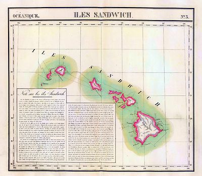
Iles Sandwich. Oceanique no. 3.
Vandermaelen, Philippe
1827 |

2449083
|
Polynesien Und Der Grosse Ocean (Ostliches Blatt).
Stieler, Adolf
1875 |

2483057
|
Oceanica, Sandwich Islands.
Mitchell, Samuel Augustus
1870 |

2515037
|
Die Vulkanreihe von Guatemala, (etc.).Maps in outline color. Main map
is of Central America. Nine inset maps detail the volcanic regions of Central
America and the islands in the Pacific Ocean and South Seas
Berghaus, Heinrich
1840 |

3354015
|
A Chart of the Sandwich Islands as Surveyed during the Visits of His
Majesty's Sloop Discovery and Armed Tender Chatham Commanded by George Vancouver
Esq. in the Years 1792, 1793 & 1794, and prepared under his immediate
inspection by Lieut. Joseph Baker. Engraved by J. Warner. 15. (with) Part
of the Gallapagos Isles (and) the Island of Cocoas.
Vancouver, George
1798 |

3354016
|
Views of the Sandwich and other Islands. 16. W. Alexander delt. from
Sketches made on the spot. London: Published May 1st 1798
Vancouver, George
1798 |

3355013
|
Carte des parties des Iles Sandwich, qui ont ete visitees aus mois de
Mai 1786 par les Fregates Francaises la Boussole et l'Astrolabe ... Carte
des Iles Sandwich, assujettie aux observations faites a bord des Fregates
Francaises la Boussole et l'Astrolabe
Bernizet, Sebastien; La Perouse, Jean-Francois de Galaup, comte de
1797 |

3355038
|
Carte plate de l'Ile Necker situee par 23034' de latitude N, et 166052'
de longitude a l'ouest de Paris et de la Basse des Fregates Francaises situee
par 23045' de latitude N. et 168010' de longitude, decouvertes en Novembre
1786. Ecrit par Herault. Atlas du Voyage de la Perouse no. 38
Bernizet, Sebastien; La Perouse, Jean-Francois de Galaup, comte de
1797 |

3405018
|
Sandwich Islands. (After missing views by Bligh and possibly Webber
Webber, John, Bligh, William, Cook, James,
1779 |

3405019
|
Chart of the Sandwich Islands. (with) Sketch of Karakakooa Bay. The writing
by W. Harrison. (By Henry Roberts; after missing survey by William Bligh.
Webber, John, Bligh, William, Cook, James,
1779 |

3565040
|
Rand, McNally & Company's indexed atlas of the world map of Oceania
and Malaysia. (with) New Caledonia and Loyalty Islands. (with) Hawaiian or
Sandwich Islands.
Rand, McNally & Company
1897 |

3706000
|
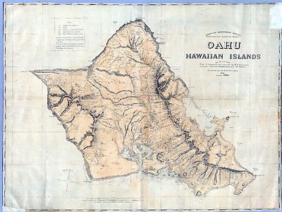
Oahu, Hawaiian Islands. Hawaiian Government Survey. W.D. Alexander, Surveyor
General. Map By C.J. Lyons. From trigonometrical surveys by W.D. Alexander,
C.J. Lyons, J.F. Brown, M.D. Monsarrat and Wm. Webster. Finished map by Richd.
Covington.
Hawaiian Government Survey ; Lyons, C.J. ; Alexander, W. D. ; Brown, J. F.
; Monsarrat, M.D. ; Webster, William ; Covington, Richard
1881 |

3707000
|
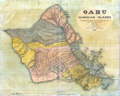
Oahu, Hawaiian Islands. Compiled from Maps of Government Surveys and
other reliable sources.
Beasley, T.D. ; Taylor, Jas. T.
1899 |

4442005
|
Map of Part of the Island of Hawaii, Sandwich Islands, Shewing the Craters
and Eruption of May and June 1840.
United States Exploring Expedition, Wilkes, Charles
1841 |

5023063
|
Les divers archipels de l'Oceanie. (with) Groupe de la Nouvle. Caledonie.
(with) Archipel des Iles Sandwich.
Garnier, F. A.
1862 |

5181000
|
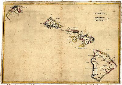
Na Mokupuni O Hawaii Nei. Kulanui Lahainaluna Maui Maraki 9 1837. He
26 mau la ka hana ana. Na Kalama i kakau
Kalama, Simona P.
1837 |

ct000259
|
Hawaii.
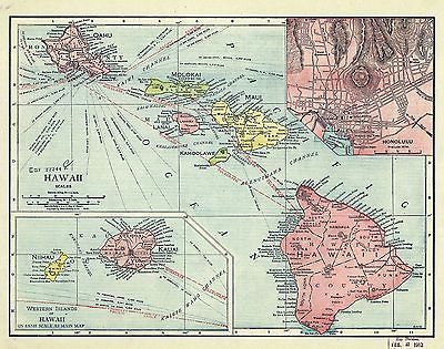
Rand McNally and Company.
c1912
|

ct000292
|
Na Mokupuni O Hawaii Nei. Kulanui Lahainaluna Maui Maraki 9 1837. He
26 mau la ka hana ana. Na Kalama i kakau
Kalama, Simona P.
1837
(duplicate copy) |

ct000609
|
Topographic map of the Island of Oahu : city and county of Honolulu, Hawaii
/ surveyed by the U.S. Geological Survey ; in cooperation with the Territory
of Hawaii ; and War Department.
Geological Survey (U.S.)
1938
|

ct001050
|
A map of the Hawaiian Islands. (copy is only two panels of a larger map.)
1838 |

ct001051
|
Giles, H.
Map of the Hawaiian Islands.
1876
|

ha000009
|
Map of Hawaii, Hawaiian islands
Preliminary ed.
Hawaiian Govt. Survey. Wall, W. A.
1886
|

ha000010
|
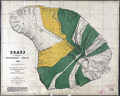
Kauai government survey, 1878 / compiled and drawn by C. S. Kittredge
; tracing by W. A. Wall.
Kittredge, C. S.
U.S. Geoglogical Survey,
18??
|

ha000011
|
Lanai / Government Survey ; W.D. Alexander, Survey-General ; triangulation,
topography, boundaries and map
Brown, J. F. (Cartographer) Hawaiian Government Survey
1900
|

ha000012
|
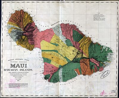
Maui, Hawaiian islands / primary triangulation by W.D. Alexander and
S.E. Bishop ; topography and boundaries
Brown, J. F. (Cartographer) Hawaiian Government Survey
1900 |

ha000013
|
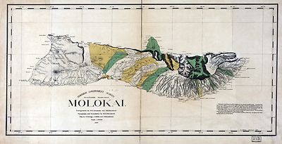
Molokai / triangulation by W.D. Alexander and M.D. Monsarrat ; topography
and boundaries
Brown, J. F. (Cartographer) Hawaiian Government Survey
1900 |

ha000014
|
Oahu, Hawaiian Islands / map by C.J. Lyons from trigonometrical surveys by
W.D. Alexander ... [et al.] ; finished map by Richd. Covington.
Lyons, C. J.
Hawaiian Govt. Survey, 1881
|

ha000015
|
Kahoolawe, Hawaii / topography by Bishop Moorhead ; control by U.S. Coast
and Geodetic Survey and Hawaiian Territory Survey.
Moorhead, Bishop.
U.S. Geological Survey, 1926
|

ha000016
|
Topographic map of the Island of Niihau, Kauai County, Hawaii / surveyed
by the U.S. Geological Survey in cooperation with the Territory of Hawaii.
Geological Survey (U.S.)
Ed. of 1929
|

ha000021
|
Honolulu and vicinity / map by W.A. Wall ; Hawaiian Government Survey
; W. D. Alexander, surveyor-general. Julius Bien & Co.,
Wall, W. A.
1887
|

rr001990
|
Hawaiian Government Survey; W. D. Alexander, Surveyor General, Oahu,
Hawaiian Islands; map by C. J. Lyons, from trigonometic surveys by W. D.
Alexander, C. J. Lyons, J. F. Brown, M. D. Monsarrat and Wm. Webster, finished
map by Richd. Covington.
Lyons, C. J.
1881 |

z3355014
|
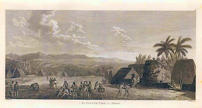
Engraved view of La Perouse's ships at Maui.
Blondela, Lieut.; La Perouse, Jean-Francois de Galaup, comte de
1788 |

z3405049
|
A morai, in Atooi.
Blondela, Lieut.; La Perouse, Jean-Francois de Galaup, comte de
1788 |

z3405050
|
Atooi morai house.
Blondela, Lieut.; La Perouse, Jean-Francois de Galaup, comte de
1788 |

z3405051
|
Shows Hawaiians, Cook's men, structures, vegetation; hills in background.
Blondela, Lieut.; La Perouse, Jean-Francois de Galaup, comte de
1788 |

z3405070
|
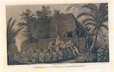
An offering before Capt. Cook, in the Sandwich Islands.
Blondela, Lieut.; La Perouse, Jean-Francois de Galaup, comte de
1788 |

z3405071
|
Tereoboo, King of Owyhee, bringing presents to Capt. Cook.
Blondela, Lieut.; La Perouse, Jean-Francois de Galaup, comte de
1788 |

z3405072
|
A man of the Sandwich Islands,
Blondela, Lieut.; La Perouse, Jean-Francois de Galaup, comte de
1788 |

z3405073
|
A young woman of the Sandwich Islands
Blondela, Lieut.; La Perouse, Jean-Francois de Galaup, comte de
1788 |

z3405074
|
A man of the Sandwich Islands, with his helmet.
Blondela, Lieut.; La Perouse, Jean-Francois de Galaup, comte de
1788 |

z3405075
|
A canoe of the Sandwich Islands, the rowers masked.'
Blondela, Lieut.; La Perouse, Jean-Francois de Galaup, comte de
1788 |

z3405076
|
A man of the Sandwich Islands, in a mask. J
Blondela, Lieut.; La Perouse, Jean-Francois de Galaup, comte de
1788 |

z3405078
|
A view of Karakokooa, in Owyhee. Engraved illustration. Shows village,
inhabitants and hills with canoes and ships in harbor.
Blondela, Lieut.; La Perouse, Jean-Francois de Galaup, comte de
1788 |

0152110
|

0414013
|

0414014
|

0592070
|

0889036
|

0889037
|

0889076
|

1010075
|

1012092
|

1494009
|

1954046
|

2703005
|

2809069
|

2844083
|

3355014
|

3603000
|

4216A
|

4442043
|

4442044
|

4442045
|

4442046
|

4442047
|

4442048
|

4442049
|

4442050
|

4442051
|

4442053
|

4442054
|

4442055
|

4442056
|

4587112
|

4607050
|

4727050
|

5028194
|

5371143
|

5409002
|

5784067
|

6956000
|

6959000
|

6978000
|

6983000
|
|
|
Features of this DVD
This auction is for a DVD of the maps listed
in electronic form,
NOT
the maps
themselves.
These maps are VERY high resolution and
can be printed at FULL SCALE or LARGER for framing and display. The results
are very high quality and convincing. |
|
Ad and disk copyright 2013
Euriskodata
All Rights Reserved |
The free listing tool. List your items fast and easy and manage your active items.
|